MyTopo
Hadley Minnesota US Topo Map
Couldn't load pickup availability
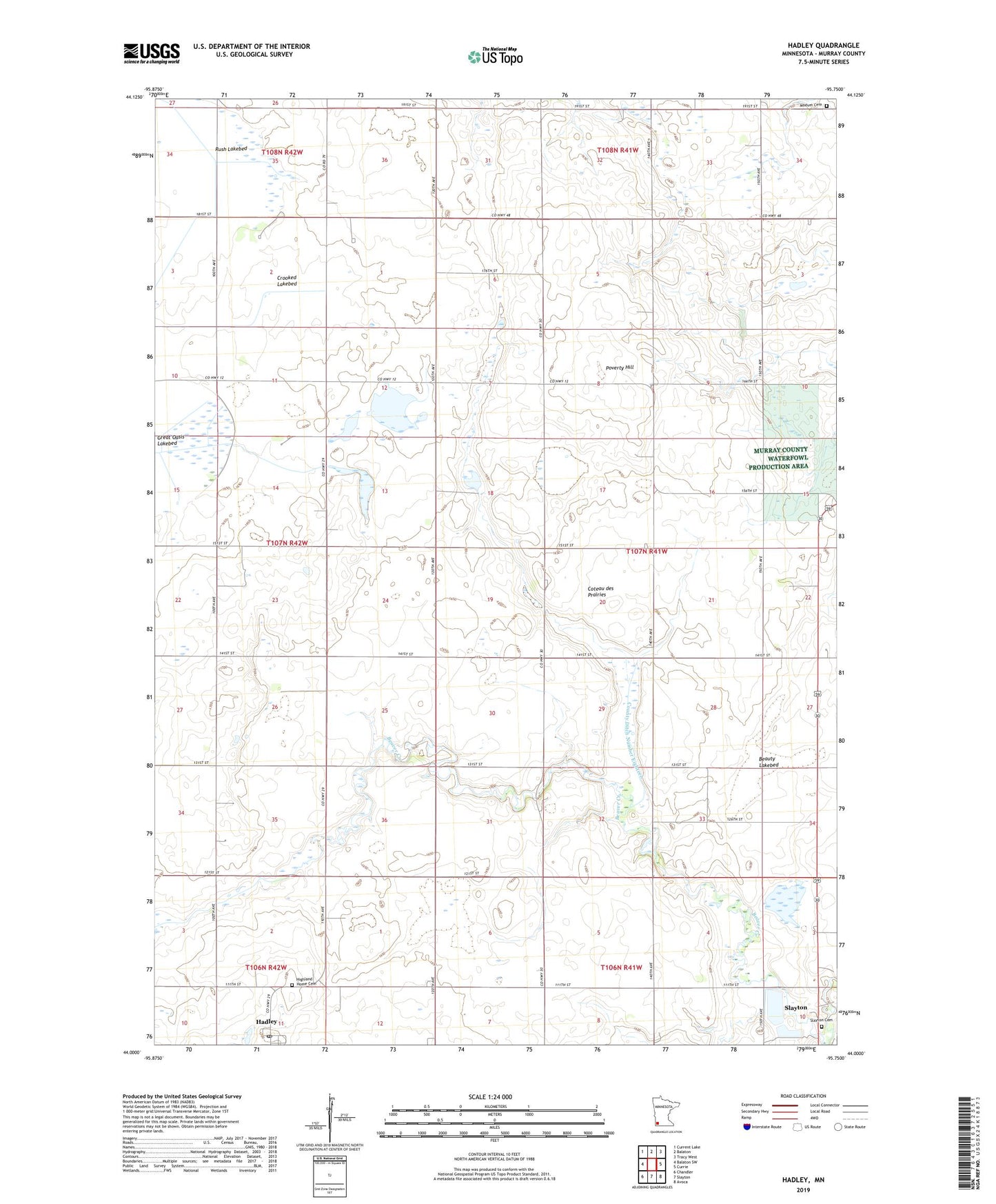
2022 topographic map quadrangle Hadley in the state of Minnesota. Scale: 1:24000. Based on the newly updated USGS 7.5' US Topo map series, this map is in the following counties: Murray. The map contains contour data, water features, and other items you are used to seeing on USGS maps, but also has updated roads and other features. This is the next generation of topographic maps. Printed on high-quality waterproof paper with UV fade-resistant inks.
Quads adjacent to this one:
West: Balaton SW
Northwest: Current Lake
North: Balaton
Northeast: Tracy West
East: Currie
Southeast: Avoca
South: Slayton
Southwest: Chandler
This map covers the same area as the classic USGS quad with code o44095a7.
Contains the following named places: Beauty Lakebed, County Ditch Number Eighteen, Crooked Lakebed, Hadley, Hadley Area Community Center, Hadley Lutheran Church, Hadley Post Office, Highland Home Cemetery, Lowville, Lowville Post Office, Lowville State Wildlife Management Areas, Mason State Wildlife Management Area, Modum Cemetery, Murray County, Poverty Hill, Rush Lakebed, Slayton Cemetery, Slayton Country Club, Slayton Wastewater Treatment Plant, Stonegate Orchard, Township of Mason, ZIP Code: 56172