MyTopo
Currie Minnesota US Topo Map
Couldn't load pickup availability
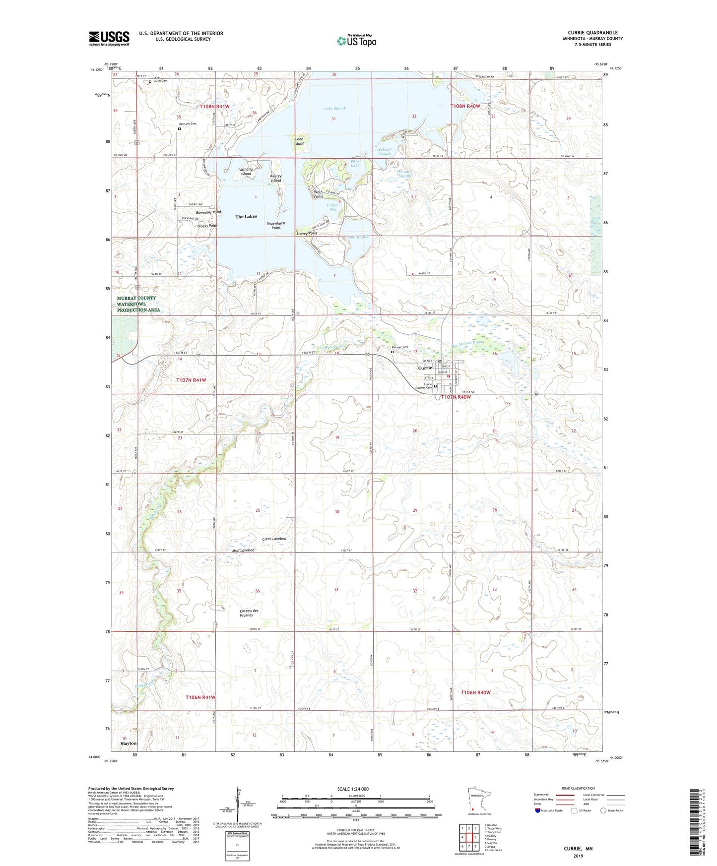
2022 topographic map quadrangle Currie in the state of Minnesota. Scale: 1:24000. Based on the newly updated USGS 7.5' US Topo map series, this map is in the following counties: Murray. The map contains contour data, water features, and other items you are used to seeing on USGS maps, but also has updated roads and other features. This is the next generation of topographic maps. Printed on high-quality waterproof paper with UV fade-resistant inks.
Quads adjacent to this one:
West: Hadley
Northwest: Balaton
North: Tracy West
Northeast: Tracy East
East: Dovray
Southeast: Lime Creek
South: Avoca
Southwest: Slayton
This map covers the same area as the classic USGS quad with code o44095a6.
Contains the following named places: Armstrong Slough, Beaver Creek, Bethany Cemetery, Blocks Point, Bowmans Point, Breezy Point, City of Currie, Clear Lakebed, Currie, Currie Clinic, Currie Pioneer Cemetery, Currie Post Office, Currie Volunteer Fire Department, End-O-Line Railroad Park, Hanover Slough, Immaculate Heart of Mary Church, Indian Bay, Keeley Island, Lake Sarah Cemetery, Lake Sarah Church, Lake Shetek, Lake Shetek State Monument, Lake Shetek State Park, Loon Island, Mud Lakebed, Park Lake, Pioneer Cemetery, Rauenhorst Point, Rupp State Wildlife Management Area, Schreiers on Shetek Campground, Shetek Church Camp, Shetek Lake Dam, Smith Lake, Stoney Point, Sweetman State Wildlife Management Area, The Lakes Census Designated Place, Township of Murray, Valhalla Island, Valhalla Island Campground, Webster Slough, Wolf Point, Wolf Point Campground