MyTopo
Squaw Lake Minnesota US Topo Map
Couldn't load pickup availability
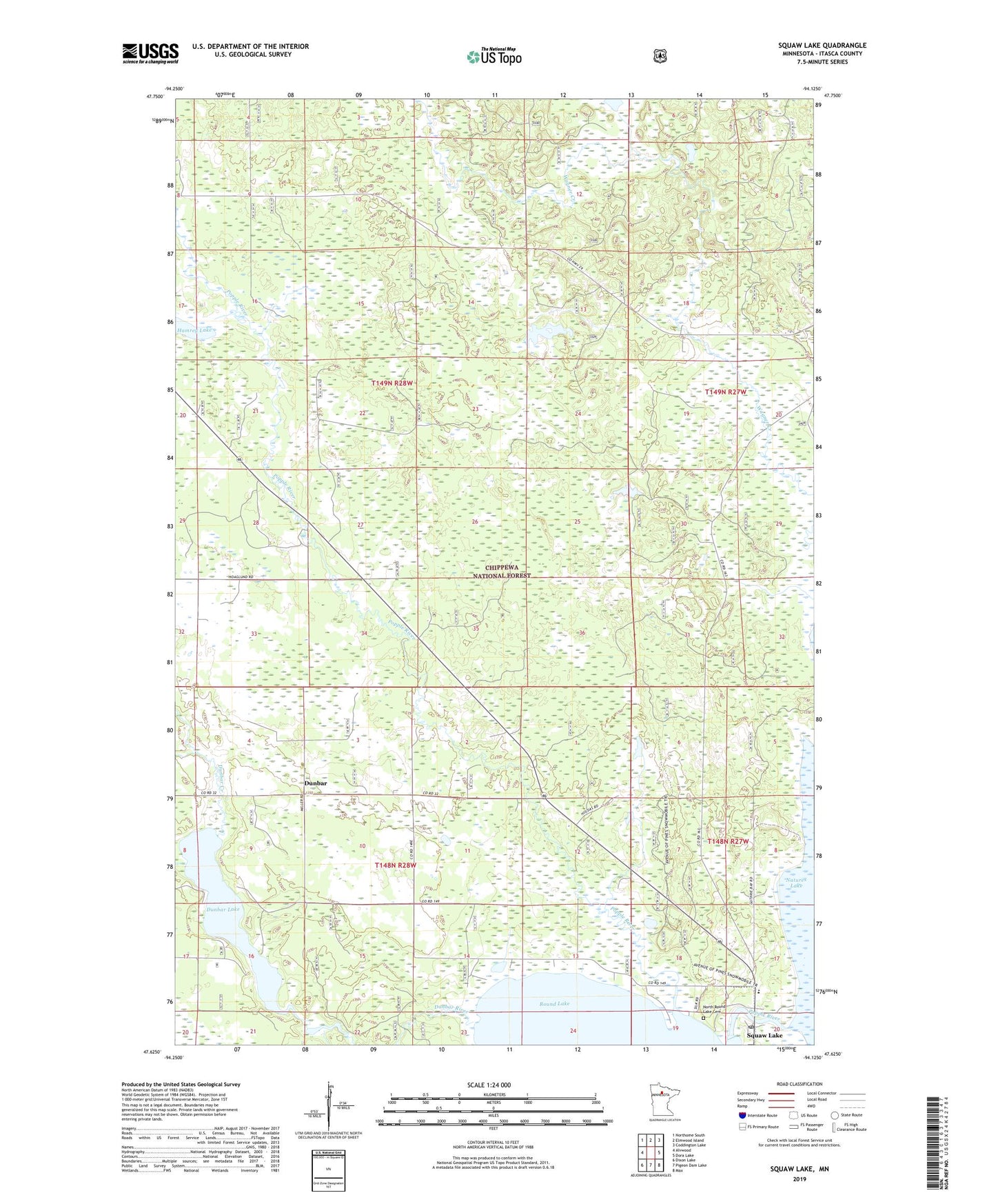
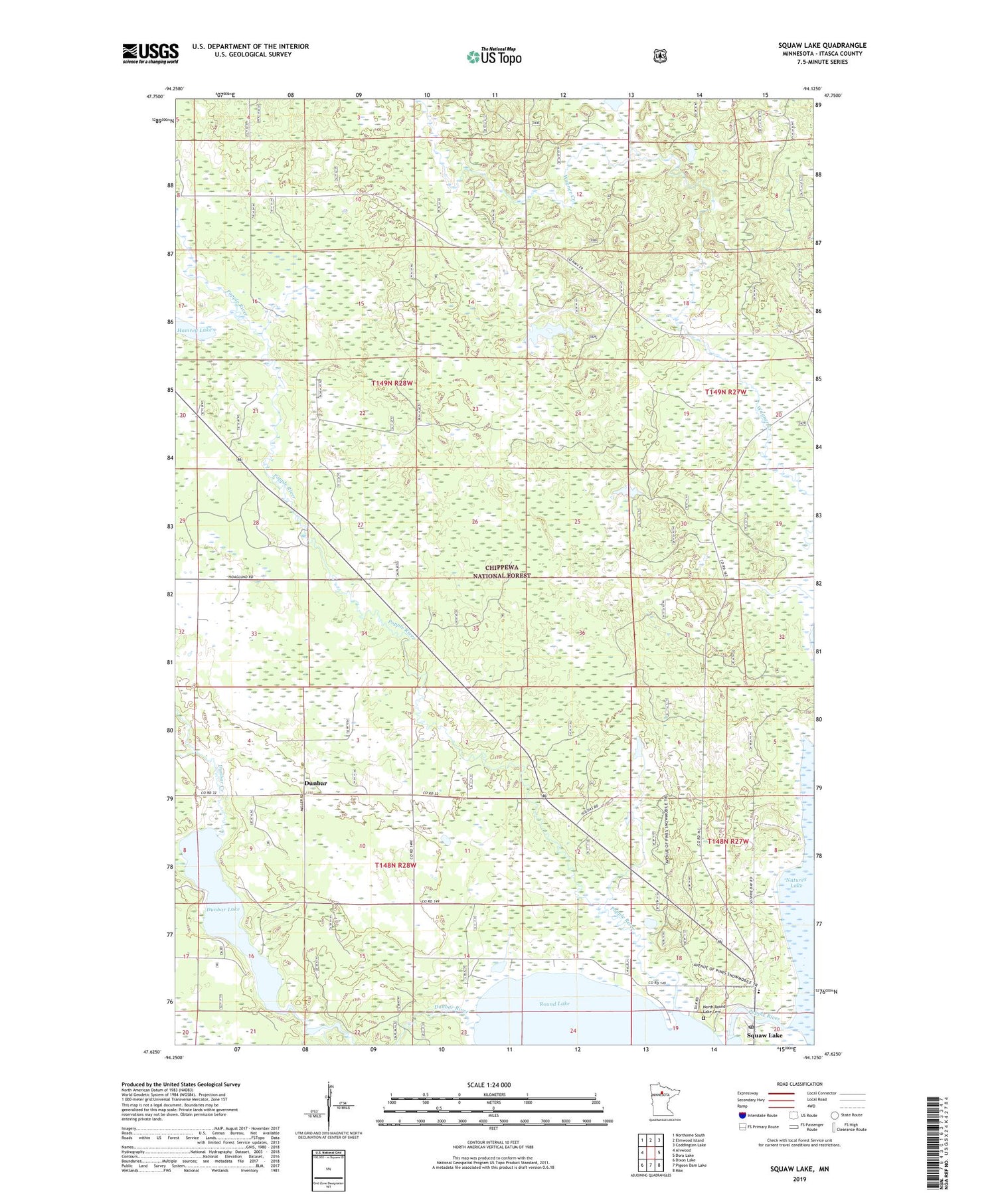
2019 topographic map quadrangle Squaw Lake in the state of Minnesota. Scale: 1:24000. Based on the newly updated USGS 7.5' US Topo map series, this map is in the following counties: Itasca. The map contains contour data, water features, and other items you are used to seeing on USGS maps, but also has updated roads and other features. This is the next generation of topographic maps. Printed on high-quality waterproof paper with UV fade-resistant inks.
Quads adjacent to this one:
West: Alvwood
Northwest: Northome South
North: Elmwood Island
Northeast: Coddington Lake
East: Dora Lake
Southeast: Max
South: Pigeon Dam Lake
Southwest: Dixon Lake
Contains the following named places: Centennial Lutheran Church, City of Squaw Lake, Dunbar, Dunbar Creek, Dunbar Lake, Dunbar Post Office, Hamrey Lake, North Round Lake Cemetery, Orchid Post Office, Saint Catherine's Catholic Church, Squaw Lake, Squaw Lake City Hall, Squaw Lake Elementary School, Squaw Lake Post Office, T and N Inn Lodging and Campground, Township of Alvwood, Township of Good Hope