MyTopo
Staples Minnesota US Topo Map
Couldn't load pickup availability
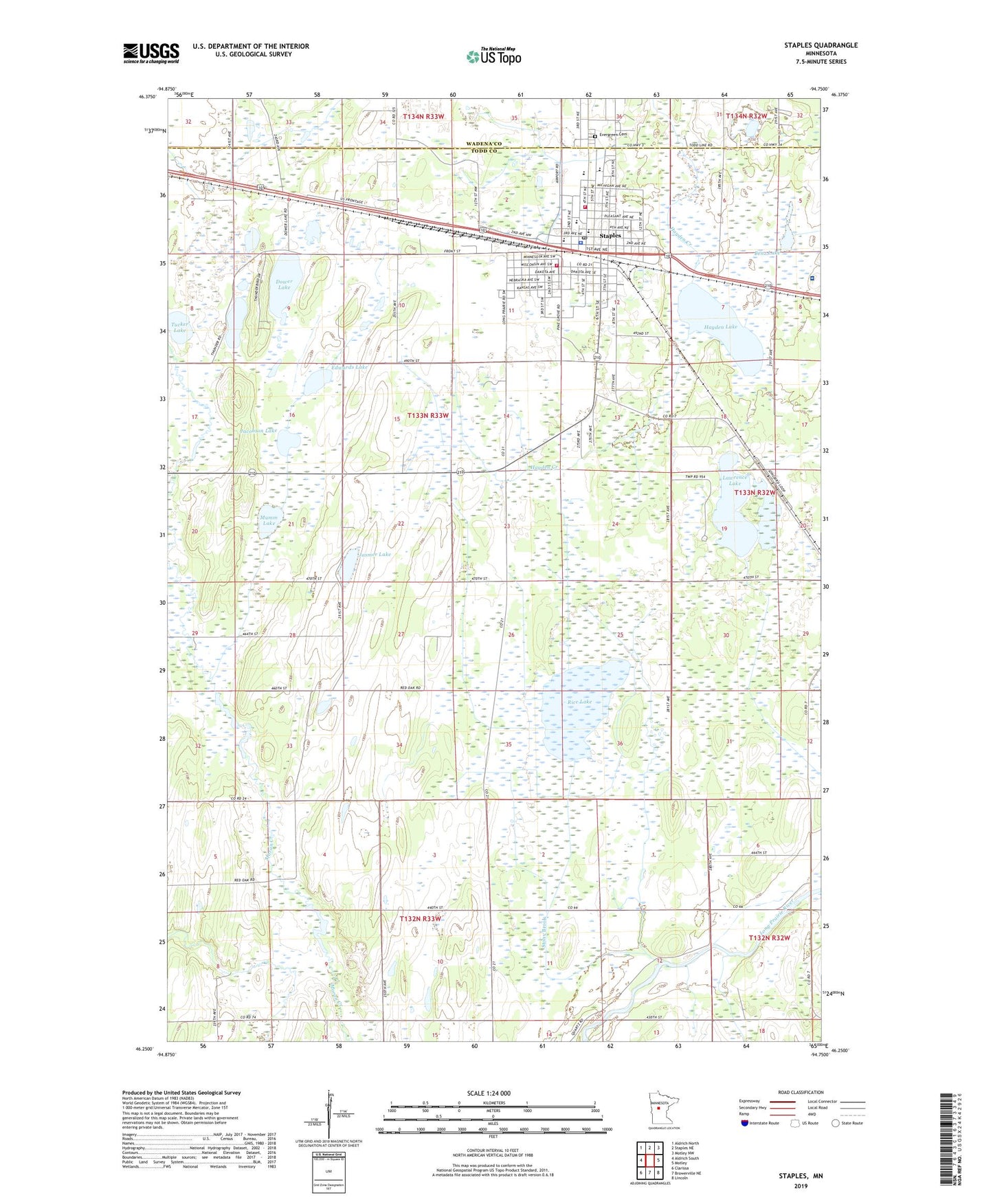
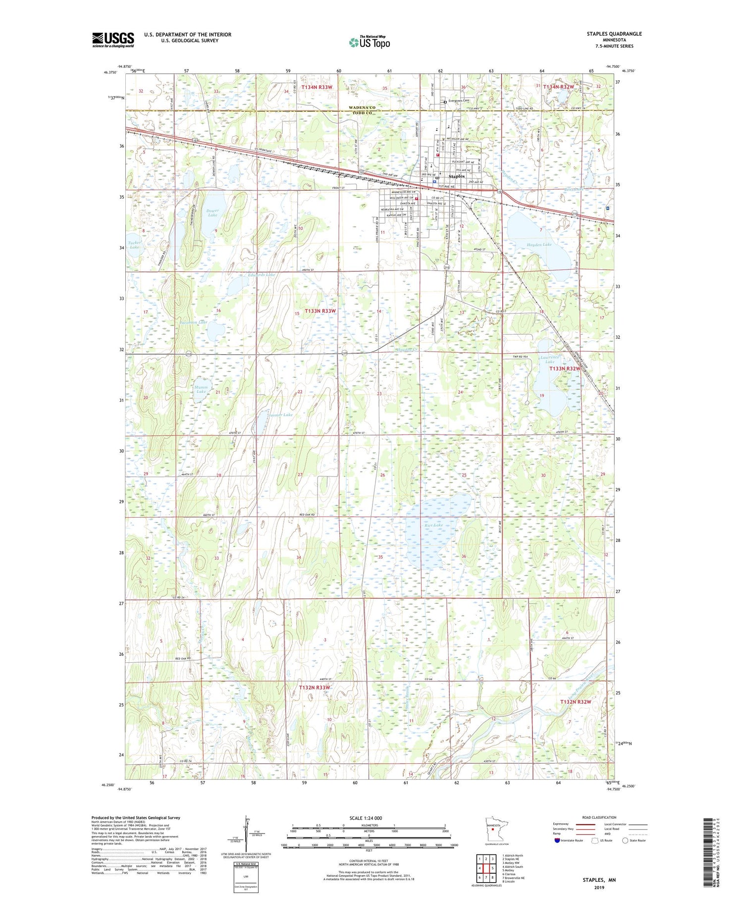
2019 topographic map quadrangle Staples in the state of Minnesota. Scale: 1:24000. Based on the newly updated USGS 7.5' US Topo map series, this map is in the following counties: Todd, Wadena. The map contains contour data, water features, and other items you are used to seeing on USGS maps, but also has updated roads and other features. This is the next generation of topographic maps. Printed on high-quality waterproof paper with UV fade-resistant inks.
Quads adjacent to this one:
West: Aldrich South
Northwest: Aldrich North
North: Staples NE
Northeast: Motley NW
East: Motley
Southeast: Lincoln
South: Browerville NE
Southwest: Clarissa
Contains the following named places: Assemblies of God Church, Benz Lake, Church of Christ, Church of the Nazarene, City of Staples, Dower Lake, Dower State Wildlife Management Area, Edwards Lake, Evergreen Cemetery, Faith Lutheran Church, Hayden Lake, Jacobson Lake, Jasmer Lake, KNSP-AM (Staples), KNSP-FM (Staples), Lakewood Health System Main Campus, Lawrence Lake, Lawrence State Wildlife Management Area, Mumm Lake, Oak Ridge Trailer Court, Pine Grove Park, Pine Ridge Trailer Court, Rice Lake, Riverside School, Sacred Heart Catholic Church, Sacred Heart Catholic School, School Number 2289, Seventh Day Adventist Church, Staples, Staples City Hall, Staples Elementary School, Staples Fire Department Station 1, Staples Fire Department Station 2, Staples Motley High School, Staples Police Department, Staples Post Office, Staples Public Library, Staples State Wildlife Management Area, Staples Wildlife Management Area Dam, Stony Brook, Township of Staples, Trinity Lutheran Church, Tucker Lake, United Congregational Church, United Methodist Church