MyTopo
Syre Minnesota US Topo Map
Couldn't load pickup availability
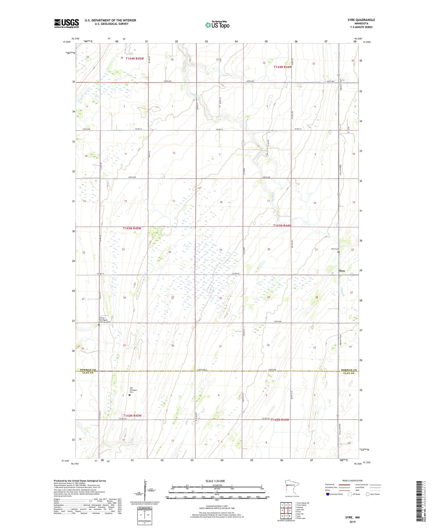
2022 topographic map quadrangle Syre in the state of Minnesota. Scale: 1:24000. Based on the newly updated USGS 7.5' US Topo map series, this map is in the following counties: Norman, Clay. The map contains contour data, water features, and other items you are used to seeing on USGS maps, but also has updated roads and other features. This is the next generation of topographic maps. Printed on high-quality waterproof paper with UV fade-resistant inks.
Quads adjacent to this one:
West: Ulen NW
Northwest: Twin Valley SW
North: Twin Valley
Northeast: Waukon
East: Flom
Southeast: Tilde Lake
South: Ulen
Southwest: Ulen SW
This map covers the same area as the classic USGS quad with code o47096b3.
Contains the following named places: County Ditch Number Twentynine, Dalby State Wildlife Management Area, Neal State Wildlife Management Area, Old Jevnaker Cemetery, Rockwell Dam, Syre, Syre Cemetery, Syre Post Office, Syre State Wildlife Management Area, Syre Station, Township of Home Lake, Twin Valley State Wildlife Management Are, United Norwegian Lutheran Cemetery