MyTopo
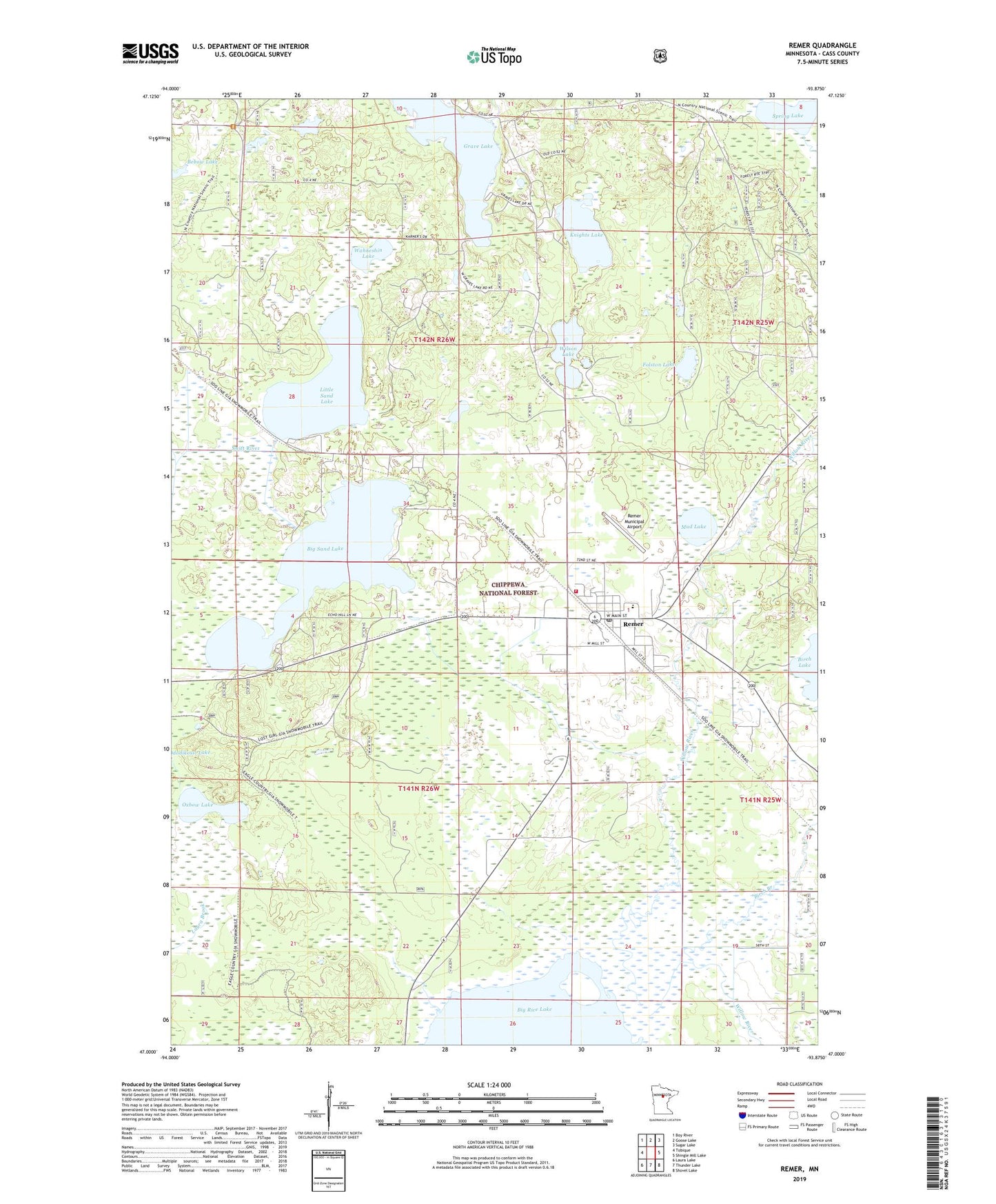
Remer Minnesota US Topo Map
Couldn't load pickup availability
Also explore the Remer Forest Service Topo of this same quad for updated USFS data
2022 topographic map quadrangle Remer in the state of Minnesota. Scale: 1:24000. Based on the newly updated USGS 7.5' US Topo map series, this map is in the following counties: Cass. The map contains contour data, water features, and other items you are used to seeing on USGS maps, but also has updated roads and other features. This is the next generation of topographic maps. Printed on high-quality waterproof paper with UV fade-resistant inks.
Quads adjacent to this one:
West: Tobique
Northwest: Boy River
North: Goose Lake
Northeast: Sugar Lake
East: Shingle Mill Lake
Southeast: Shovel Lake
South: Thunder Lake
Southwest: Laura Lake
This map covers the same area as the classic USGS quad with code o47093a8.
Contains the following named places: Bethany Evangelical Lutheran Church, Big Sand Lake, Birch Branch, Cedar Point Resort and Campground, City of Remer, Duluth Clinic - Remer, Eagle Country Christian Academy, Fairview Cemetery, Folston Lake, Grave Lake, Knights Lake, Little Sand Lake, Little Sand Lake Campground, Loon Lake, Loon Lake Dam, Mud Lake, Northland High School, Oxbow Lake, Remer, Remer Alliance Church, Remer Congregational Church, Remer Fire Department, Remer Motel and Campground, Remer Municipal Airport, Remer Police Department, Remer Post Office, Saint Paul's Catholic Church, Spring Lake, Township of Remer, Township of Slater, Wahneshin Lake, Wilson Lake