MyTopo
Watson Minnesota US Topo Map
Couldn't load pickup availability
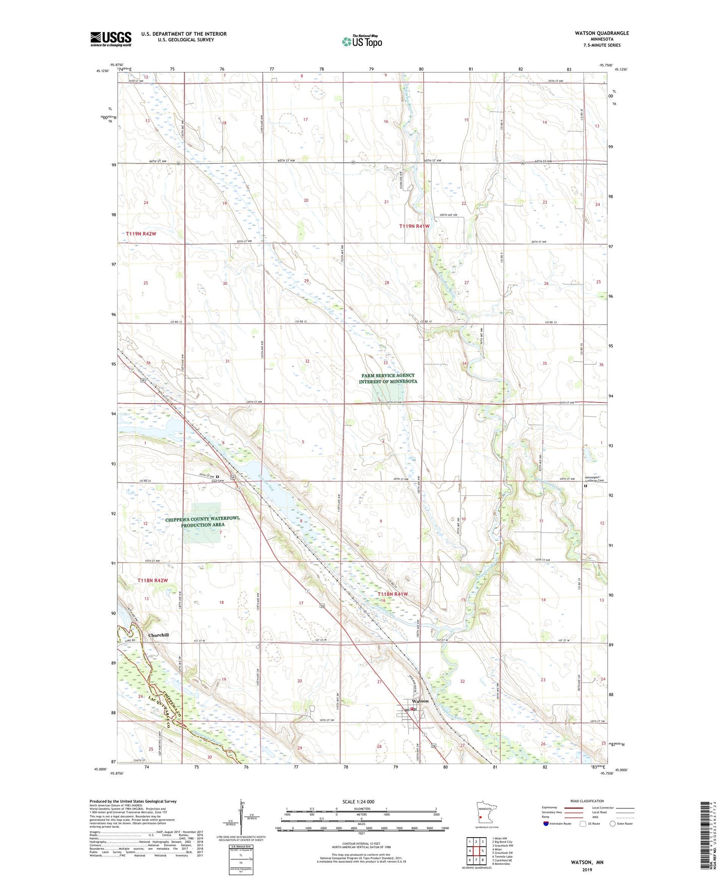
2022 topographic map quadrangle Watson in the state of Minnesota. Scale: 1:24000. Based on the newly updated USGS 7.5' US Topo map series, this map is in the following counties: Chippewa, Lac qui Parle. The map contains contour data, water features, and other items you are used to seeing on USGS maps, but also has updated roads and other features. This is the next generation of topographic maps. Printed on high-quality waterproof paper with UV fade-resistant inks.
Quads adjacent to this one:
West: Milan
Northwest: Milan NW
North: Big Bend City
Northeast: Gracelock NW
East: Gracelock SW
Southeast: Montevideo
South: Clarkfield NE
Southwest: Tenmile Lake
This map covers the same area as the classic USGS quad with code o45095a7.
Contains the following named places: Bethel Camp, Chippewa River Diversion Dam, Churchill, City of Watson, Dry Weather Creek, Easy Bean Farm, Immanuel Church, Joseph Renville Historical Marker, Lac qui Parle Dam, Lac Qui Parle Dam, Lac qui Parle Mission 1835-1854 Historical Marker, Lac qui Parle Mission Park, Lac Qui Parle Reservoir, Lions Park, Norwegian Lutheran Church Cemetery, School Number 276, School Number 277, School Number 282, School Number 288, School Number 293, Township of Big Bend, Township of Tunsberg, Watson, Watson Evangelical Church, Watson Fire Department, Watson Lutheran Church, Watson Post Office, Watson Sag, Zion Cemetery, Zion Church, ZIP Codes: 56262, 56295