MyTopo
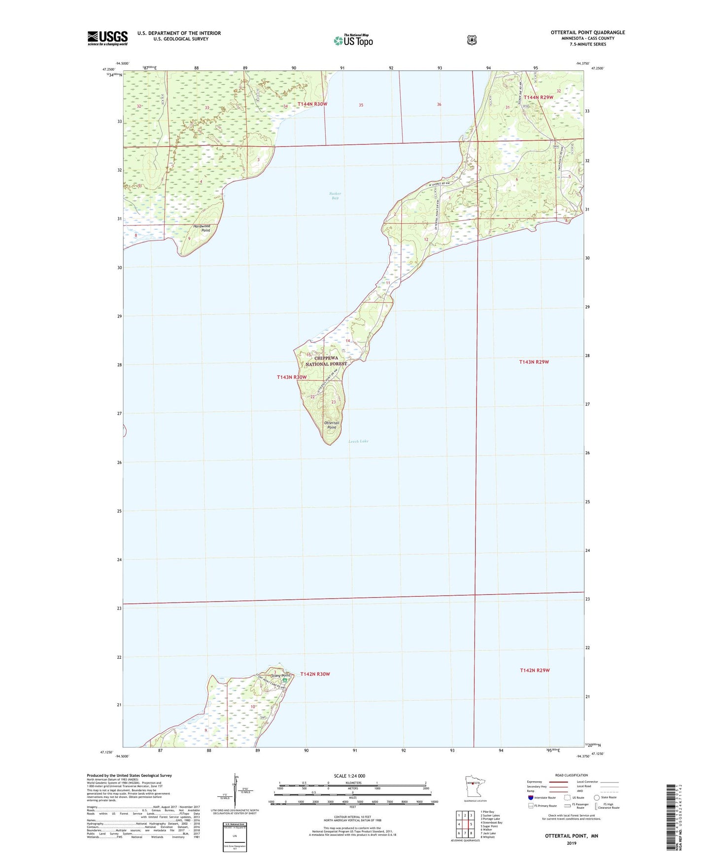
Ottertail Point Minnesota US Topo Map
Couldn't load pickup availability
Also explore the Ottertail Point Forest Service Topo of this same quad for updated USFS data
2022 topographic map quadrangle Ottertail Point in the state of Minnesota. Scale: 1:24000. Based on the newly updated USGS 7.5' US Topo map series, this map is in the following counties: Cass. The map contains contour data, water features, and other items you are used to seeing on USGS maps, but also has updated roads and other features. This is the next generation of topographic maps. Printed on high-quality waterproof paper with UV fade-resistant inks.
Quads adjacent to this one:
West: Steamboat Bay
Northwest: Pike Bay
North: Sucker Lakes
Northeast: Portage Lake
East: Sugar Point
Southeast: Whipholt
South: Jack Lake
Southwest: Walker
This map covers the same area as the classic USGS quad with code o47094b4.
Contains the following named places: Big Rock Summer Recreation Residences, Hardwood Point, Leech Lake, Ottertail Point, Stony Point, Stony Point Campground and Picnic Area, Sucker Bay, Two Points, Unorganized Territory of North Central Cass