MyTopo
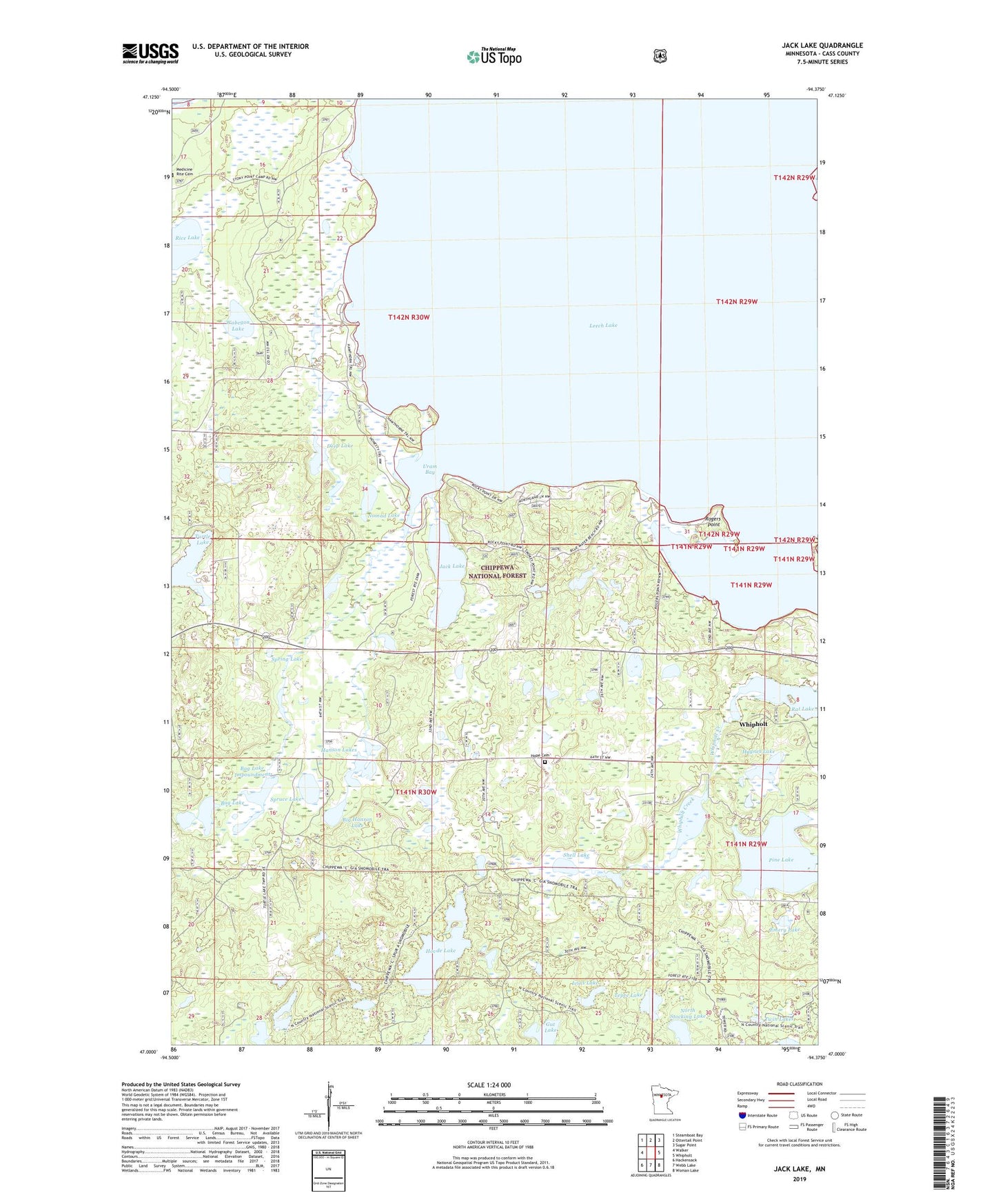
Jack Lake Minnesota US Topo Map
Couldn't load pickup availability
Also explore the Jack Lake Forest Service Topo of this same quad for updated USFS data
2022 topographic map quadrangle Jack Lake in the state of Minnesota. Scale: 1:24000. Based on the newly updated USGS 7.5' US Topo map series, this map is in the following counties: Cass. The map contains contour data, water features, and other items you are used to seeing on USGS maps, but also has updated roads and other features. This is the next generation of topographic maps. Printed on high-quality waterproof paper with UV fade-resistant inks.
Quads adjacent to this one:
West: Walker
Northwest: Steamboat Bay
North: Ottertail Point
Northeast: Sugar Point
East: Whipholt
Southeast: Woman Lake
South: Webb Lake
Southwest: Hackensack
This map covers the same area as the classic USGS quad with code o47094a4.
Contains the following named places: Bag Lake, Bag Lake Impoundment, Big Hanson Lake, Chippewa Bible Church, Deep Lake, Emery Lake, Gut Lake, Hanson Lakes, Haynes Lake, Hope Cemetery, Hovde Lake, Ivins Lake, Jack Lake, Medicine Rite Cemetery, Nomad Lake, North Stocking Lake, Pine Lake, Rat Lake, Rice Lake, Rogers Point, Shell Lake, Spring Lake, Spruce Lake, Tanglewood Lake, Tepee Lake, Township of Turtle Lake, Turtle Lake, Twin Lakes, Uram Bay, Wabegon Lake, Whipholt Census Designated Place, ZIP Code: 56484