MyTopo
Wilbert Minnesota US Topo Map
Couldn't load pickup availability
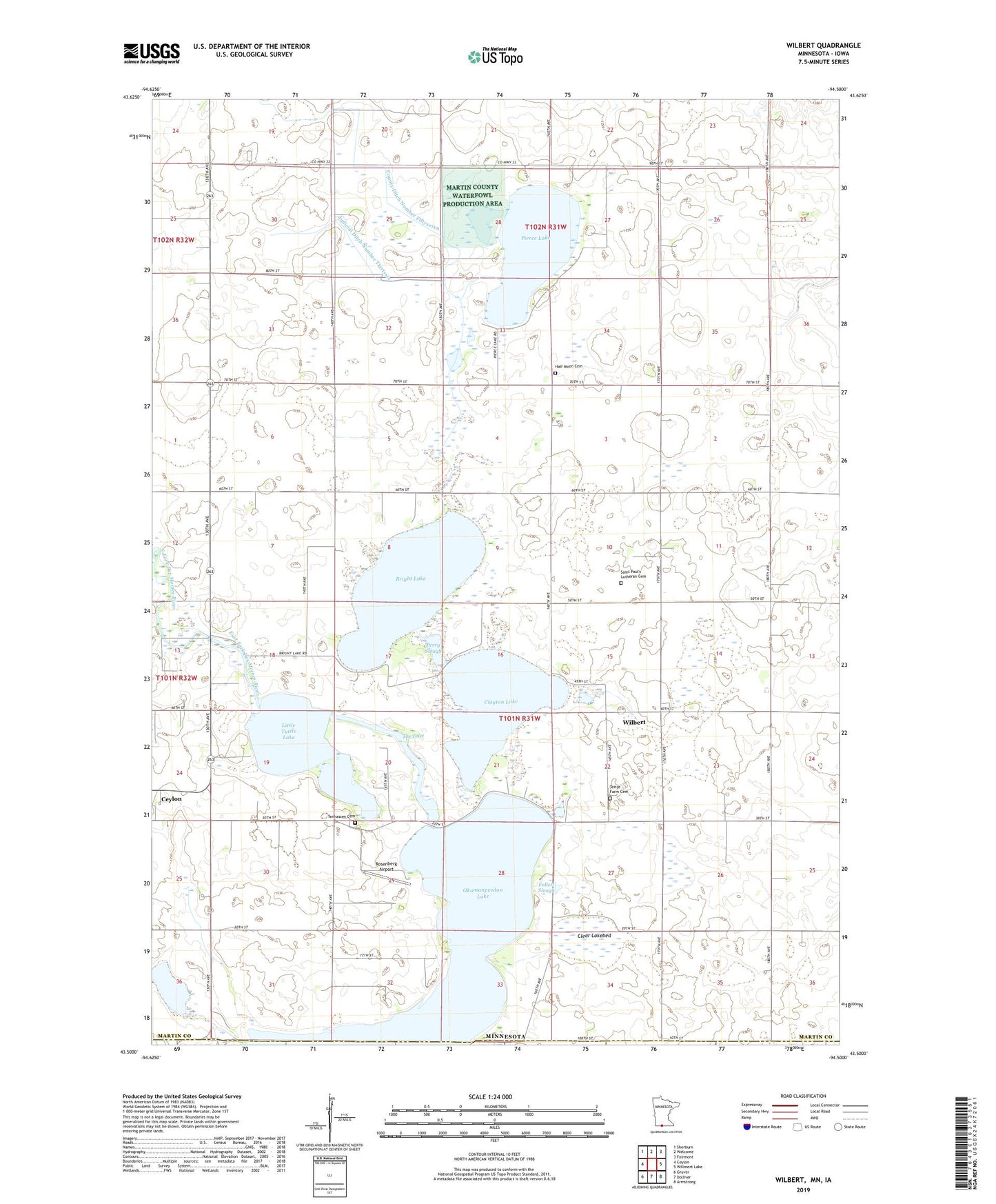
2022 topographic map quadrangle Wilbert in the states of Minnesota, Iowa. Scale: 1:24000. Based on the newly updated USGS 7.5' US Topo map series, this map is in the following counties: Martin, Emmet. The map contains contour data, water features, and other items you are used to seeing on USGS maps, but also has updated roads and other features. This is the next generation of topographic maps. Printed on high-quality waterproof paper with UV fade-resistant inks.
Quads adjacent to this one:
West: Ceylon
Northwest: Sherburn
North: Welcome
Northeast: Fairmont
East: Willmert Lake
Southeast: Armstrong
South: Dolliver
Southwest: Gruver
This map covers the same area as the classic USGS quad with code o43094e5.
Contains the following named places: Bright Lake, Ceylon Wayside, Clayton Lake, Clear Lakebed, County Ditch Number Twentyeight, Follett Slough, Half Moon Cemetery, Judicial Ditch Number Thirtysix, Kings Slough, Little Tuttle Lake, Martin County Waterfowl Production Area, Mud Slough, Okamanpeedan Lake, Perry Slough, Pierce Lake, Rosenberg Airport, Saint Paul's Lutheran Cemetery, Saint Paul's Lutheran Church, Saint Paul's Lutheran School, Teitje Farm Cemetery, Tenhassen Cemetery, The Inlet, Township of Tenhassen, Wilbert, Wilbert Post Office, ZIP Code: 56121