MyTopo
Dolliver Iowa US Topo Map
Couldn't load pickup availability
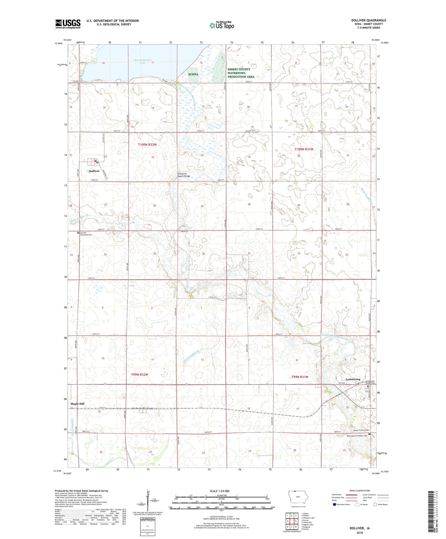
2022 topographic map quadrangle Dolliver in the state of Iowa. Scale: 1:24000. Based on the newly updated USGS 7.5' US Topo map series, this map is in the following counties: Emmet. The map contains contour data, water features, and other items you are used to seeing on USGS maps, but also has updated roads and other features. This is the next generation of topographic maps. Printed on high-quality waterproof paper with UV fade-resistant inks.
Quads adjacent to this one:
West: Gruver
Northwest: Ceylon
North: Wilbert
Northeast: Willmert Lake
East: Armstrong
Southeast: Seneca
South: Ringsted
Southwest: Ingham Lake
This map covers the same area as the classic USGS quad with code o43094d5.
Contains the following named places: Armstrong Grove Cemetery, City of Dolliver, Ditch Number 26, Ditch Number 68, Dolliver, Dolliver Post Office, Ellsworth Ranch Bridge, Gridley, Gridley Post Office, Gruver Fire Department Station 2, Guse Farms, Lincoln Township Cemetery, Maple Hill, Maple Hill Post Office, Mount Calvary Cemetery, Okamanpeedan Lake, Okomanpado Lake Historical Marker, Saint Marys Catholic Cemetery, Township of Armstrong Grove, Township of Iowa Lake, Township of Lincoln, Township of Swan Lake, Tuttle Lake County Park, Tuttle Lake State Game Management Area, ZIP Code: 50531