MyTopo
Armstrong Iowa US Topo Map
Couldn't load pickup availability
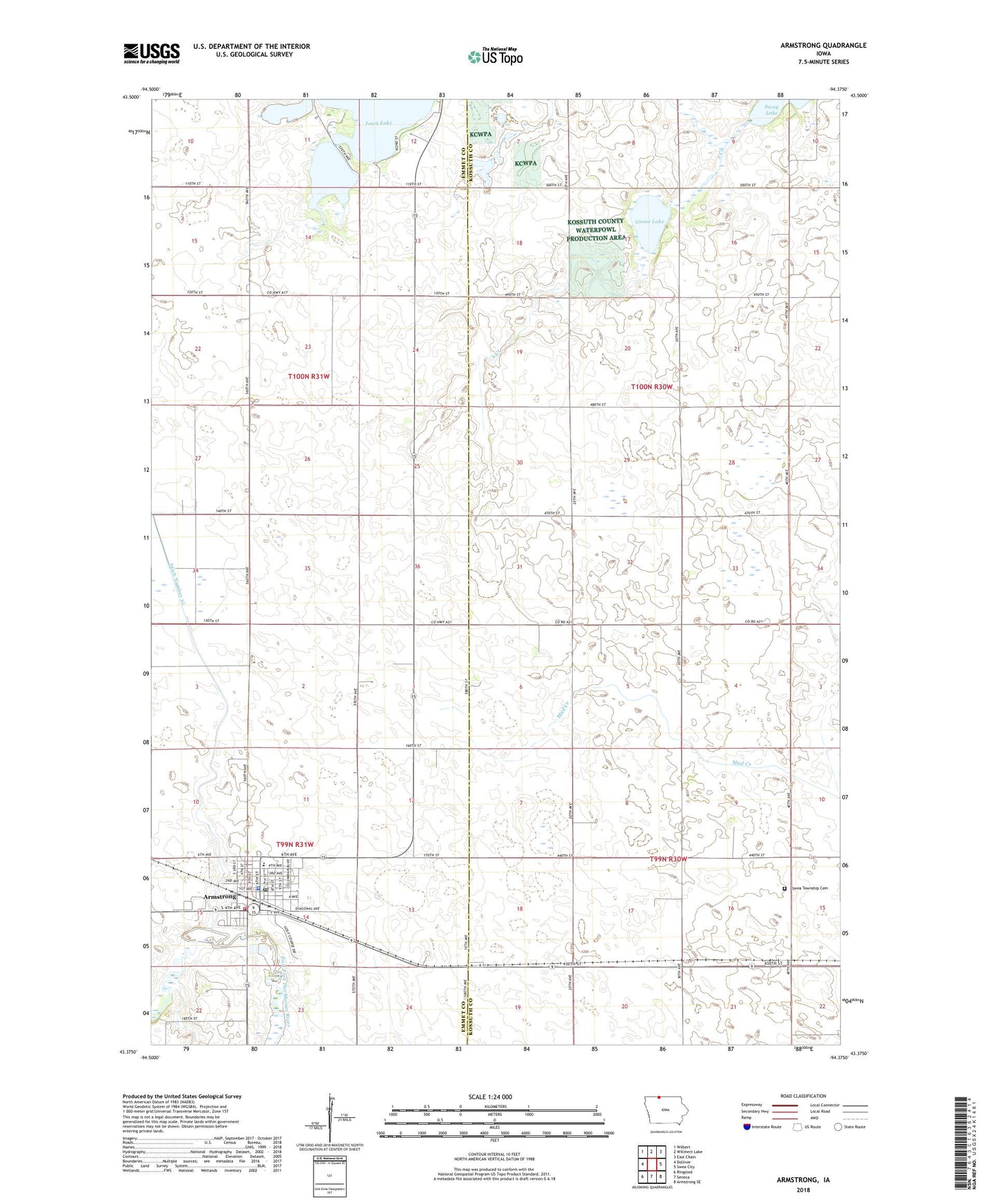
2022 topographic map quadrangle Armstrong in the state of Iowa. Scale: 1:24000. Based on the newly updated USGS 7.5' US Topo map series, this map is in the following counties: Kossuth, Emmet. The map contains contour data, water features, and other items you are used to seeing on USGS maps, but also has updated roads and other features. This is the next generation of topographic maps. Printed on high-quality waterproof paper with UV fade-resistant inks.
Quads adjacent to this one:
West: Dolliver
Northwest: Wilbert
North: Willmert Lake
Northeast: East Chain
East: Swea City
Southeast: Armstrong SE
South: Seneca
Southwest: Ringsted
This map covers the same area as the classic USGS quad with code o43094d4.
Contains the following named places: Armstrong, Armstrong Emergency Medical Services, Armstrong Fire Department, Armstrong Medical Clinic, Armstrong Police Department, Armstrong Post Office, Armstrong Public Library, City of Armstrong, Co-operative Grain and Product Company Elevator, Country Greens Golf Course, Ditch Number 35, Eagle Lake, Free Methodist Church, Goose Lake, Goose Lake State Game Management Area, Iowa Lake, Iowa Lake Marsh State Game Management Area, Iowa Lake Post Office, Iowa Lake State Game Management Area, Nazareth Lutheran Church, North Union High School, Presbyterian Church, R T Farms, Saint Marys Catholic Church, South Creek, Swea, Swea Township Cemetery, Township of Eagle, Township of Swea, Turner Clinic, United Methodist Church, ZIP Code: 50514