MyTopo
Witoka Minnesota US Topo Map
Couldn't load pickup availability
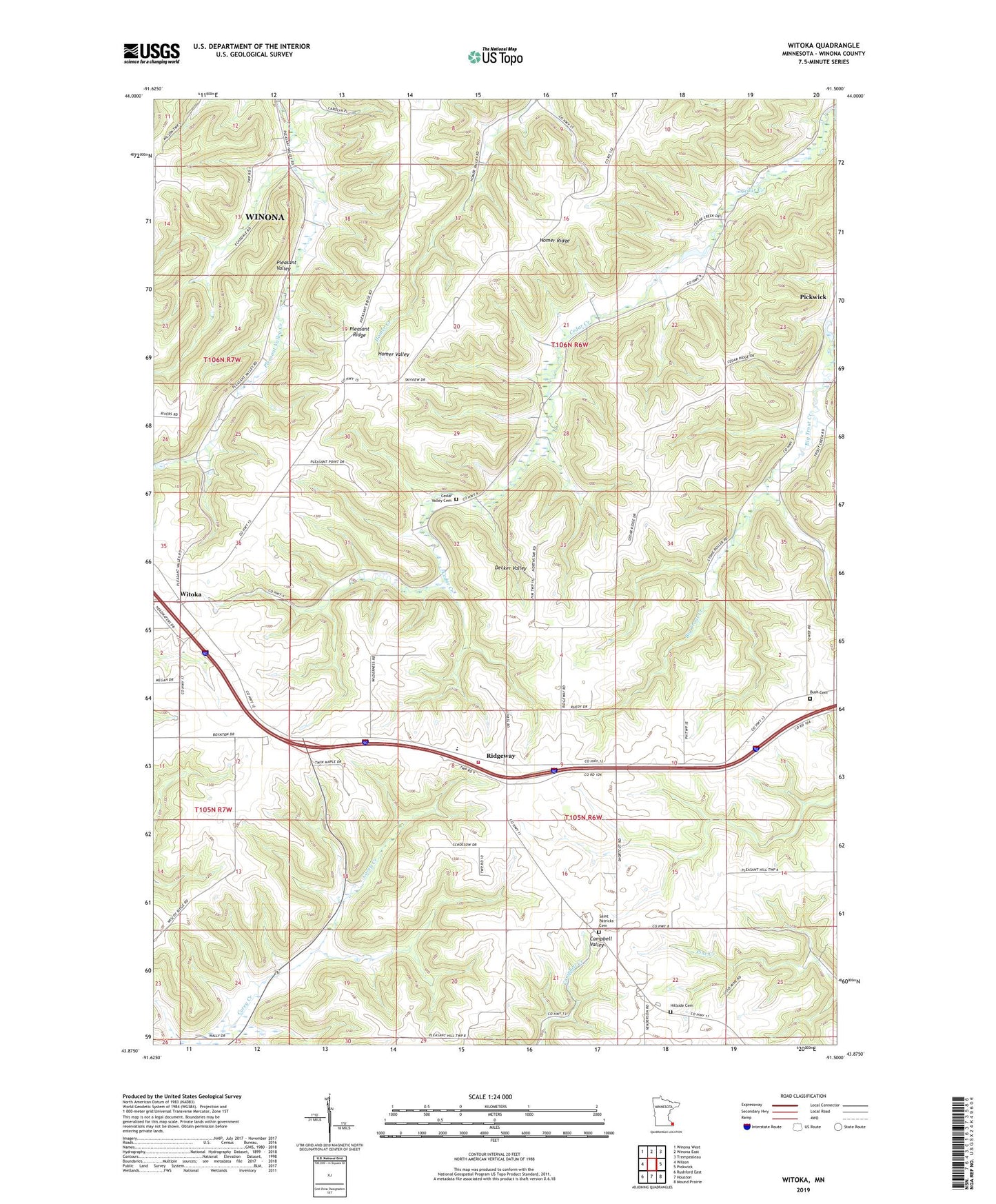
2022 topographic map quadrangle Witoka in the state of Minnesota. Scale: 1:24000. Based on the newly updated USGS 7.5' US Topo map series, this map is in the following counties: Winona. The map contains contour data, water features, and other items you are used to seeing on USGS maps, but also has updated roads and other features. This is the next generation of topographic maps. Printed on high-quality waterproof paper with UV fade-resistant inks.
Quads adjacent to this one:
West: Wilson
Northwest: Winona West
North: Winona East
Northeast: Trempealeau
East: Pickwick
Southeast: Mound Prairie
South: Houston
Southwest: Rushford East
This map covers the same area as the classic USGS quad with code o43091h5.
Contains the following named places: Bush Cemetery, Cedar Valley Cemetery, Cedar Valley Lutheran Church, Grace Church, Hillside Cemetery, Homer Ridge, Hundorf Dam, Judy Dam, Loyal Hoseck Detention Structure Number 1 Dam, Loyal Hoseck Detention Structure Number 2 Dam, Pleasant Ridge, Pleasant Valley Site Number 10 Dam, Pleasant Valley Site Number 3 Dam, Pleasant Valley Site Number 6 Dam, Pleasant Valley Site Number 7 Dam, Pleasant Valley Site Number 8 Dam, Ridgeway, Ridgeway Post Office, Ridgeway Volunteer Fire Department, Saint Patricks Cemetery, Township of Homer, Township of Pleasant Hill, Witoka, Witoka Post Office