MyTopo
Avalon Mississippi US Topo Map
Couldn't load pickup availability
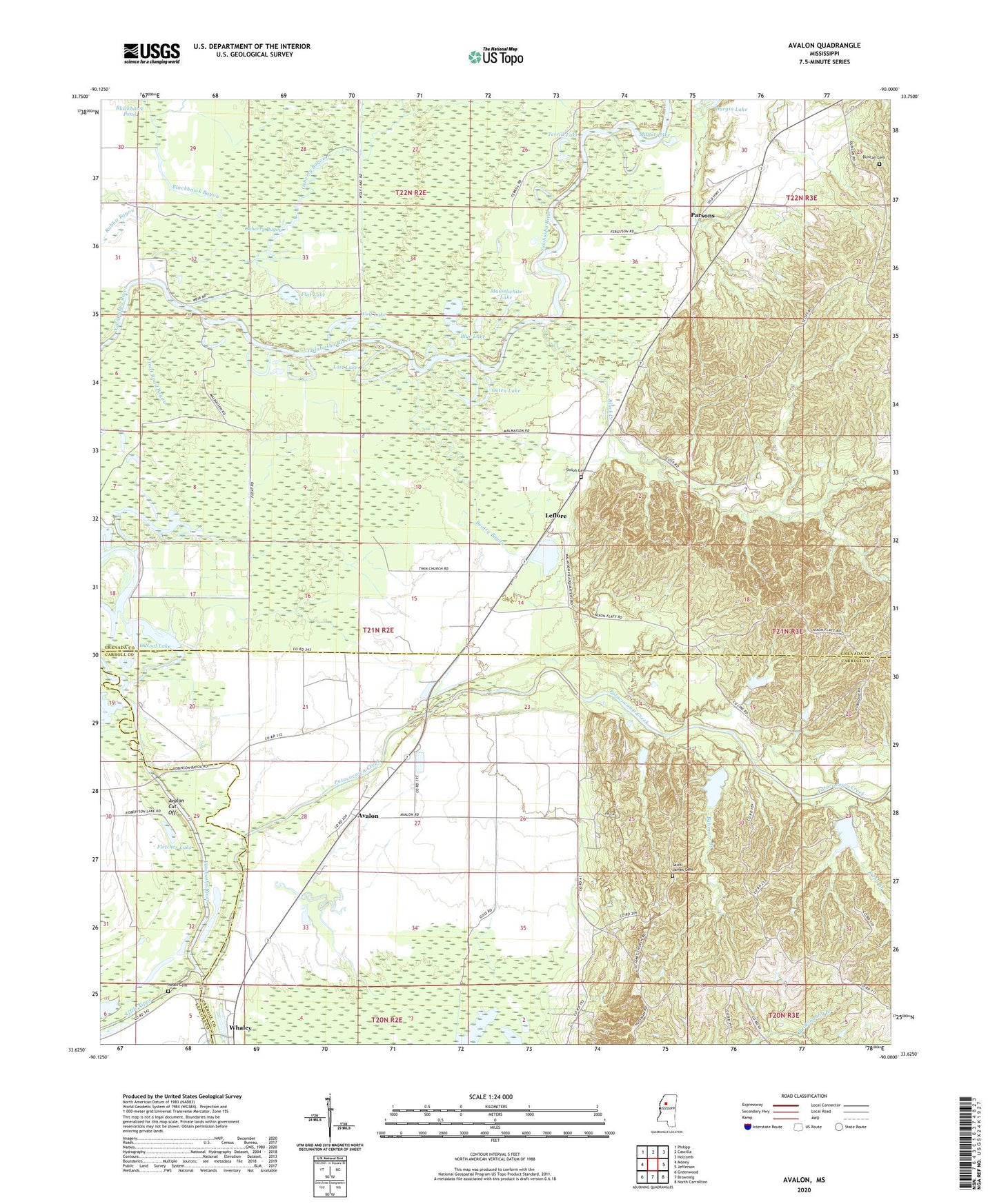
2024 topographic map quadrangle Avalon in the state of Mississippi. Scale: 1:24000. Based on the newly updated USGS 7.5' US Topo map series, this map is in the following counties: Grenada, Carroll, Leflore. The map contains contour data, water features, and other items you are used to seeing on USGS maps, but also has updated roads and other features. This is the next generation of topographic maps. Printed on high-quality waterproof paper with UV fade-resistant inks.
Quads adjacent to this one:
West: Money
Northwest: Philipp
North: Cascilla
Northeast: Holcomb
East: Jefferson
Southeast: North Carrollton
South: Browning
Southwest: Greenwood
This map covers the same area as the classic USGS quad with code o33090f1.
Contains the following named places: Avalon, Avalon Cut-Off, Babmore Branch, Beatty Bayou, Beaverdam Lake, Black Creek, Blue Lake, Church of Christ, Duncan Cemetery, Duncan Crossing, Durgin Lake, Flat Lake, Fletcher Lake, Holly Grove Church Number 2, Hope School, Jacklot Lake, Kirby Branch, Leflore, Lost Chance Lake, Lost Lake, Malmaison State Wildlife Management Area, Minter Lake, Musselwhite Lake, Neals Cemetery, Neals Chapel, O'Neal Lake, Ooten Lake, Oxberry Bayou, Parsons, Potacocawa Creek Structure Y-3la-17 Dam, Potacocawa Watershed Y-3la-1 Dam, Potacocawa Watershed Y-3la-2 Dam, Potacocowa Creek, Potacocowa Watershed Y-3la-18 Dam, Potacocowa Watershed Y-3la-28 Dam, Saint Andrews Church, Saint James Cemetery, Saint James Church Number 1, Saint James Church Number 2, Samuels Chapel, Scurlock School, Shiloh Cemetery, Shiloh Church, Supervisor District 5, Swins Chapel, Terrill Lake, Turpin Switch, Union Grove Church, Valley, Valley School, Wolf Lake, Woods Chapel, ZIP Code: 38940