MyTopo
Sherman Mississippi US Topo Map
Couldn't load pickup availability
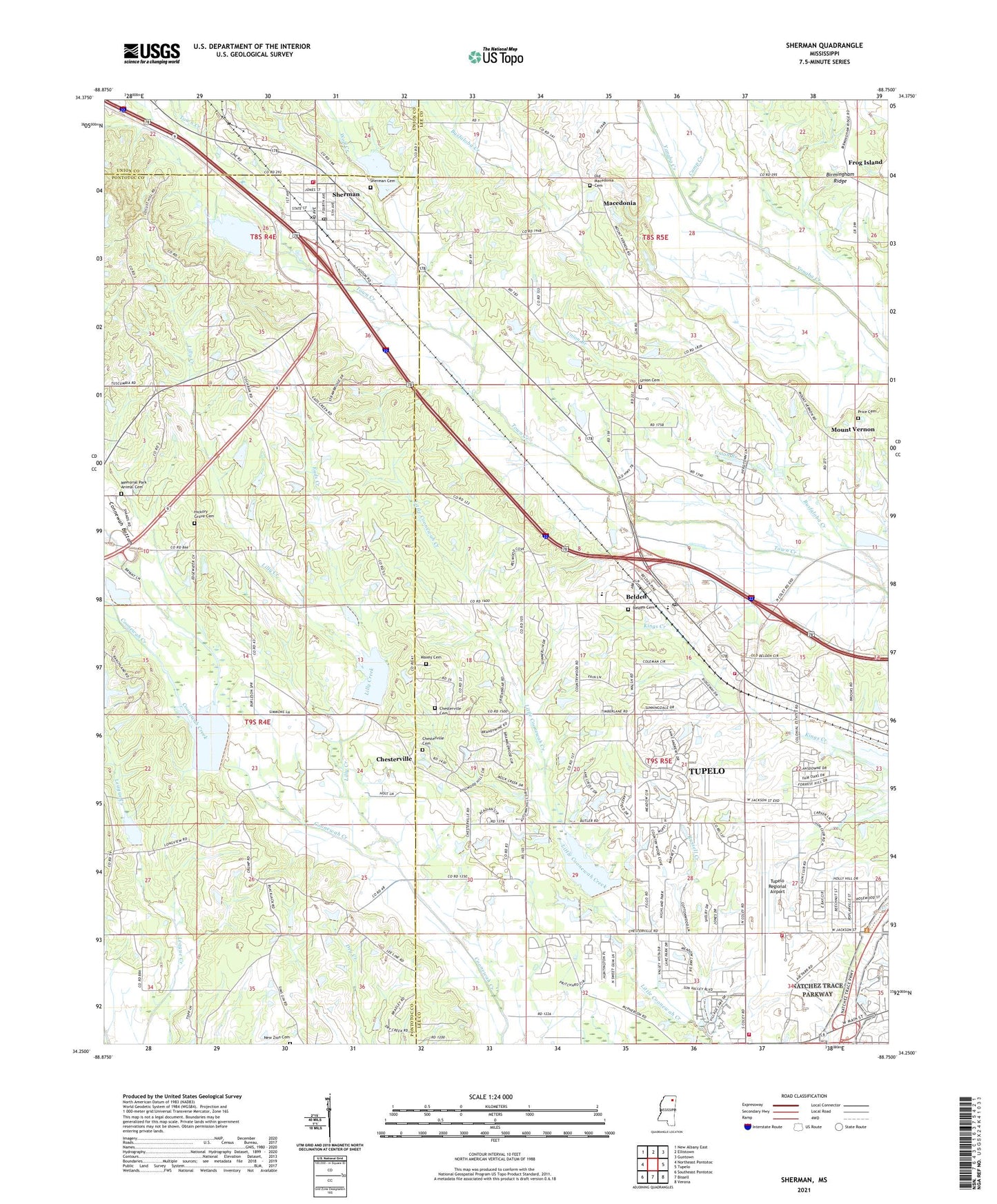
2024 topographic map quadrangle Sherman in the state of Mississippi. Scale: 1:24000. Based on the newly updated USGS 7.5' US Topo map series, this map is in the following counties: Lee, Pontotoc, Union. The map contains contour data, water features, and other items you are used to seeing on USGS maps, but also has updated roads and other features. This is the next generation of topographic maps. Printed on high-quality waterproof paper with UV fade-resistant inks.
Quads adjacent to this one:
West: Northeast Pontotoc
Northwest: New Albany East
North: Ellistown
Northeast: Guntown
East: Tupelo
Southeast: Verona
South: Bissell
Southwest: Southeast Pontotoc
This map covers the same area as the classic USGS quad with code o34088c7.
Contains the following named places: Belden, Belden Attendance Center, Belden Baptist Church, Belden Cemetery, Belden Post Office, Bethel Church, Busfaloba Creek, Calvary Church, Camp Creek, Chapel Grove Church, Chesterville, Chesterville Baptist Church, Chesterville Cemetery, Chesterville United Methodist Church, Chiwapa Structure 65 Dam, Connewah Bottom, Eads Creek, Faith Revival Center, Frog Island, George Sims Lake Dam, Good News Church, Green Liberty Church, Hickory Grove Cemetery, Hopewell Church, J W Vinson Lake Dam, Kimble Chapel, Lilly Creek, Locust Hill Church, Macedonia, Macedonia Baptist Church, Macedonia School, Maxey Cemetery, Memorial Park Animal Cemetery, Mount Pleasant Church, Mount Vernon, Mount Vernon School, New Resident Church, New Zion Cemetery, Old Chesterville Cemetery, Old Macedonia Cemetery, Pauls Chapel, Price Cemetery, Russell Creek, Ryan Creek, Sherman, Sherman Baptist Church, Sherman Cemetery, Sherman Church of Christ, Sherman City Fire Department, Sherman City Police Department, Sherman Post Office, Sherman School, Sherman United Methodist Church, Supervisor District 3, Town Creek Structure 23 Dam, Town Creek Structure 24 Dam, Town of Sherman, Towncreek Watershed 18 Dam, Traceland, Tracewood, Tupelo Airport Industrial Park, Tupelo Country Club, Tupelo Fire Department Station 6, Tupelo Fire Department Station 7, Tupelo Municipal Airport Fire Department, Tupelo Regional Airport, Union Branch, Union Cemetery, Union Church, Union School, Wildwood, Wilson School, Wolf Creek, ZIP Codes: 38826, 38869