MyTopo
Brooklyn Mississippi US Topo Map
Couldn't load pickup availability
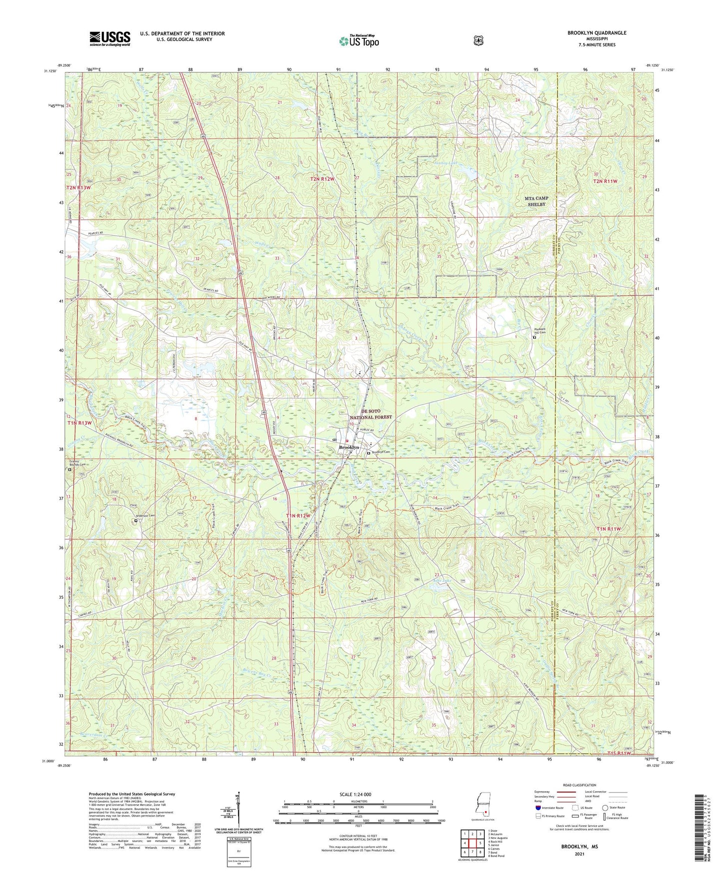
2021 topographic map quadrangle Brooklyn in the state of Mississippi. Scale: 1:24000. Based on the newly updated USGS 7.5' US Topo map series, this map is in the following counties: Forrest, Perry. The map contains contour data, water features, and other items you are used to seeing on USGS maps, but also has updated roads and other features. This is the next generation of topographic maps. Printed on high-quality waterproof paper with UV fade-resistant inks.
Quads adjacent to this one:
West: Rock Hill
Northwest: Dixie
North: McLaurin
Northeast: New Augusta
East: Janice
Southeast: Bond Pond
South: Bond
Southwest: Carnes
Contains the following named places: Anderson Cemetery, Ashe Lake, Ashe Lake Dam, Ashe Lake Picnic Area, Ashe Lake Recreation Area, Bear Creek, Big Creek, Brooklyn, Brooklyn Cemetery, Brooklyn Post Office, Brooklyn Volunteer Fire Department, Chancellor, Chaney Creek, Clear Creek, Clear Creek Church, Currie, Davis Creek, Dixie, First Baptist Church of Brooklyn, Forrest County Agricultural High School, Grace Chapel Baptist Church, Granny Bounds Cemetery, Granny Creek, Griffins Precinct, Holmes Spur, Howell Lake Dam, Janney Lake, Long Branch, Macklin Creek, Pearces Mill Creek, Pleasant Hill Cemetery, Poplar Creek, Rosine, South Forrest Attendance Center, Trueway Church, United State Forest Service Ashe Nursery, Walls Creek, Whites School