MyTopo
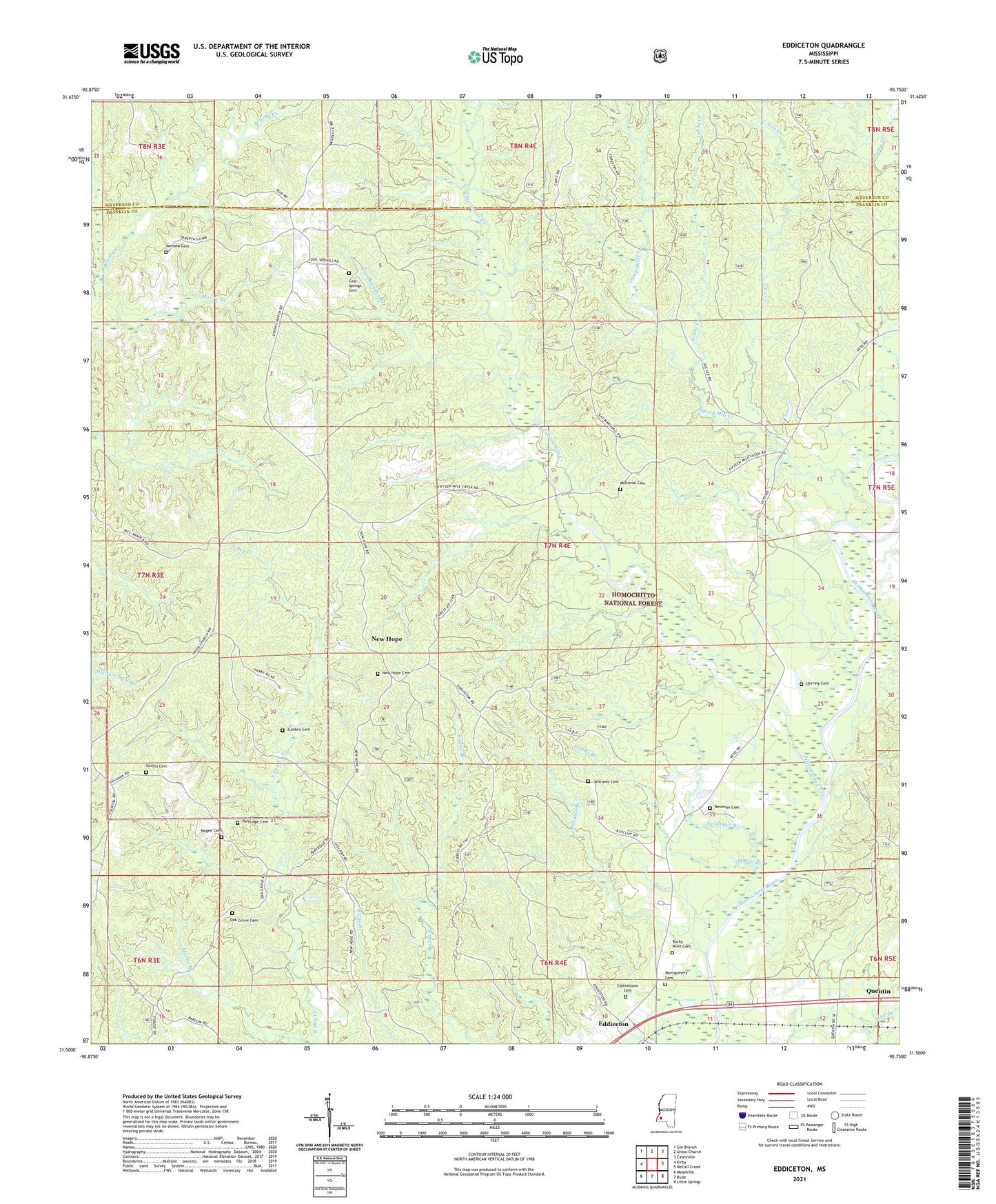
Eddiceton Mississippi US Topo Map
Couldn't load pickup availability
Also explore the Eddiceton Forest Service Topo of this same quad for updated USFS data
2024 topographic map quadrangle Eddiceton in the state of Mississippi. Scale: 1:24000. Based on the newly updated USGS 7.5' US Topo map series, this map is in the following counties: Franklin, Jefferson. The map contains contour data, water features, and other items you are used to seeing on USGS maps, but also has updated roads and other features. This is the next generation of topographic maps. Printed on high-quality waterproof paper with UV fade-resistant inks.
Quads adjacent to this one:
West: Kirby
Northwest: Gin Branch
North: Union Church
Northeast: Caseyville
East: McCall Creek
Southeast: Little Springs
South: Bude
Southwest: Meadville
This map covers the same area as the classic USGS quad with code o31090e7.
Contains the following named places: Bonus Oil Field, Cool Springs Branch, Cool Springs Cemetery, Cool Springs Church, Dodds Branch, Eddiceton, Eddiceton Oil Field, Eddicetown Baptist Church, Eddicetown Cemetery, Fifteenmile Creek, Goldman Branch, Griffin Cemetery, Herring Cemetery, Johns Creek, Jones Branch, Lea Creek, Magee Cemetery, Maxwell Branch, McDanial Cemetery, Montgomery Cemetery, New Hope, New Hope Baptist Church, New Hope Cemetery, Newman Cemetery, Oak Grove Cemetery, Oak Grove Church, Partridge Cemetery, Pleasant Grove Church, Rocky Point Cemetery, Sarepta Baptist Church, Sarepta Cemetery, Steep Hill Creek, Veto, Wheats, Williams Cemetery, Willis Branch Oil Field, Zumbro Cemetery