MyTopo
Church Hill Mississippi US Topo Map
Couldn't load pickup availability
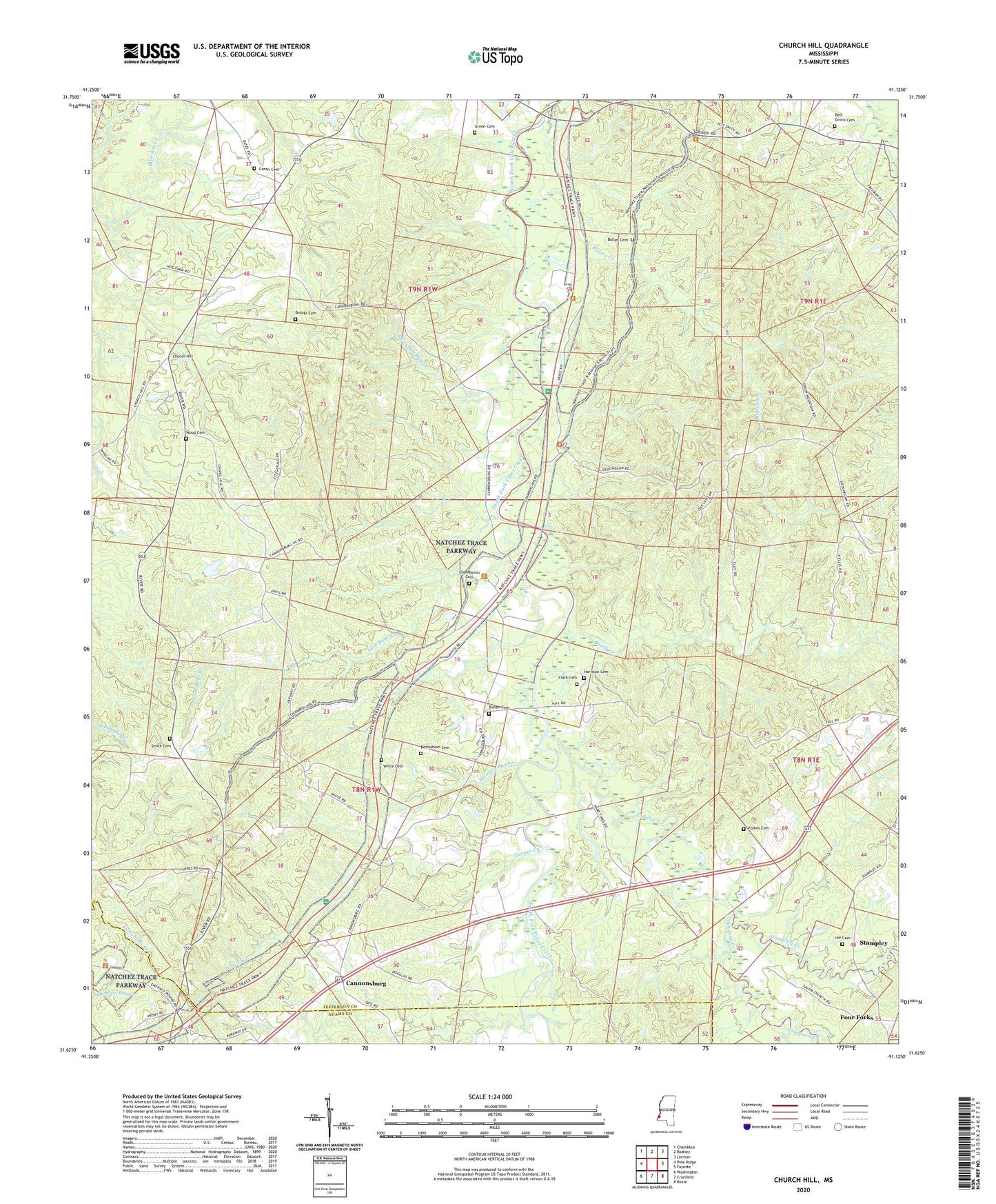
2024 topographic map quadrangle Church Hill in the state of Mississippi. Scale: 1:24000. Based on the newly updated USGS 7.5' US Topo map series, this map is in the following counties: Jefferson, Adams. The map contains contour data, water features, and other items you are used to seeing on USGS maps, but also has updated roads and other features. This is the next generation of topographic maps. Printed on high-quality waterproof paper with UV fade-resistant inks.
Quads adjacent to this one:
West: Pine Ridge
Northwest: Chamblee
North: Rodney
Northeast: Lorman
East: Fayette
Southeast: Roxie
South: Cranfield
Southwest: Washington
This map covers the same area as the classic USGS quad with code o31091f2.
Contains the following named places: Bell Grove Cemetery, Bethlehem Cemetery, Bethlehem Church, Brooks Cemetery, Bullen Cemetery, Bullen Creek, Burch Creek, Cannonsburg, Cannonsburg Oil Field, Chamberlin Cemetery, Church Hill, Church Hill Church, Church Hill Lookout Tower, Church Hill Post Office, Clark Cemetery, Clifton Church, Coles Creek Church, Coles Creek Oil Field, Compton Creek, Folkes Cemetery, Folkes Creek, Four Forks, Gibson Bayou, Gospel Church, Green Cemetery, Harrison Cemetery, Jefferson Chapel, Lee Cemetery, Lum Bayou, Mercy Seat Baptist Church, Monkey Bayou, Moss Hill Bayou, Mound Plantation, Mount Bethel Church, Mount Zion Church, North Sunnyside Oil Field, Penquite Creek, Saint James Church, Salem Church, Selsertown, Smith Cemetery, Springfield, Stampley, Stampley Creek, Stampley Oil Field, Sunnyside Oil Field, Supervisor District 4, Taylor Chapel Baptist Church, Turpin Creek, White Cemetery, Wood Cemetery