MyTopo
Lorman Mississippi US Topo Map
Couldn't load pickup availability
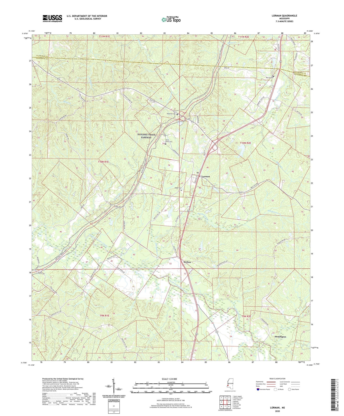
2024 topographic map quadrangle Lorman in the state of Mississippi. Scale: 1:24000. Based on the newly updated USGS 7.5' US Topo map series, this map is in the following counties: Jefferson, Claiborne. The map contains contour data, water features, and other items you are used to seeing on USGS maps, but also has updated roads and other features. This is the next generation of topographic maps. Printed on high-quality waterproof paper with UV fade-resistant inks.
Quads adjacent to this one:
West: Rodney
Northwest: Saint Joseph
North: Widows Creek
Northeast: Port Gibson
East: Red Lick
Southeast: Gin Branch
South: Fayette
Southwest: Church Hill
This map covers the same area as the classic USGS quad with code o31091g1.
Contains the following named places: Barnes Creek, Bolls Creek, C L Huff Lake Dam, Cane Ridge Church, China Grove Cemetery, Claiborne County Fire Department Station 1, Clifton, Coon Box, Fellowship Church, Gibbs School, Hickman Creek, Jessamine Ridge Church, Katherine Street Lake Dam, Lorman, Lorman Post Office, McCaa Cemetery, Melton, Morning Star Church, North Fork, Poplar Hill School, Ridge Cemetery, Russum Oil Field, Russum School, Sam Fonda Lake Dam, Shankstown, Shankstown Creek, Stonington, Waterloo Cemetery, Waterloo Church, ZIP Code: 39096