MyTopo
Rodney Mississippi US Topo Map
Couldn't load pickup availability
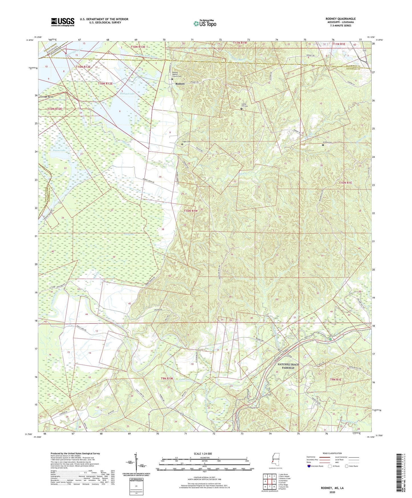
2024 topographic map quadrangle Rodney in the state of Mississippi. Scale: 1:24000. Based on the newly updated USGS 7.5' US Topo map series, this map is in the following counties: Jefferson, Claiborne, Tensas. The map contains contour data, water features, and other items you are used to seeing on USGS maps, but also has updated roads and other features. This is the next generation of topographic maps. Printed on high-quality waterproof paper with UV fade-resistant inks.
Quads adjacent to this one:
West: Chamblee
Northwest: Lake Bruin
North: Saint Joseph
Northeast: Widows Creek
East: Lorman
Southeast: Fayette
South: Church Hill
Southwest: Pine Ridge
This map covers the same area as the classic USGS quad with code o31091g2.
Contains the following named places: Alcorn College Lake Dam, Alcorn State University Airport, Black Creek, Brownland Oil Field, Bush Lake, Calvits Lake, Cool Boiler Bayou, Dobyns Bridge, Dowd Creek, Fayette Oil and Gas Field, Flatland Lake, George Harrell Lake Dam, Golden Mount Church, Griffin Cemetery, Gum Ridge, Harpers Branch, Huntley, Idlewild Oil Field, Ihrie, Laurel Hill Cemetery, Laurel Hill Church, Laurel Hill Plantation, Logan Cemetery, Mammy Judy Bayou, Miller School, Mount Israel Church, Mud Island Creek, Muddy Bayou, Noland Hill School, North Fayette Oil Field, North Fork Coles Creek, Old Mount Zion Church, Old Rodney Presbyterian Church, Piazza Lake, R R Smith Lake Dam, Richland Church, Rodney, Rodney Baptist Church, Rodney Baptist Church Cemetery, Rodney Island Oil Field, Rodney Landing, Rodney Oil Field, Rodney Sacred Heart Catholic Church, Rodney School, Saint Peter Church, South Fork Coles Creek, Southside Plantation, Supervisor District 5, Travelers Rest Church, Uniontown, Williams Lake Dam