MyTopo
Montgomery Mississippi US Topo Map
Couldn't load pickup availability
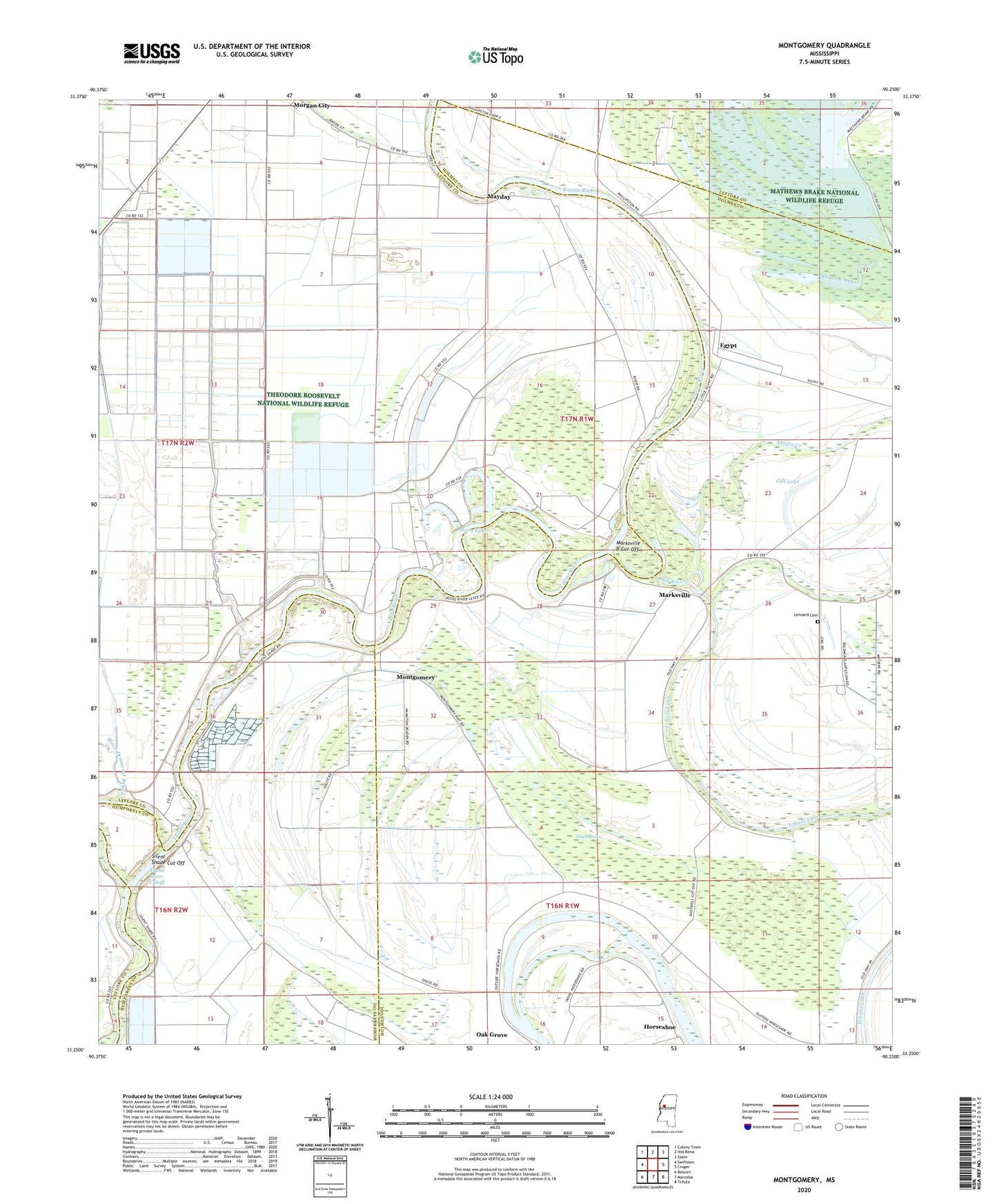
2024 topographic map quadrangle Montgomery in the state of Mississippi. Scale: 1:24000. Based on the newly updated USGS 7.5' US Topo map series, this map is in the following counties: Holmes, Leflore, Humphreys. The map contains contour data, water features, and other items you are used to seeing on USGS maps, but also has updated roads and other features. This is the next generation of topographic maps. Printed on high-quality waterproof paper with UV fade-resistant inks.
Quads adjacent to this one:
West: Swiftown
Northwest: Colony Town
North: Itta Bena
Northeast: Sidon
East: Cruger
Southeast: Tchula
South: Marcella
Southwest: Belzoni
This map covers the same area as the classic USGS quad with code o33090c3.
Contains the following named places: Abiaca Creek, Archerletti Landing, Ashton Landing, Bright Star Church, Cliffords Landing, Dent Lake, Eagle Brake, Eagle Lake, Eagle Lake Landing, East Lake, Eden Landing, Egypt, Egypt Landing, Eldrin Fondren Ponds Dam, Gill Lake, Hazel Dell Landing, Henry Halls Landing, Horseshoe, Jerusalem Church, Joe Long Ponds Dam, Lennard Cemetery, Lower Egypt Landing, Markhams Ferry, Marksville, Marksville B Cut-Off, Marksville Landing, Mathews Brake National Wildlife Refuge, Mayday, Mayday Landing, McAfees Landing, McAffees Ferry, Montgomery, Montgomery Place Landing, Moon Lake, Mount Valley Church, New Mount Zion Church, Oak Grove, Old River, Perkins Landing, Saint Paul's Church Number 1, Sheppard Landing, Shipps Landing, Silent Shade, Silent Shade Cut-Off, Silent Shade Landing, Spring Valley Church, Supervisor District 5, Sweet Canyon Church, Valley Forge Landing, Valley View Church, Walton Bend Landing, Wards Landing, West Over Landing, West Point Landing, Wests Landing, Yazoo River Cutoff