
MyTopo
Crawford East Mississippi US Topo Map
Couldn't load pickup availability
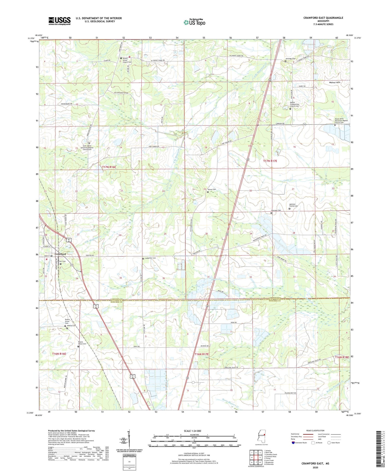
2020 topographic map quadrangle Crawford East in the state of Mississippi. Scale: 1:24000. Based on the newly updated USGS 7.5' US Topo map series, this map is in the following counties: Lowndes, Noxubee. The map contains contour data, water features, and other items you are used to seeing on USGS maps, but also has updated roads and other features. This is the next generation of topographic maps. Printed on high-quality waterproof paper with UV fade-resistant inks.
Quads adjacent to this one:
West: Crawford West
Northwest: Artesia
North: Bent Oak
Northeast: Columbus South
East: Trinity
Southeast: Cliftonville
South: Brooksville
Southwest: Lynn Creek
Contains the following named places: Bethel Church, Carr Cemetery, Carson Airport, Charity Mission Church, Colier Hardy Quarters, Crawford, Crawford City Hall, Crawford Post Office, Dawkins Lake Dam, Fairview Cemetery, Fairview Church, Hackberry School, Hardy Lake Dam, Harrison Grove Church, Harrison Grove School, Harrison Store, Jennings Cemetery, Ledbetter Cemetery, Lowndes County District 4 Volunteer Fire and Rescue Department - Hill City Station, Lowndes County District 4 Volunteer Fire and Rescue Department Crawford Station, Ming Lake Dam, Mississippi No Name 171 Dam, Moshulitubbees Prairie Village, Mount Olive Church, New Chapel, North Branch Magowah Creek, Potts Store, Prairie Grove Cemetery, Prairie Grove Church, Prairie Grove School, Saint James Church, Shavers, South Branch Magowah Creek, Sullivan Lake Dam, Turner Cemetery, Wilkins Cemetery, ZIP Code: 39743


