MyTopo
Bent Oak Mississippi US Topo Map
Couldn't load pickup availability
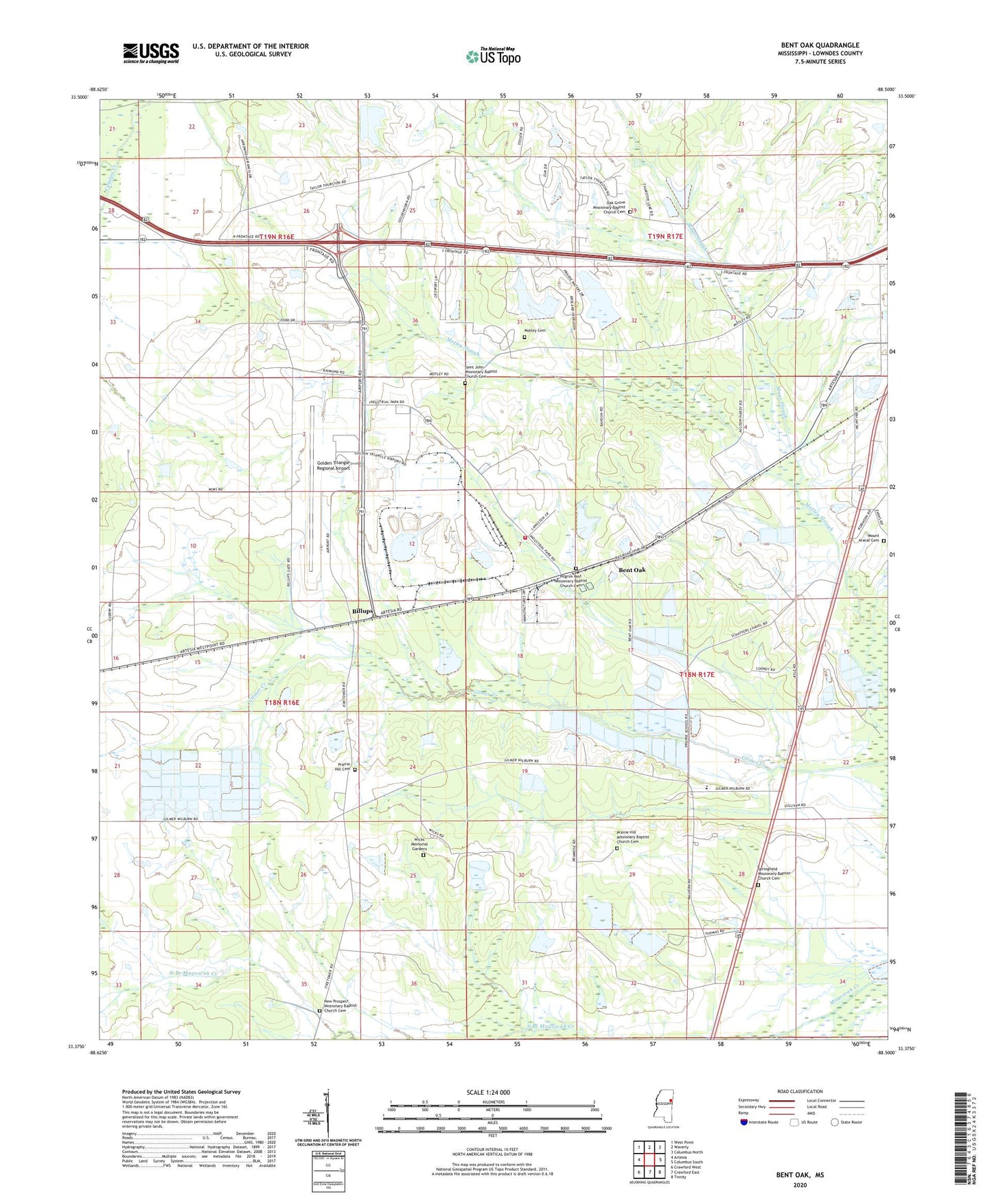
2024 topographic map quadrangle Bent Oak in the state of Mississippi. Scale: 1:24000. Based on the newly updated USGS 7.5' US Topo map series, this map is in the following counties: Lowndes. The map contains contour data, water features, and other items you are used to seeing on USGS maps, but also has updated roads and other features. This is the next generation of topographic maps. Printed on high-quality waterproof paper with UV fade-resistant inks.
Quads adjacent to this one:
West: Artesia
Northwest: West Point
North: Waverly
Northeast: Columbus North
East: Columbus South
Southeast: Trinity
South: Crawford East
Southwest: Crawford West
This map covers the same area as the classic USGS quad with code o33088d5.
Contains the following named places: Allendale, Allendale Church, Angus Farms Lake Dam, Banks School, Bent Oak, Billups, Billups Chapel, Chism Lake Dam, Golden Triangle Industrial Park, Golden Triangle Regional Airport, Imes Lake Dam, Lowndes County District 5 Volunteer Fire and Rescue Department Industrial Park, Lowndes County Farm, Lowndes County Vocational Technical School, Mayo Slough, McIntyre, Mississippi No Name 161 Dam, Mississippi No Name 162 Dam, Mississippi No Name 163 Dam, Mississippi Sheriffs Boys Ranch, Motley Cemetery, Motley Church, Motley School, Mount Ararat Cemetery, Mount Ararat Church, Nemo School, New Prospect Church, New Prospect Missionary Baptist Church Cemetery, New Zion Church, Oak Grove Church, Prairie Chapel, Prairie Hill, Prairie Hill Cemetery, Prairie Hill Church, Prairie Oaks Farm, Saint Johns Church, Shaeffer Chapel, Shula Grove, Springfield Church, Supervisor District 5, Swoope Quarters, Thomas Lake Dam, Thomas Store, White Hawk Ranch, White Oaks Ranch, Wicks Memorial Gardens, ZIP Code: 39701