MyTopo
Hollywood Mississippi US Topo Map
Couldn't load pickup availability
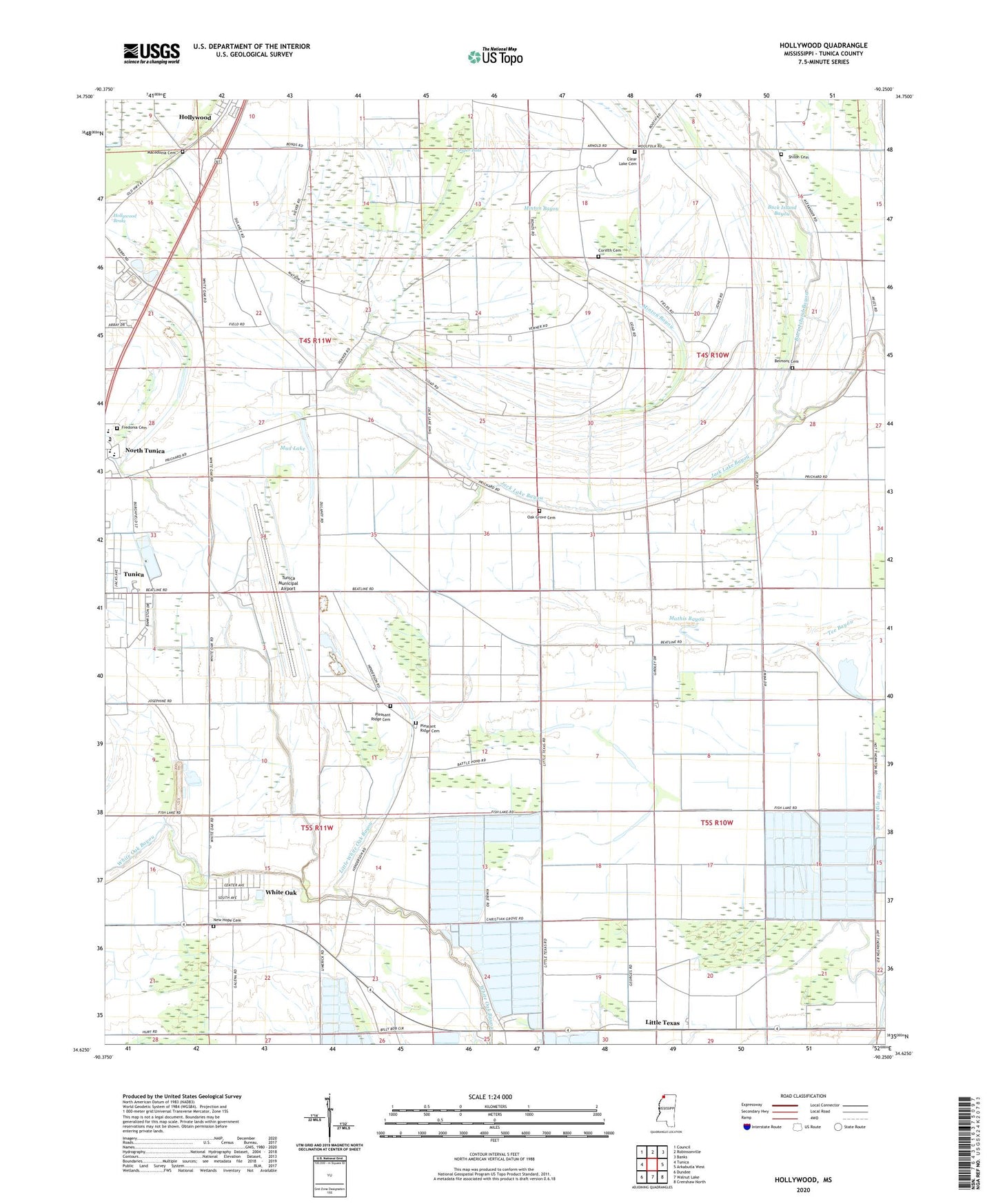
2024 topographic map quadrangle Hollywood in the state of Mississippi. Scale: 1:24000. Based on the newly updated USGS 7.5' US Topo map series, this map is in the following counties: Tunica. The map contains contour data, water features, and other items you are used to seeing on USGS maps, but also has updated roads and other features. This is the next generation of topographic maps. Printed on high-quality waterproof paper with UV fade-resistant inks.
Quads adjacent to this one:
West: Tunica
Northwest: Council
North: Robinsonville
Northeast: Banks
East: Arkabutla West
Southeast: Crenshaw North
South: Walnut Lake
Southwest: Dundee
This map covers the same area as the classic USGS quad with code o34090f3.
Contains the following named places: Arnold Field Airport, Belmont Cemetery, Belmont Church, Bill School, Buck Island Bayou, Christian Grove Church, Clear Lake, Clear Lake Cemetery, Clear Lake Church, Corinth Cemetery, Corinth Church, Corinth School, Cypress Grove Church, Delta Hills of Pritchard School, Fish Lake, Fredonia Cemetery, Fredonia School, Free Grace Church, Hollywood, Houston School, Isles School, Jack Lake Bayou, Jasper Lake, Jenkins Chapel, Little Texas, Little Texas Church, Little Texas School, Little White Oak Bayou, Macedonia Cemetery, Mathis Bayou, Millers Union Church, Millers Union School, Minton Bayou, Moon Chapel, Mud Lake, New Hope Cemetery, New Hope Church, New Hope School, Oak Grove Cemetery, Oak Grove Church, Pleasant Ridge Cemetery, Pleasant Ridge Church, Saint Mathews Church, Saint Pauls Church, Shiloh Cemetery, Shiloh Church, Supervisor District 2, Supervisor District 3, Tunica Municipal Airport, Tunica-Rosa Fort High School, White Oak, White Oak Census Designated Place