MyTopo
Mesa Mississippi US Topo Map
Couldn't load pickup availability
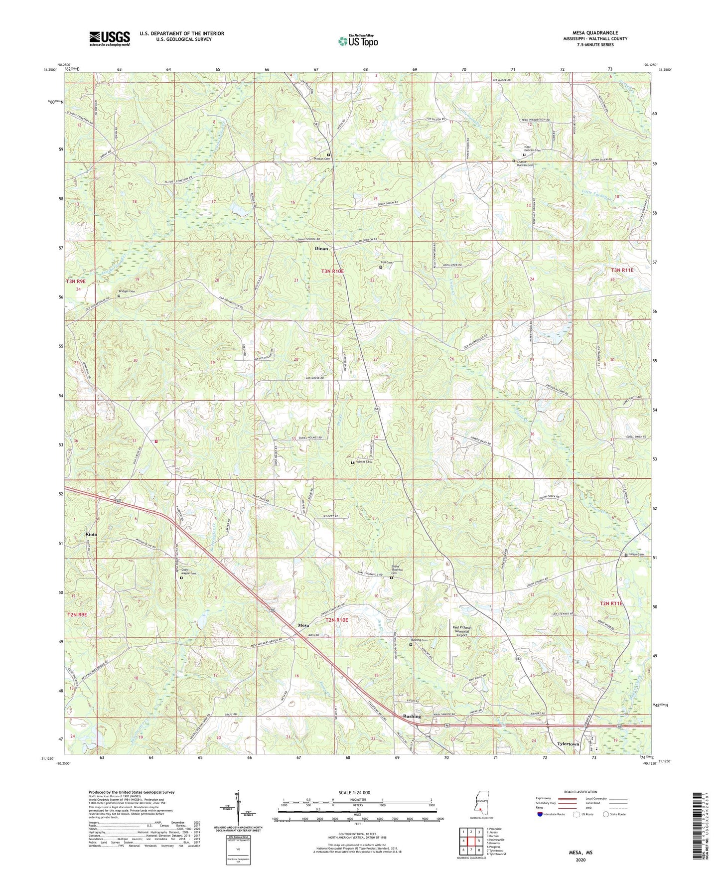
2024 topographic map quadrangle Mesa in the state of Mississippi. Scale: 1:24000. Based on the newly updated USGS 7.5' US Topo map series, this map is in the following counties: Walthall. The map contains contour data, water features, and other items you are used to seeing on USGS maps, but also has updated roads and other features. This is the next generation of topographic maps. Printed on high-quality waterproof paper with UV fade-resistant inks.
Quads adjacent to this one:
West: Holmesville
Northwest: Pricedale
North: Jayess
Northeast: Darbun
East: Kokomo
Southeast: Tylertown SE
South: Tylertown
Southwest: Progress
This map covers the same area as the classic USGS quad with code o31090b2.
Contains the following named places: Bridges Cemetery, Charlie Duncan Cemetery, Dinan, Dinan Baptist Church, Duncan Cemetery, Elisha Thornhill Cemetery, Foil Cemetery, Holmes Cemetery, Isaac Duncan Cemetery, Kioto, Mesa, Mesa Baptist Church, Mesa Mount Olive Baptist Church, New Bethel Church, Oak Grove Church, Oak Grove Volunteer Fire Department, Obed Magee Cemetery, Paul Pittman Memorial Airport, Roy Atchinson Lake Dam, Rushing, Rushing Cemetery, Saint Paul Missionary Baptist Church, Supervisor District 5, Tylertown Primary School, Union Baptist Church, Union Cemetery, West Mount Olive Missionary Baptist Church, WTYL-AM (Tylertown), WTYL-FM (Tylertown)