MyTopo
Carmichael Mississippi US Topo Map
Couldn't load pickup availability
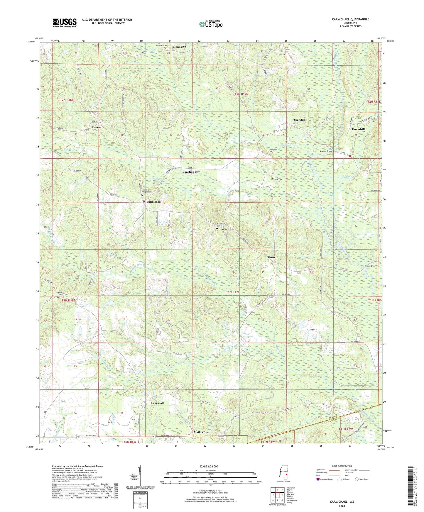
2024 topographic map quadrangle Carmichael in the state of Mississippi. Scale: 1:24000. Based on the newly updated USGS 7.5' US Topo map series, this map is in the following counties: Clarke, Wayne. The map contains contour data, water features, and other items you are used to seeing on USGS maps, but also has updated roads and other features. This is the next generation of topographic maps. Printed on high-quality waterproof paper with UV fade-resistant inks.
Quads adjacent to this one:
West: De Soto
Northwest: Quitman
North: Sykes
Northeast: Hinton
East: Melvin
Southeast: Isney
South: Matherville
Southwest: Shubuta
This map covers the same area as the classic USGS quad with code o31088h5.
Contains the following named places: Andrew Chapel, Andrews Chapel Cemetery, Bass Everett Cemetery, Beckman Lake Dam, Bell School, Berry Cemetery, Berry Church, Bolingchessa Creek, Brewer, Brush Creek, Bryan School, Calvary Hill Church, Carmichael, Carmichael Cemetery, Carmichael Oil Field, Carmichael School, Carmichael Volunteer Fire Department, Cedar Creek, Cedar School, Claude Mauley Lake Dam, Crandall, Davis Poultry Farm, Double Creek, Evans Bridge, Fivemile Creek, Horn, Horne School, Indian Mound, Junction City, Junction City Oil Field, Langsdale, Lees Chapel, Liberty Church, Lindsey School, Little Rock Church, Lucky School, Mannassa, Mannassa Cemetery, Mannassa Methodist Church, Mannassa School, Matherville, Mount Nebo Church, Mount Olive Church, Mount Olive School, Poplar Springs Church, Providence Cemetery, Providence Church, Quitman Lookout Tower, Shady Grove Cemetery, Shady Grove Church, Supervisor District 5, Tallabogue Creek, Theads Bridge, Theadsville Volunteer Fire Department, Threadville, Union Church, West Langsdale Oil Field, White Liberty Cemetery, Zion Chapel