
MyTopo
Matherville Mississippi US Topo Map
Couldn't load pickup availability
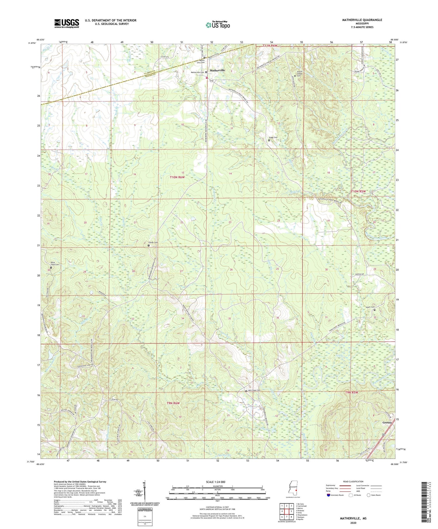
2024 topographic map quadrangle Matherville in the state of Mississippi. Scale: 1:24000. Based on the newly updated USGS 7.5' US Topo map series, this map is in the following counties: Wayne, Clarke. The map contains contour data, water features, and other items you are used to seeing on USGS maps, but also has updated roads and other features. This is the next generation of topographic maps. Printed on high-quality waterproof paper with UV fade-resistant inks.
Quads adjacent to this one:
West: Shubuta
Northwest: De Soto
North: Carmichael
Northeast: Melvin
East: Isney
Southeast: Aquilla
South: Denham
Southwest: Waynesboro
This map covers the same area as the classic USGS quad with code o31088g5.
Contains the following named places: Bethel Church, Billie Field Cemetery, Busby Game Refuge, Coyt, Cypress Creek, Cypress Oil Field, Diamond, Diamond School, Dry Creek, Enon Church, Gandy Cemetery, Geneva Presbyterian Church, Gretna, Hebron Church, Little Dry Creek, Matherville, Matherville Cemetery, Mayfalfa Farm, Mill Creek, Mount Levy Cemetery, Mount Levy Church, Mount Levy School, New Hope Cemetery, Olive Branch School, Page Creek, Saint James Church, Saint John Church, Saint Luke Church, Saint Lukes Church, Saint Paul Church, Salem Cemetery, Salem Church, Sand Branch, Scotch Chapel Cemetery, Shiloh Creek, South Cypress Creek Oil Field, Stagg Cemetery, Stagg Lake Dam, Tick Creek, Wayne County Volunteer Fire Department Matherville Station


