MyTopo
Dead Tiger Creek Mississippi US Topo Map
Couldn't load pickup availability
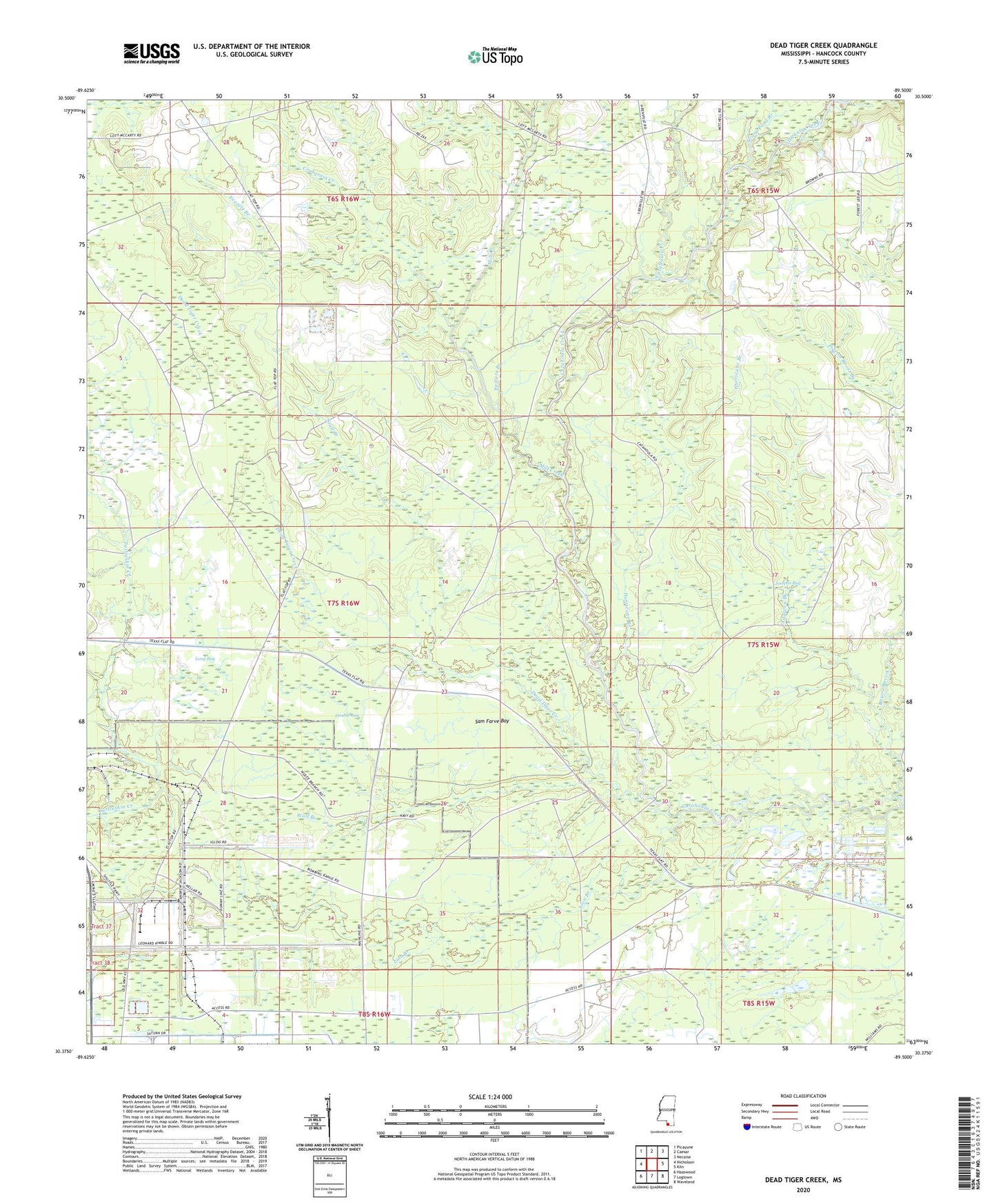
2020 topographic map quadrangle Dead Tiger Creek in the state of Mississippi. Scale: 1:24000. Based on the newly updated USGS 7.5' US Topo map series, this map is in the following counties: Hancock. The map contains contour data, water features, and other items you are used to seeing on USGS maps, but also has updated roads and other features. This is the next generation of topographic maps. Printed on high-quality waterproof paper with UV fade-resistant inks.
Quads adjacent to this one:
West: Nicholson
Northwest: Picayune
North: Caesar
Northeast: Necaise
East: Kiln
Southeast: Waveland
South: Logtown
Southwest: Haaswood
Contains the following named places: Adgreen Branch, Bayou Bacon, Bienville Church, Catahoula Creek, Catfish Ponds Lake Dam, Crabgrass Creek, Crane Pond Branch, Dead Tiger Creek, Dead Tiger School, Double Bay, Everett Branch, Flat Top, Flattop School, Fletcher Lake Dam, Harmony Church, Hickory Creek, Hurricane Branch, John C Stennis Space Center, Josephs Bay, Lion Branch, Long Bay, Mill Creek, Mississippi Army Ammunition Plant, Pasture Branch, Sam Farve Bay, Shrub Branch, Stall Branch, Wolf Branch