MyTopo
Caesar Mississippi US Topo Map
Couldn't load pickup availability
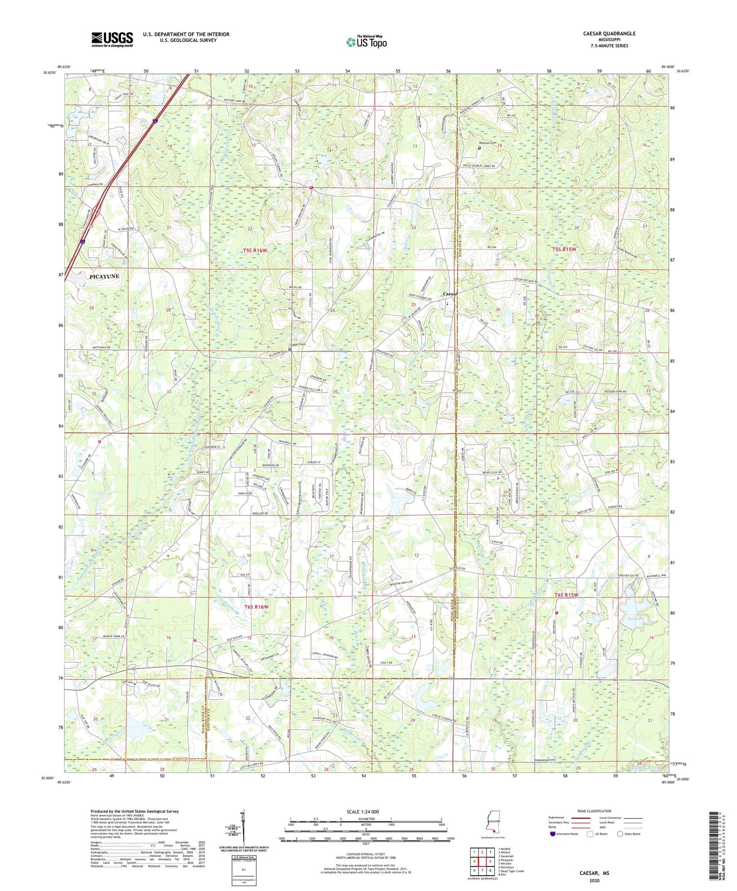
2024 topographic map quadrangle Caesar in the state of Mississippi. Scale: 1:24000. Based on the newly updated USGS 7.5' US Topo map series, this map is in the following counties: Pearl River, Hancock. The map contains contour data, water features, and other items you are used to seeing on USGS maps, but also has updated roads and other features. This is the next generation of topographic maps. Printed on high-quality waterproof paper with UV fade-resistant inks.
Quads adjacent to this one:
West: Picayune
Northwest: McNeill
North: Millard
Northeast: Savannah
East: Necaise
Southeast: Kiln
South: Dead Tiger Creek
Southwest: Nicholson
This map covers the same area as the classic USGS quad with code o30089e5.
Contains the following named places: Beaver Wood Estates, Belle-Terre Airport, Blacksnake Branch, Boardpile Branch, Bounds Lake Dam, Caesar, Caesar Church, Carriere Volunteer Fire Department Station 3 Sycamore Road, Center, Chester Lee Lake Dam, Clearwater Campground and Recreational Vehicle Park, Crosby Lake Dam, Davis Branch, Deer Park Phase III Mobile Home Park, Flattop Unity Baptist Church, Gibson School, Gipson Cemetery, Goodyear Baptist Church, H H Pepper Lake Dam, Harmony Baptist Church, Hillcrest Road Baptist Church, Lee Lake, Lee Lake Dam, Lees Chapel Baptist Church, Lees Field, Leetown, Leetown Christian School, Leetown School, Leetown Volunteer Fire Department, Lumpkin School, Mill Creek Church, Mount Carmel Church, Parkview Baptist Church, Pearson Cemetery, Playground Branch, Salem Church, Salem School, Southeast Volunteer Fire Department Station 1 Headquarters, Southeast Volunteer Fire Department Station 2, Stanfield Creek, Supervisor District 5, West Union Baptist Church, ZIP Code: 39466