MyTopo
Picayune Mississippi US Topo Map
Couldn't load pickup availability
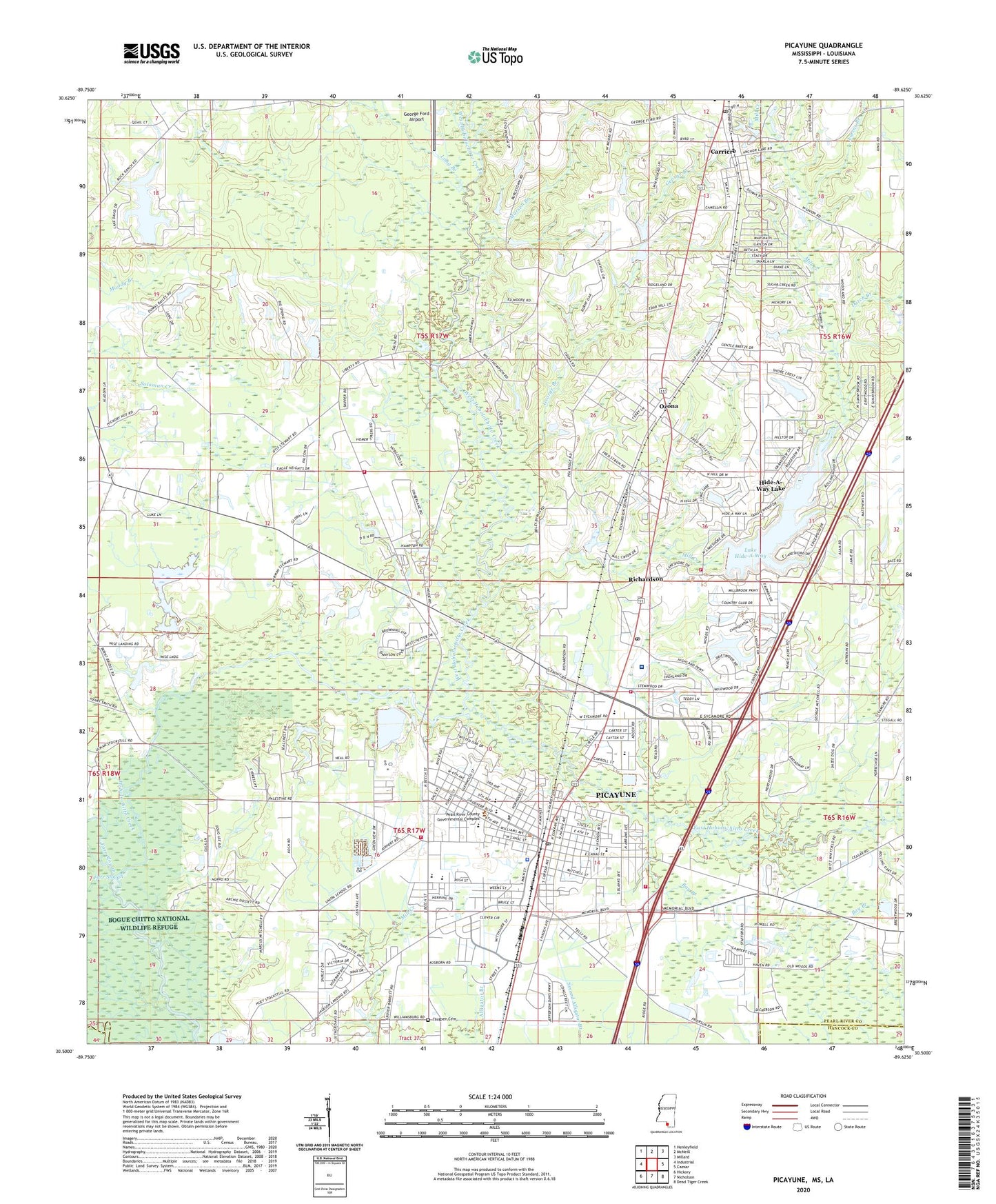
2024 topographic map quadrangle Picayune in the state of Mississippi. Scale: 1:24000. Based on the newly updated USGS 7.5' US Topo map series, this map is in the following counties: Pearl River, Hancock, St. Tammany. The map contains contour data, water features, and other items you are used to seeing on USGS maps, but also has updated roads and other features. This is the next generation of topographic maps. Printed on high-quality waterproof paper with UV fade-resistant inks.
Quads adjacent to this one:
West: Industrial
Northwest: Henleyfield
North: McNeill
Northeast: Millard
East: Caesar
Southeast: Dead Tiger Creek
South: Nicholson
Southwest: Hickory
This map covers the same area as the classic USGS quad with code o30089e6.
Contains the following named places: Amazing Savior Lutheran Church, Anointed Dove Gospel Baptist Church, Antioch Baptist Church, Bay Branch, Bethlehem Baptist Church, Burgetown Church, Carriere, Carriere Post Office, Carriere Volunteer Fire Department Station 2 Hideaway Lake, Christian Life Assembly of God Church, Church of Christ, City of Picayune, Covenant Christian Academy, Covenant Health and Rehabilitation Center, Crosby Arboretum, Crosby Arboretum Nature Center, Crosby Chemical Company Lagoon Dam, Crosby Memorial Library, David Lake Dam, Double C Ranch Lake Dam, Dutch Branch, Earl Pinham Lake Dam, East Hobolochitto Creek, East Jerusalem Baptist Church, East Side Elementary School, Farr Slough, Fellowship Baptist Mission Church, First Baptist Church of Carriere, First Baptist Church of Ozona, First Baptist Church of Picayune, First Presbyterian Church, First United Methodist Church, First United Pentecostal Church, Friendship Park, Friendship Park Community Center, George Branch, George Ford Airport, Greater Emmanuel Missionary Church, Hide-A-Way Lake, Hide-A-Way Lake Census Designated Place, Hide-A-Way Lake Dam, Highland Community Hospital, Hobolochitto Creek, Kimballs Store, Kingdom Builders Manifested Word Outreach Church, Kingdom Hall of Jehovahs Witnesses, Lake David, Lake Hide-A-Way, Liberty Church, Liberty Road Mobile Home Park, Long Branch, Lutens Branch, Marsen Branch, Mill Creek, Millbrook Country Club, Mount Calvary Baptist Church, Neil Lumpkin Lake Dam, New Beginning Missionary Baptist Church, New Palestine Baptist Church, Northgate Shopping Center, Ozona, Palestine, Parkview Baptist Church, Pearl River Central School, Pearl River County Emergency Communications South Repeater Site, Picayune, Picayune Church of Christ, Picayune Church of God, Picayune City Hall, Picayune Convalescent Center, Picayune Fire Department Station 1, Picayune Fire Department Station 2, Picayune Fire Department Station 3, Picayune High School, Picayune Junior High School, Picayune Municipal Courthouse, Picayune Police Department, Picayune Post Office, Picayune Radio Range Station, Picayune Shopping Center, Pilgrim Bound Baptist Church, Pincote Pavilion, Pine Grove Station, Pine Grove Volunteer Fire Department Station 2, Pine Tree Plaza Shopping Center, Pleasant Valley Baptist Church, Power House of Deliverance Church, Rattlesnake Bay, Richardson, River Ridge Shopping Center, Rosa of Sharon Church of God, Roseland Park Baptist Church, Roseland Park Elementary School, Saint Barnabas Anglican Church, Saint Charles Catholic Church, Saint James African Methodist Episcopal Church, Saint Matthews Baptist Church, Saint Pauls Episcopal Church, Solid Rock Church, Southside Elementary School, Space Flight Plaza Shopping Center, Sun Roamers Recreational Vehicle Resort, Sycamore Church, The Church of Jesus Christ of Latter Day Saints, Thigpen Cemetery, Trinity Outreach Ministries Church, Trinity United Methodist Church, Union School, Weems Chapel United Methodist Church, West Hobolochitto Creek, Westlawn Baptist Church, Westside Elementary School, WJOJ-FM (Picayune), WRJW-AM (Picayune)


