MyTopo
Decatur NW Mississippi US Topo Map
Couldn't load pickup availability
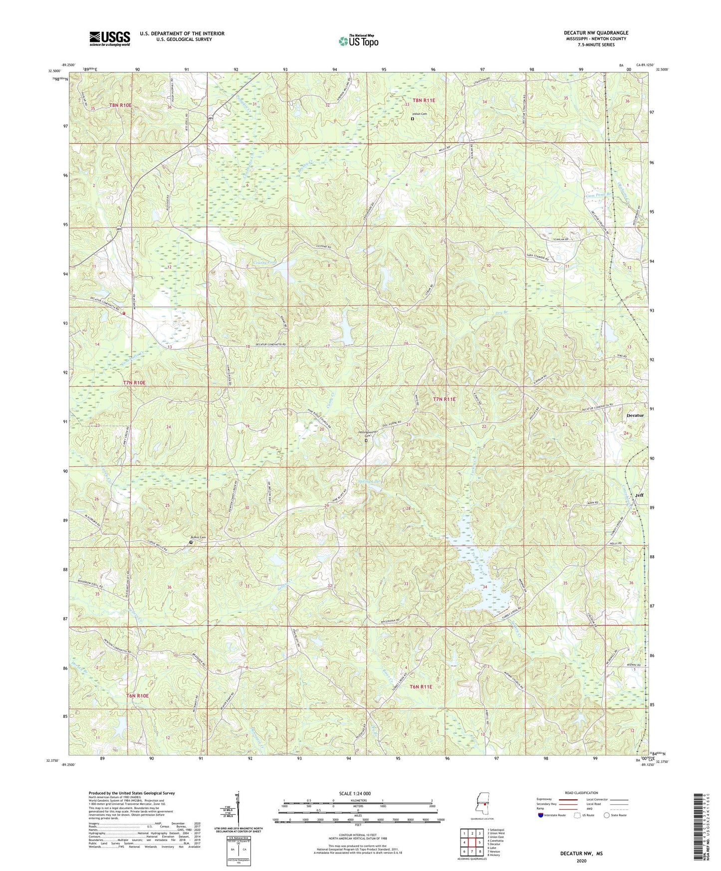
2020 topographic map quadrangle Decatur NW in the state of Mississippi. Scale: 1:24000. Based on the newly updated USGS 7.5' US Topo map series, this map is in the following counties: Newton. The map contains contour data, water features, and other items you are used to seeing on USGS maps, but also has updated roads and other features. This is the next generation of topographic maps. Printed on high-quality waterproof paper with UV fade-resistant inks.
Quads adjacent to this one:
West: Conehatta
Northwest: Sebastopol
North: Union West
Northeast: Union East
East: Decatur
Southeast: Hickory
South: Newton
Southwest: Lake
Contains the following named places: Addy Store, Barnes Mill, Beat Line School, Beatline Church, Bethlehem Church, Bill May Lake Dam, Brushy Creek, Buena Vista School, Bufkin Cemetery, Center Point School, Conehatta Volunteer Fire Department, County Pond, County Pond Dam, Cross Roads Church, Doctor Moore Lake Dam, Fellowship Church, Gum Pond Branch, Hickory Grove School, Hollingsworth Cemetery, Indian Cemetery, Jeff, Leach Store, Macedonia Church, McMullan Lake Dam, Midway Church, Okahta Talaia, Pilgrim Rest Church, Pine Bluff, Pine Bluff Church, Pine Ridge Church, Pleasant Valley Church, Poplar Church, Poplar Springs School, Possum Trot Church, Pumpkin Creek, Saint Mary Church, Scanlon, Spring Lake, Spring Lake Hunting Club Lake Dam, Stratton, Supervisor District 3, Toomer, Tuckers Mill, Union Grove School, Union Ridge School, West Decatur Church