MyTopo
Duncan Mississippi US Topo Map
Couldn't load pickup availability
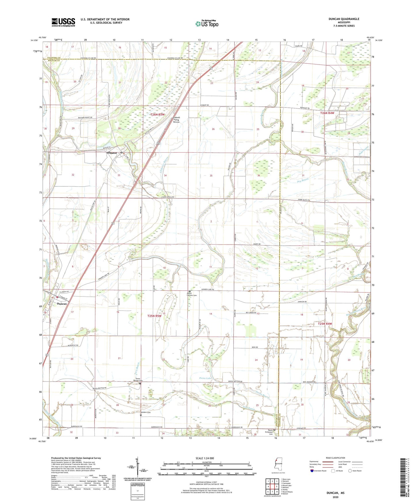
2020 topographic map quadrangle Duncan in the state of Mississippi. Scale: 1:24000. Based on the newly updated USGS 7.5' US Topo map series, this map is in the following counties: Bolivar, Coahoma. The map contains contour data, water features, and other items you are used to seeing on USGS maps, but also has updated roads and other features. This is the next generation of topographic maps. Printed on high-quality waterproof paper with UV fade-resistant inks.
Quads adjacent to this one:
West: Round Lake
Northwest: Rena Lara
North: Sherard
Northeast: Clarksdale
East: Mattson
Southeast: Baltzer
South: Mound Bayou
Southwest: Shelby
Contains the following named places: Africa, Alford Butler Lake Dam, Alligator, Alligator Bayou, Alligator Elementary School, Alligator Lake, Alligator Post Office, Bethel Church, Bobo Outlet, Brooks Elementary School, Cub Lake Slough, Dry Bayou, Duncan, Duncan Post Office, Emory Pond, Glidwell Flying Service, Hickory Grove Church, Howden Lake, Locust Grove Church, Macedonia Church, Mount Evergreen Cemetery, Mount Evergreen Church, Mount Harmon Cemetery, Mount Harmon Church, Mount Hope Church, Mount Moriah Church, Mount Olive Church, Mount Pleasant Church, New Hopewell Church, Niland Chapel, Palestine Church, Pecan Lake, Saint John Church, Sanders Cemetery, Sanders Chapel, Supervisor District 5, Town of Alligator, Town of Duncan, Travel Rest Church, Turkey Bayou, Turn Bayou, Union Grove Church, Union Temple, Union Temple Cemetery, Wildwood Plantation, Woodbine School, Yellow Bayou