MyTopo
Mattson Mississippi US Topo Map
Couldn't load pickup availability
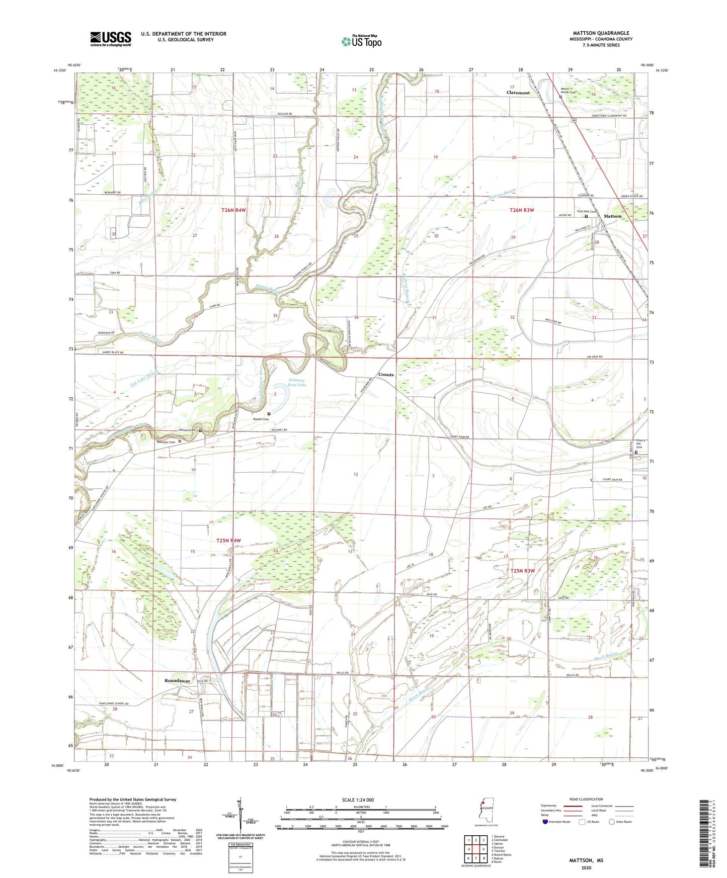
2024 topographic map quadrangle Mattson in the state of Mississippi. Scale: 1:24000. Based on the newly updated USGS 7.5' US Topo map series, this map is in the following counties: Coahoma. The map contains contour data, water features, and other items you are used to seeing on USGS maps, but also has updated roads and other features. This is the next generation of topographic maps. Printed on high-quality waterproof paper with UV fade-resistant inks.
Quads adjacent to this one:
West: Duncan
Northwest: Sherard
North: Clarksdale
Northeast: Sabino
East: Tutwiler
Southeast: Rome
South: Baltzer
Southwest: Mound Bayou
This map covers the same area as the classic USGS quad with code o34090a5.
Contains the following named places: Adams Chapel, Antioch Church, Bethel Church, Black Hill School, Bobo Lake, Carr Chapel, Cherry Hill Cemetery, Cherry Hill Church, Claremont, Clark Bayou, Counts, Dulaney-Ross Lake, Fairview Church, Fishing Bayou, Galilee Church, Harris Bayou, Harvey Chapel, Hickory Grove Church, Hilliard School, Johnson Cemetery, Marby Chapel, Mattson, Mount Horeb Cemetery, Mount Horeb Church, Mount Olive Church, Oak Grove Church, Olive Branch School, Plummer Lake, Robinson Cemetery, Rosenwald School, Ross Church, Roundaway, Roundaway Elementary School, Roundaway Lake, Rucks, Russell Cemetery, Saint Marys Church, Sentry Mount Church, Sunflower School, Sunshine Church, Sunshine School, Supervisor District 4, Traynham, True Vine Cemetery, Union Chapel, Williams Chapel, Willis Store