MyTopo
Ethel South Mississippi US Topo Map
Couldn't load pickup availability
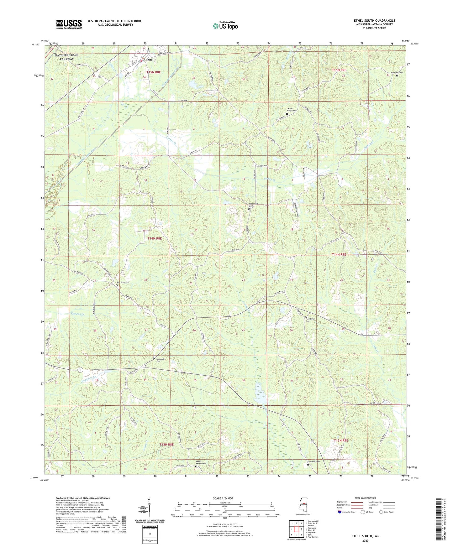
2024 topographic map quadrangle Ethel South in the state of Mississippi. Scale: 1:24000. Based on the newly updated USGS 7.5' US Topo map series, this map is in the following counties: Attala. The map contains contour data, water features, and other items you are used to seeing on USGS maps, but also has updated roads and other features. This is the next generation of topographic maps. Printed on high-quality waterproof paper with UV fade-resistant inks.
Quads adjacent to this one:
West: Kosciusko
Northwest: Kosciusko NE
North: Ethel North
Northeast: McCool
East: Ethel SE
Southeast: Four Corners
South: Zama
Southwest: Singleton
This map covers the same area as the classic USGS quad with code o33089a4.
Contains the following named places: Breazeale Cemetery, Carson Ridge, Carson Ridge Baptist Church, Carson Ridge Cemetery, Carson Ridge School, Cowpen, Eagle Mills, Ebenezer Baptist Church, Ebenezer Cemetery, Edgefield School, Ethel, Ethel Baptist Church, Ethel High School, Ethel Post Office, Harmony Baptist Church, Harmony Cemetery, Joplin, Joplin School, Joplins Mill, Mercer, Mississippi No Name 5 Dam, Mount Moriah Cemetery, Mount Moriah Church, New Hope, New Hope Baptist Church, New Hope Cemetery, New Hope School, Newtonville, Pansy School, Peeler School, Providence, Providence Baptist Church, Providence Cemetery, Supervisor District 5, Tabernacle, Tabernacle Cemetery, Tabernacle Methodist Church, Tabernacle School, Thompson, Thompson School, Town of Ethel, Turkey Creek, Turkey Post Office, ZIP Code: 39067