MyTopo
Ethel North Mississippi US Topo Map
Couldn't load pickup availability
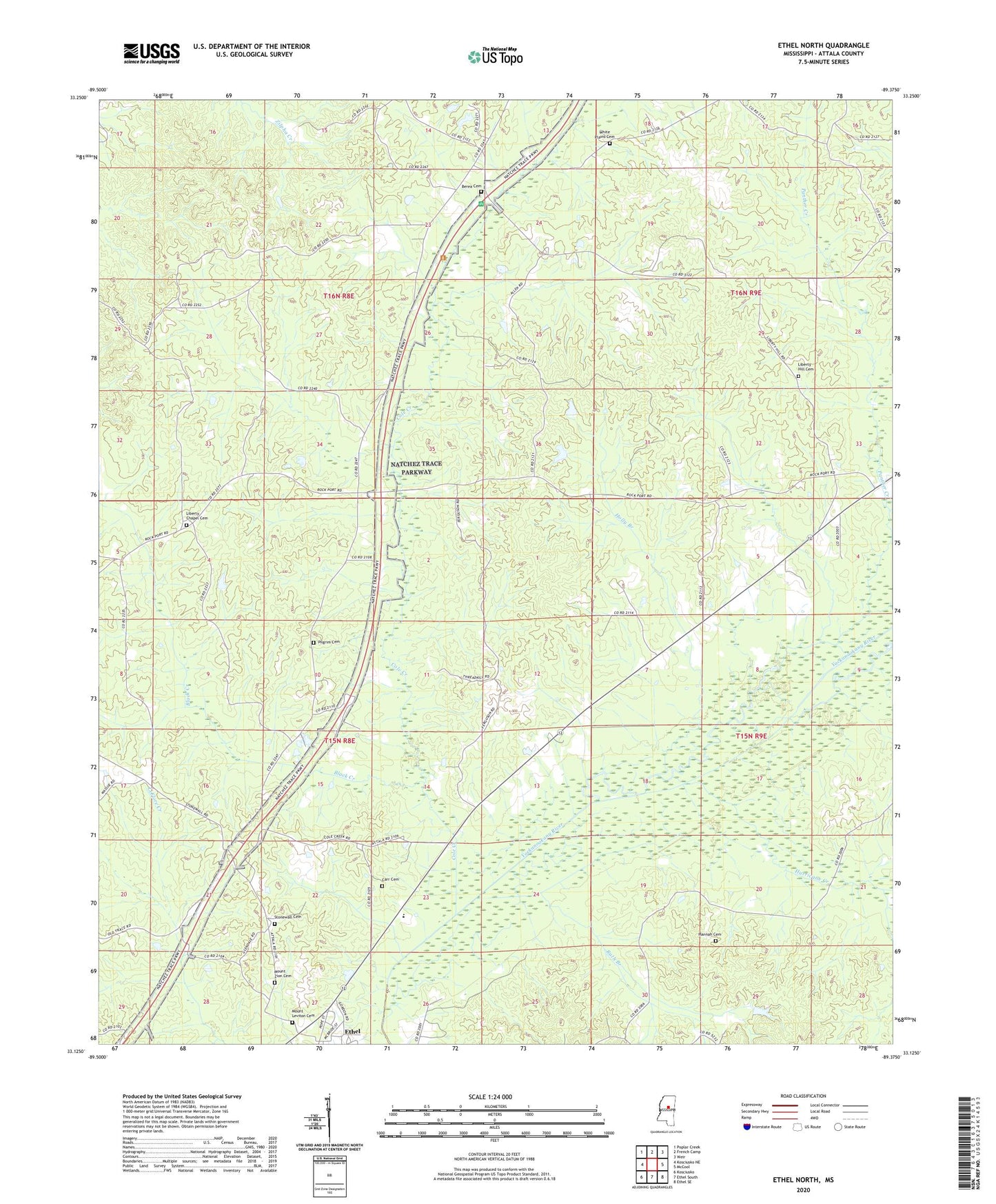
2024 topographic map quadrangle Ethel North in the state of Mississippi. Scale: 1:24000. Based on the newly updated USGS 7.5' US Topo map series, this map is in the following counties: Attala. The map contains contour data, water features, and other items you are used to seeing on USGS maps, but also has updated roads and other features. This is the next generation of topographic maps. Printed on high-quality waterproof paper with UV fade-resistant inks.
Quads adjacent to this one:
West: Kosciusko NE
Northwest: Poplar Creek
North: French Camp
Northeast: Weir
East: McCool
Southeast: Ethel SE
South: Ethel South
Southwest: Kosciusko
This map covers the same area as the classic USGS quad with code o33089b4.
Contains the following named places: Abraham Baptist Church, Berea, Berea Baptist Church, Berea Cemetery, Berea School, Black Creek, Carr Cemetery, Cole Creek, Greenlee Elementary School, Greenlee School, Gregory, Hannah Cemetery, Hannah Plantation, Holly Branch, Hurricane Creek, Liberty Chapel, Liberty Chapel Cemetery, Liberty Chapel Public School, Liberty Hill, Liberty Hill Cemetery, Liberty Hill Methodist Church, Liberty Hill School, McElroy Lake Dam, Mount Leviton Cemetery, Mount Leviton Church, Mount Zion Cemetery, Mount Zion Church, Multona Springs, Multona Springs School, Nash Creek School, Panther Creek, Phoenix Mills, Pilgrim Cemetery, Ruth Branch, Stonewall Cemetery, Stonewall Church, Supervisor District 2, Unity School, White Plains Baptist Church, White Plains Cemetery, White Plains School