MyTopo
Fearns Springs Mississippi US Topo Map
Couldn't load pickup availability
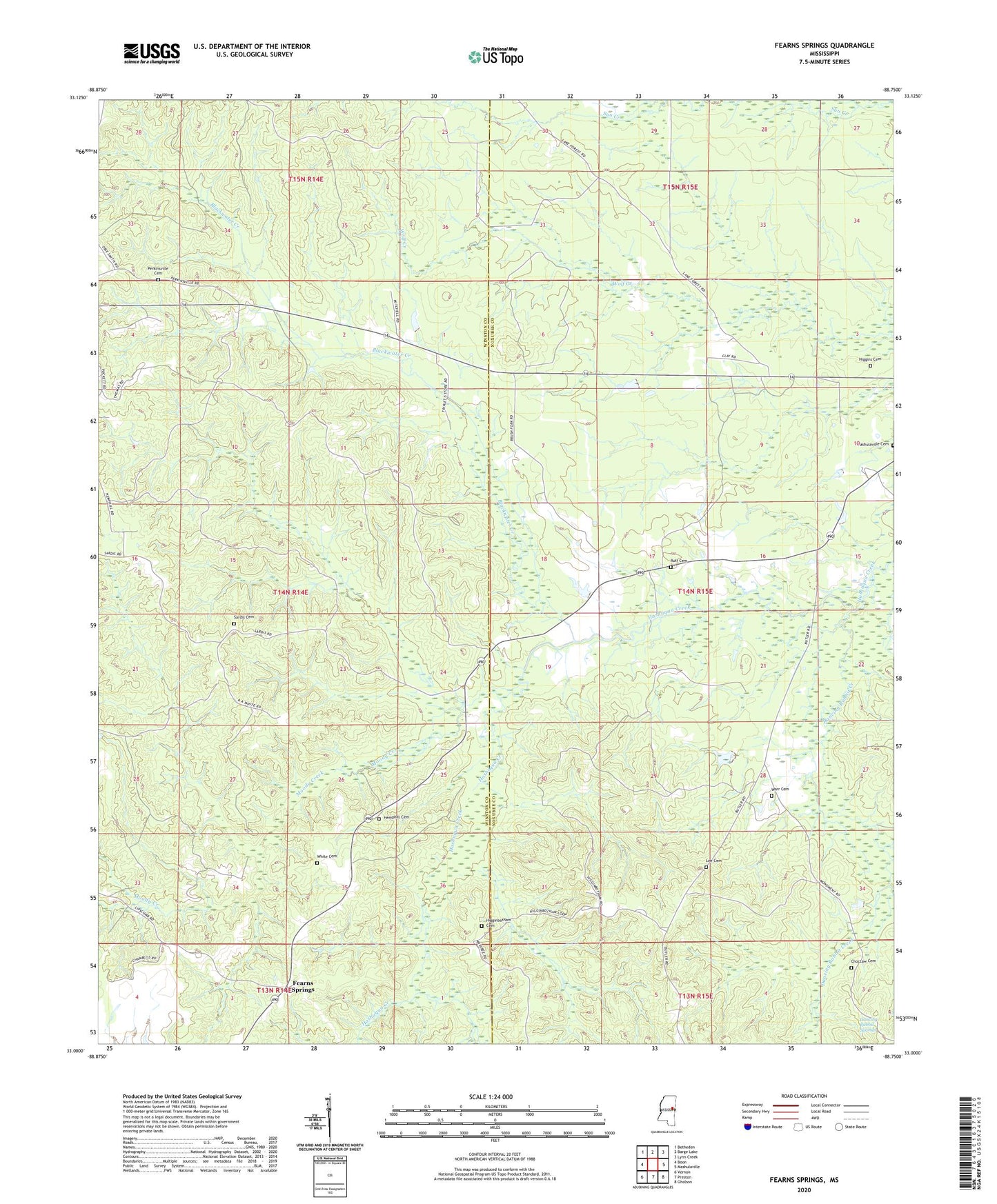
2020 topographic map quadrangle Fearns Springs in the state of Mississippi. Scale: 1:24000. Based on the newly updated USGS 7.5' US Topo map series, this map is in the following counties: Winston, Noxubee. The map contains contour data, water features, and other items you are used to seeing on USGS maps, but also has updated roads and other features. This is the next generation of topographic maps. Printed on high-quality waterproof paper with UV fade-resistant inks.
Quads adjacent to this one:
West: Boon
Northwest: Betheden
North: Barge Lake
Northeast: Lynn Creek
East: Mashulaville
Southeast: Gholson
South: Preston
Southwest: Vernon
Contains the following named places: Blackwater Creek, Brush Fork Church, Buckhorn, Choctaw Cemetery, Dancing Rabbit Creek, Dancing Rabbit Springs, Fearns Springs, Hemphill Cemetery, Higginbotham Cemetery, Higgins Cemetery, Lee Cemetery, Little Member Church, Mashulaville Cemetery, Moody Creek, Moody Millpond, Mount Nebome Church, New Prospect Church, Perkinsville, Perkinsville Baptist Church, Perkinsville Cemetery, Ruff Cemetery, Sardis Cemetery, Sardis Church, Triplets Corners, Triplett Lake Dam, Warr Cemetery, White Cemetery