MyTopo
Forreston Mississippi US Topo Map
Couldn't load pickup availability
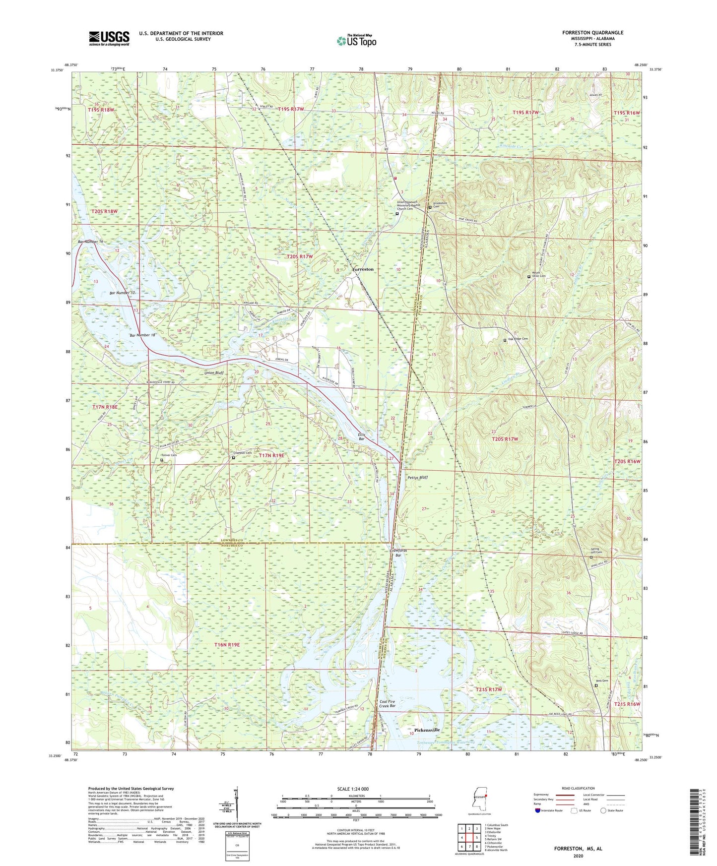
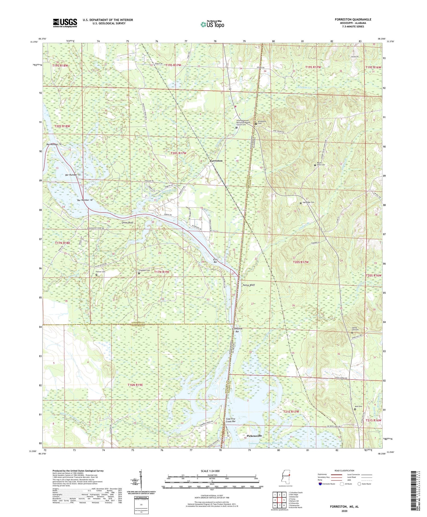
2020 topographic map quadrangle Forreston in the states of Alabama, Mississippi. Scale: 1:24000. Based on the newly updated USGS 7.5' US Topo map series, this map is in the following counties: Lowndes, Pickens, Noxubee. The map contains contour data, water features, and other items you are used to seeing on USGS maps, but also has updated roads and other features. This is the next generation of topographic maps. Printed on high-quality waterproof paper with UV fade-resistant inks.
Quads adjacent to this one:
West: Trinity
Northwest: Columbus South
North: New Hope
Northeast: Ethelsville
East: Reform SW
Southeast: Aliceville North
South: Pickensville
Southwest: Cliftonville
Contains the following named places: Aliceville Lake, Bar Number 16, Bar Number 17, Bar Number 18, Boyd Creek, Broken Pumpkin Creek, Brookshire Cemetery, Carmen Church, Chandler Cemetery, Coal Fire Creek, Coal Fire Creek Bar, Crawford Lake, Crawfords Bar, Crawfords Ferry, Crawfords Island, Ellis Bar, Forreston, Gees Gin, Hairston Bend Cutoff, Herbert Mission Church, James Creek, James Creek Recreation Area, Kincaide Creek, Lindsey Branch, Lowndes County District 3 Volunteer Fire and Rescue Department Highway 69 Station, Mount Avery Church, Mount Olive Cemetery, Mount Olive Church, Nash Creek, Nashville, Nashville Ferry, Oak Ridge Cemetery, Oak Ridge School, Pettys Bluff, Pilgrim Church, Prude Lake, Ross Cemetery, Smith Chapel, Spring Hill Cemetery, Toliver Cemetery, Union Bluff, Union Bluff Landing, Union Hopewell Church, Woolbank Creek