MyTopo
French Camp Mississippi US Topo Map
Couldn't load pickup availability
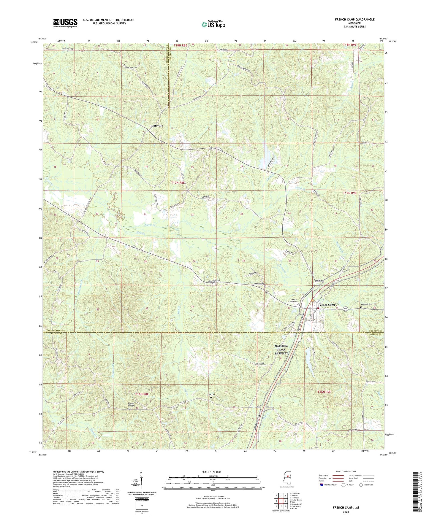
2024 topographic map quadrangle French Camp in the state of Mississippi. Scale: 1:24000. Based on the newly updated USGS 7.5' US Topo map series, this map is in the following counties: Choctaw, Attala, Montgomery. The map contains contour data, water features, and other items you are used to seeing on USGS maps, but also has updated roads and other features. This is the next generation of topographic maps. Printed on high-quality waterproof paper with UV fade-resistant inks.
Quads adjacent to this one:
West: Poplar Creek
Northwest: Kilmichael
North: Stewart
Northeast: Tomnolen
East: Weir
Southeast: McCool
South: Ethel North
Southwest: Kosciusko NE
This map covers the same area as the classic USGS quad with code o33089c4.
Contains the following named places: Beech Springs School, Bluff Chapel, Branscome Cemetery, Chapel Hill, Chapel Hill Cemetery, Chapel Hill Methodist Church, Covenant Church, Curtis Branch, Davidson Creek, Downing Branch, Downing School, Dranes Mills, Eades Cemetery, Elkins Creek, Epworth Church, Fair School, French Camp, French Camp Cemetery, French Camp Elementary School, French Camp Post Office, French Camp Volunteer Fire Department, Hemphill Cemetery, Huntsville, Huntsville Church of Christ, Pinkey Grove Church, Prospect School, School Lake Dam, Shady Grove Church, Supervisor District 3, Town of French Camp, Wolf Creek, ZIP Code: 39745