MyTopo
Shottsville Alabama US Topo Map
Couldn't load pickup availability
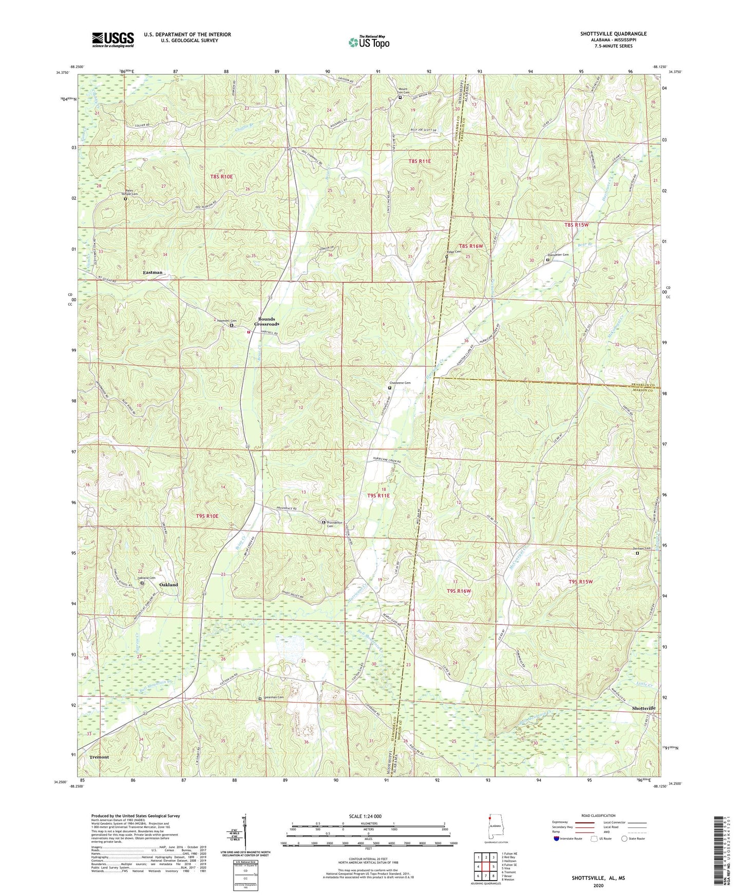
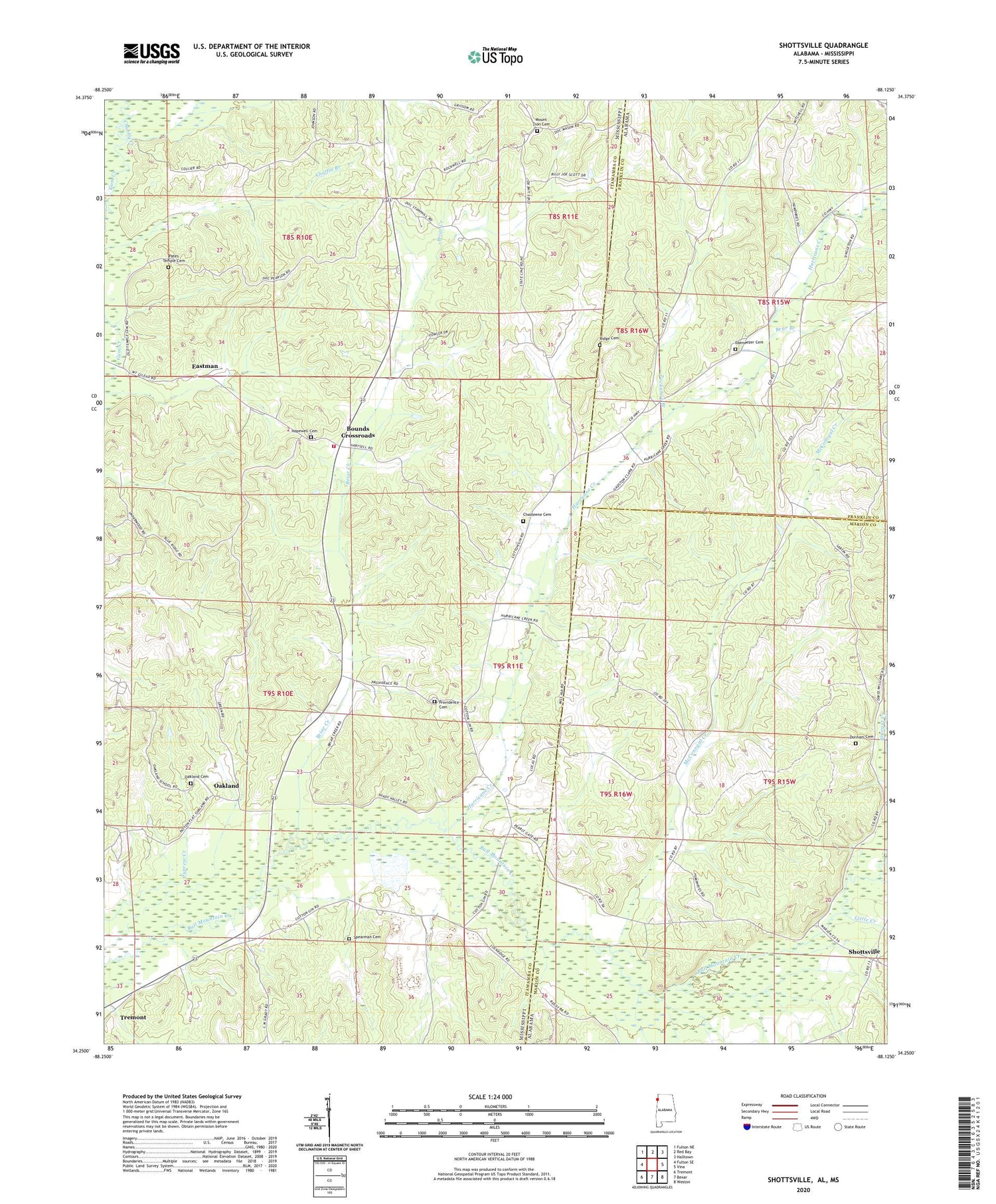
2024 topographic map quadrangle Shottsville in the states of Mississippi, Alabama. Scale: 1:24000. Based on the newly updated USGS 7.5' US Topo map series, this map is in the following counties: Marion, Itawamba, Franklin. The map contains contour data, water features, and other items you are used to seeing on USGS maps, but also has updated roads and other features. This is the next generation of topographic maps. Printed on high-quality waterproof paper with UV fade-resistant inks.
Quads adjacent to this one:
West: Fulton SE
Northwest: Fulton NE
North: Red Bay
Northeast: Halltown
East: Vina
Southeast: Weston
South: Bexar
Southwest: Tremont
Contains the following named places: Banner Bounds Volunteer Fire Department - Bounds Station, Bear Branch, Bethany Church, Bounds Crossroads, Briar Creek, C W Murphy Pond Dam, Chasteene Cemetery, Chubby Creek, Collier Lake Dam, Donham Cemetery, Eastman, Ebenezer Cemetery, Ebenezer Church, Hopewell Cemetery, Hurricane Creek, Hurricane Creek Church, Little Creek, Lone Star Church, McConegal Creek, Mount Carmel Church, Mount Olive Church, Mount Zion Cemetery, Mount Zion Church, North Fork Hurricane Creek, Oakland, Oakland Cemetery, Pates Temple Cemetery, Pearly Gates Church, Providence Cemetery, Providence Church, Rara Avis, Ridge Cemetery, Shady Valley Church, Shekel, Shottsville, Spearman Cemetery, Tuckahoe Branch, Yale, Yale College