MyTopo
Fulton SE Mississippi US Topo Map
Couldn't load pickup availability
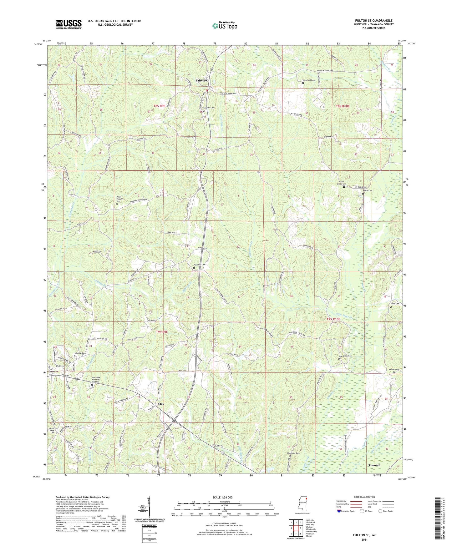
2024 topographic map quadrangle Fulton SE in the state of Mississippi. Scale: 1:24000. Based on the newly updated USGS 7.5' US Topo map series, this map is in the following counties: Itawamba. The map contains contour data, water features, and other items you are used to seeing on USGS maps, but also has updated roads and other features. This is the next generation of topographic maps. Printed on high-quality waterproof paper with UV fade-resistant inks.
Quads adjacent to this one:
West: Fulton
Northwest: Kirkville
North: Fulton NE
Northeast: Red Bay
East: Shottsville
Southeast: Bexar
South: Tremont
Southwest: Beans Ferry
This map covers the same area as the classic USGS quad with code o34088c3.
Contains the following named places: A E Young Lake Dam, Benefield Cemetery, Chaffin Branch, Chamblee Cemetery, Clay, Dulaney Branch, East Fulton Baptist Church, East Fulton Cemetery, Fairview, Fairview Cemetery, Fairview Church, Fairview Junior High School, Fairview Lookout Tower, Gum Church, Gun Creek Cemetery, Hardin Chapel Cemetery, Hardins Church, Hillcrest Cemetery, Ingraham, Itawamba County, Itawamba Memorial Gardens, Lentz Cemetery, Little Briar Creek, Martin Cemetery, Mount Gilead Cemetery, Mount Gilead Church, Mount Pleasant Cemetery, Mount Pleasant Church, New Temple Church, Northeast Itawamba Volunteer Fire Department Station 851, Palmetto Cemetery, Panther Creek, Pine Grove Church, Plainview Church, Pleasanton, R K Houston Lake Dam, Supervisor District 5, Union Chapel, Weaver Cemetery