MyTopo
Townsend Mississippi US Topo Map
Couldn't load pickup availability
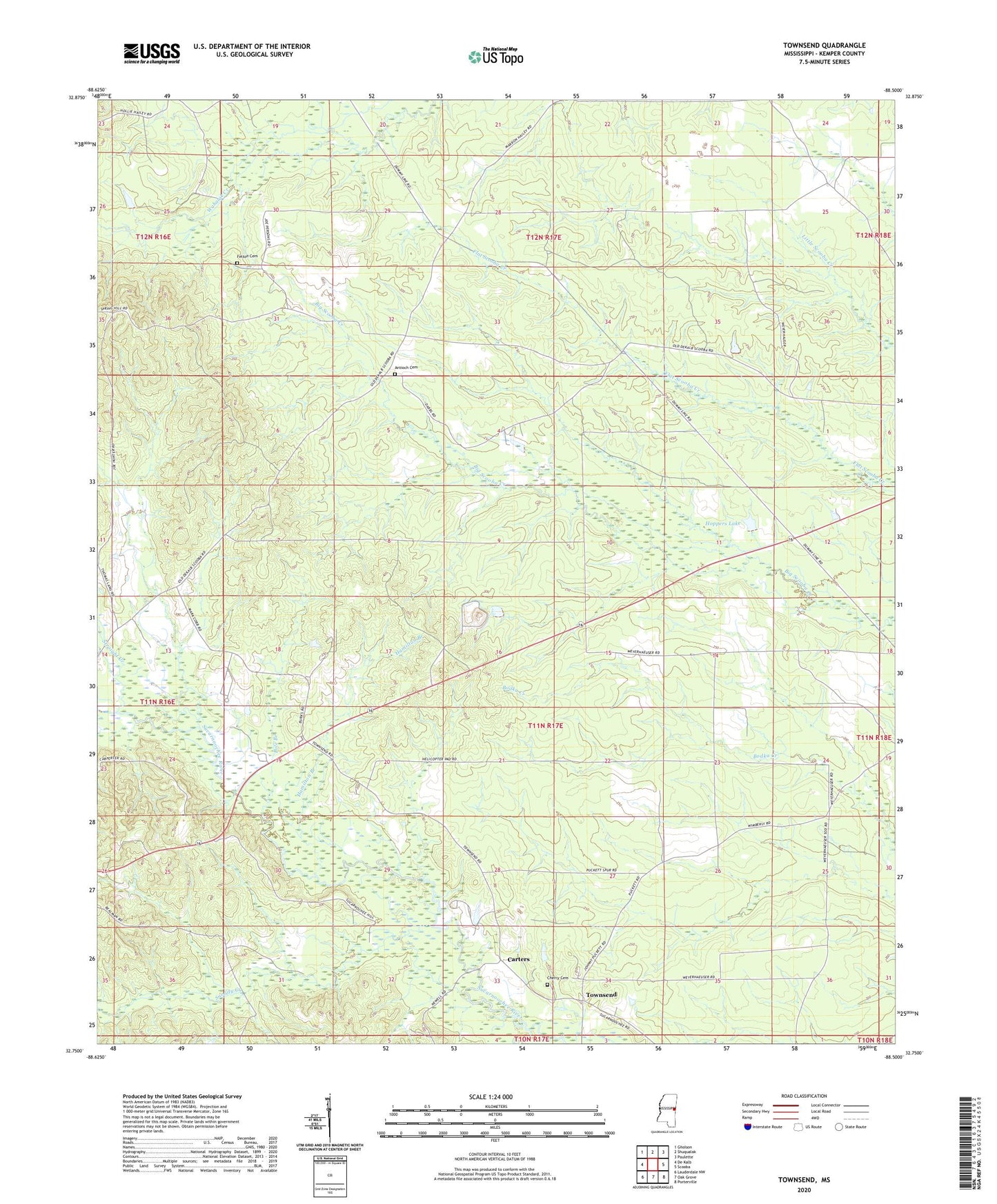
2024 topographic map quadrangle Townsend in the state of Mississippi. Scale: 1:24000. Based on the newly updated USGS 7.5' US Topo map series, this map is in the following counties: Kemper. The map contains contour data, water features, and other items you are used to seeing on USGS maps, but also has updated roads and other features. This is the next generation of topographic maps. Printed on high-quality waterproof paper with UV fade-resistant inks.
Quads adjacent to this one:
West: De Kalb
Northwest: Gholson
North: Shuqualak
Northeast: Paulette
East: Scooba
Southeast: Porterville
South: Oak Grove
Southwest: Lauderdale NW
This map covers the same area as the classic USGS quad with code o32088g5.
Contains the following named places: Antioch, Antioch Baptist Church, Antioch Cemetery, Antioch School, Carters, Cherry Cemetery, East Abeika, Felton Cemetery, Hamilton Branch, Hoppers Lake, Hoppers Lake Dam, Pole Branch, Snoody Creek, Spinks Pond Dam, Stonewall Church, Straight Creek, Townsend