MyTopo
Goshen Springs Mississippi US Topo Map
Couldn't load pickup availability
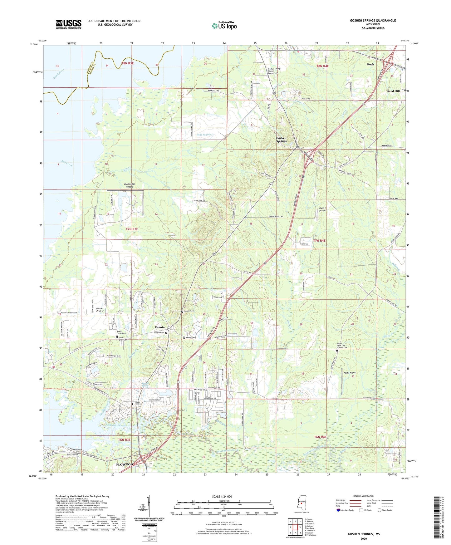
2020 topographic map quadrangle Goshen Springs in the state of Mississippi. Scale: 1:24000. Based on the newly updated USGS 7.5' US Topo map series, this map is in the following counties: Rankin, Madison. The map contains contour data, water features, and other items you are used to seeing on USGS maps, but also has updated roads and other features. This is the next generation of topographic maps. Printed on high-quality waterproof paper with UV fade-resistant inks.
Quads adjacent to this one:
West: Madison
Northwest: Canton
North: Shoccoe
Northeast: Sharon SE
East: Leesburg
Southeast: Pelahatchie
South: Brandon
Southwest: Jackson SE
Contains the following named places: Bakers Creek, Barnes Prairie, Clark Creek, Cypress Lake, Fannin, Fannin Baptist Cemetery, Fannin Baptist Church, Fannin Cemetery, Fannin Methodist Church, Fannin Station, Goshen Springs, Goshen Springs Pilgrim Branch Cemetery, Goshen Springs Station, Hills Prairie, Holiness Church, Kaehr Airport, Koch, Lake Harbor Church, Lake Harbor Volunteer Fire Department Station 1, Mach 1 Jet Port, McWrights Lake Dam, Mill Creek, Mount Helens Church, Mount Helm Cemetery Number One, New Fannin, New Truelight Church, Pelahatchie Depot, Pilgrim Branch Church, Pilgrim Branch School, Pisgah School, Plummer Slough, Reservoir Fire Department Station 3, Riley Creek, Saddlebag Creek, Saint Peters Church, Samuel Spring, Sand Hill, Sandhill Post Office, Shady Grove Cemetery, Shady Grove Church, Sherrils Lake Dam, Spring Branch, Sunrise Point, Supervisor District 2, True Light Cemetery, Waterwood, Wesley Church, Woodbridge Airport, ZIP Code: 39047