
MyTopo
Greenwood Springs Mississippi US Topo Map
Couldn't load pickup availability
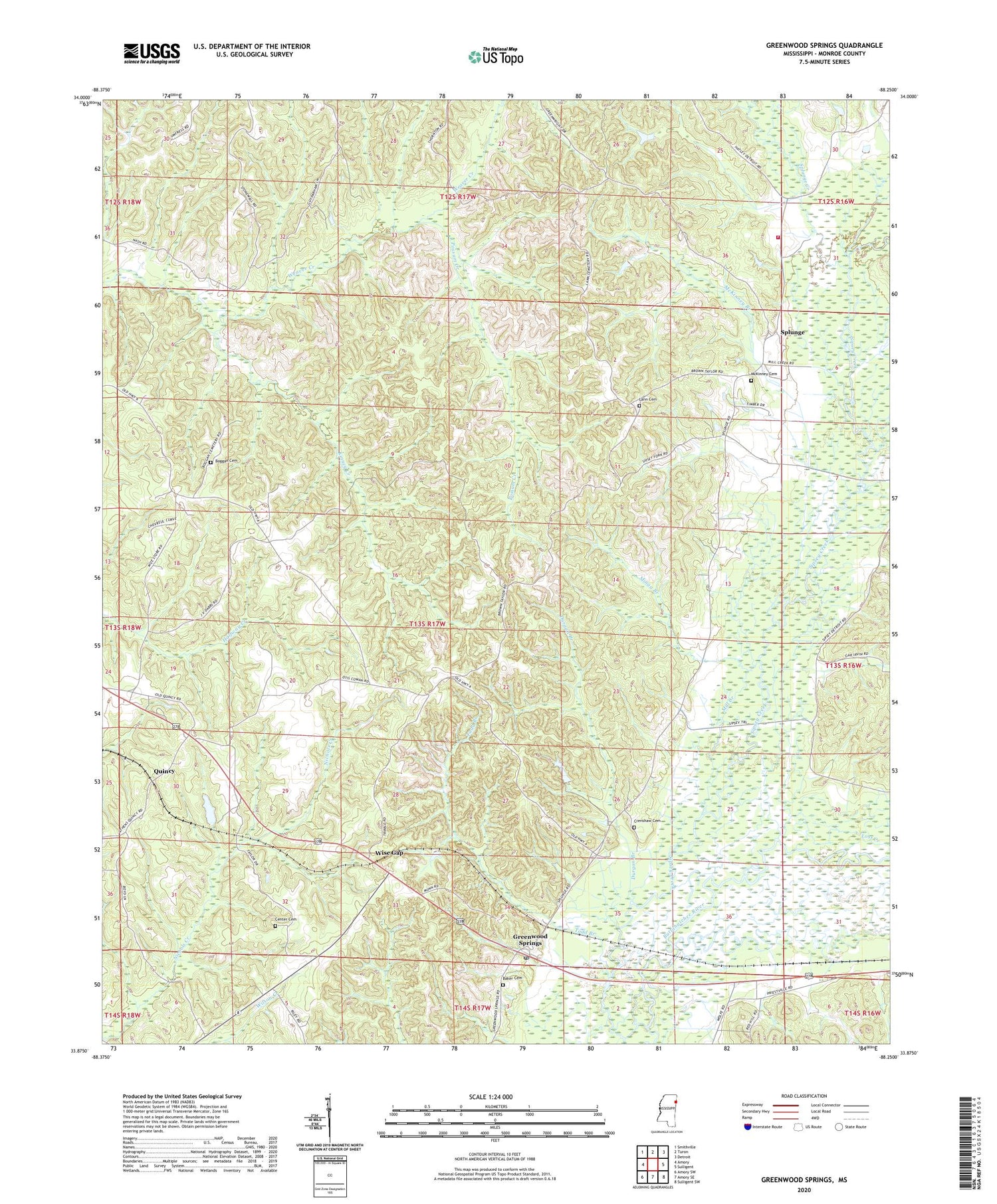
2020 topographic map quadrangle Greenwood Springs in the state of Mississippi. Scale: 1:24000. Based on the newly updated USGS 7.5' US Topo map series, this map is in the following counties: Monroe. The map contains contour data, water features, and other items you are used to seeing on USGS maps, but also has updated roads and other features. This is the next generation of topographic maps. Printed on high-quality waterproof paper with UV fade-resistant inks.
Quads adjacent to this one:
West: Amory
Northwest: Smithville
North: Turon
Northeast: Detroit
East: Sulligent
Southeast: Sulligent SW
South: Amory SE
Southwest: Amory SW
Contains the following named places: Baker Cemetery, Boggan Cemetery, Cauhorn, Center Cemetery, Crenshaw Cemetery, DePriest Free Will Baptist Church, Durgan Branch, Gibbs Box, Greenwood Springs, Greenwood Springs Baptist Church, Greenwood Springs Post Office, Greenwood Springs School, Greenwood Springs United Methodist Church, Kinney Creek, Lann Cemetery, McKinney Branch, McKinney Cemetery, Mill Creek, Minga Branch, New Hope Church, Possum Creek, Quincy, Quincy Church, Riggan Chapel, Rocky Springs Church, Splunge, Splunge Baptist Church, Splunge Creek, Splunge Volunteer Fire Department, Supervisor District 2, Todd Branch, Trinity Baptist Church, Wise Gap, ZIP Code: 38848


