MyTopo
Turon Mississippi US Topo Map
Couldn't load pickup availability
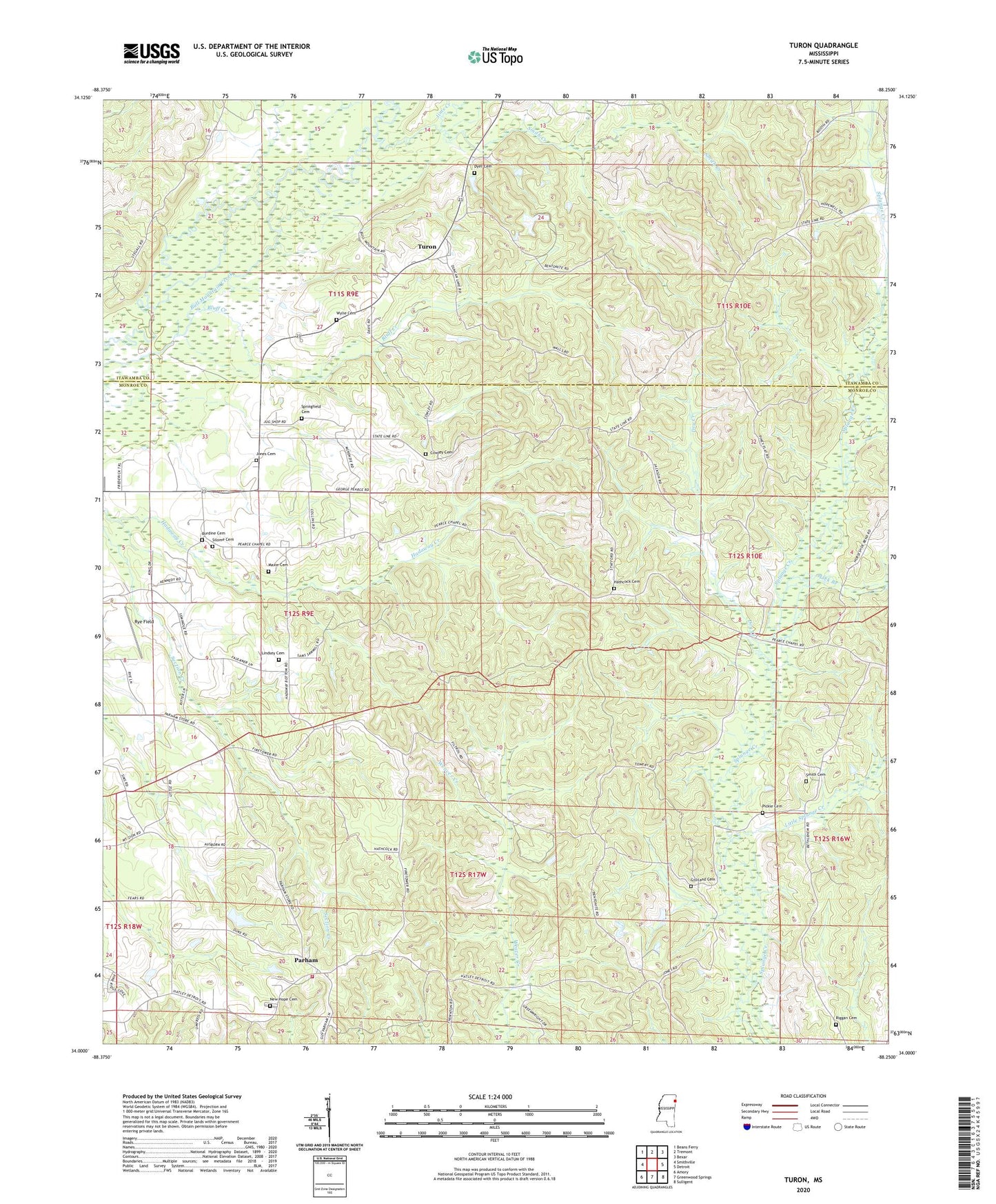
2024 topographic map quadrangle Turon in the state of Mississippi. Scale: 1:24000. Based on the newly updated USGS 7.5' US Topo map series, this map is in the following counties: Monroe, Itawamba. The map contains contour data, water features, and other items you are used to seeing on USGS maps, but also has updated roads and other features. This is the next generation of topographic maps. Printed on high-quality waterproof paper with UV fade-resistant inks.
Quads adjacent to this one:
West: Smithville
Northwest: Beans Ferry
North: Tremont
Northeast: Bexar
East: Detroit
Southeast: Sulligent
South: Greenwood Springs
Southwest: Amory
This map covers the same area as the classic USGS quad with code o34088a3.
Contains the following named places: Ashcraft School, Bethlehem Church, Bluff Creek, Bristow, Burdine Cemetery, Cowley Cemetery, Dry Creek, Dyer Cemetery, Gilliland Cemetery, Hathcock Cemetery, Hatley Volunteer Fire Department Station 2, Ironwood Bluff, Jims Creek, Jones Cemetery, Lick Branch, Lindsey Cemetery, Little Splunge Creek, Maxie Cemetery, Miston, Monroe Sporting Club Lake Dam, New Hope Baptist Church, New Hope Cemetery, New Hope Church of Christ, Parham, Pearce Church, Pecks Shop, Pickle Cemetery, Riggan Cemetery, Riggins, Rye Field, Silome Cemetery, Smith Cemetery, Smith Creek, Splunge Lookout Tower, Springfield Cemetery, Turon, W A Gideon Lake Dam, Wylie Cemetery, ZIP Code: 38870