MyTopo
Dedeaux Mississippi US Topo Map
Couldn't load pickup availability
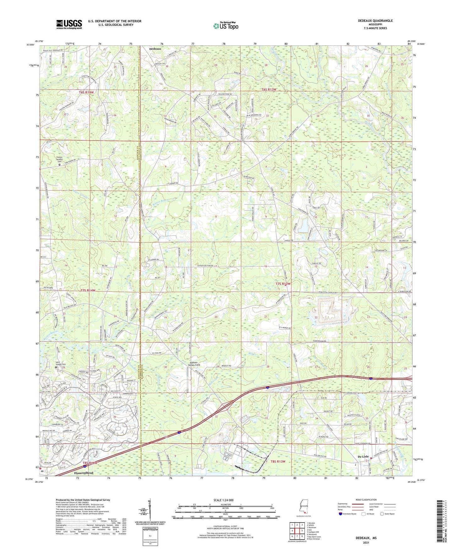
2024 topographic map quadrangle Dedeaux in the state of Mississippi. Scale: 1:24000. Based on the newly updated USGS 7.5' US Topo map series, this map is in the following counties: Harrison, Hancock. The map contains contour data, water features, and other items you are used to seeing on USGS maps, but also has updated roads and other features. This is the next generation of topographic maps. Printed on high-quality waterproof paper with UV fade-resistant inks.
Quads adjacent to this one:
West: Kiln
Northwest: Necaise
North: Sellers
Northeast: Wortham
East: Gulfport NW
Southeast: Pass Christian
South: Bay Saint Louis
Southwest: Waveland
This map covers the same area as the classic USGS quad with code o30089d3.
Contains the following named places: Addison-Henley Field, Alphonse G Malley Memorial Cemetery, Bayou La Terre, Bayou Lasalle, City of Diamondhead, Coon Branch, De Lisle, Dedeaux, DeLisle Census Designated Place, Diamondhead, Diamondhead Census Designated Place, Diamondhead Country Club, Diamondhead Fire Department, Diamondhead Post Office, Fenton Volunteer Fire Department, First Baptist Church of Delisle, Grace Chapel Church, Harrison County Fire Rescue Station Number 6, Harrison County Fire Service Fire Station 7, Little Bethel Church, Mill Creek, Mount Zion United Methodist Church, Pass Christian Middle School, Pickens Lagoon, Polar Branch, Sacred Heart Parish and Church, Saint Anne Church, Saint Joseph Cemetery, Saint Joseph Church, Saint Stephens Catholic Church, Saint Williams Church, Sandy Creek, Shell Beach, Stephens School, Supervisor District 3, The Oaks Golf Club, Vidalia Road Mobile Home Park, ZIP Codes: 39525, 39571