MyTopo
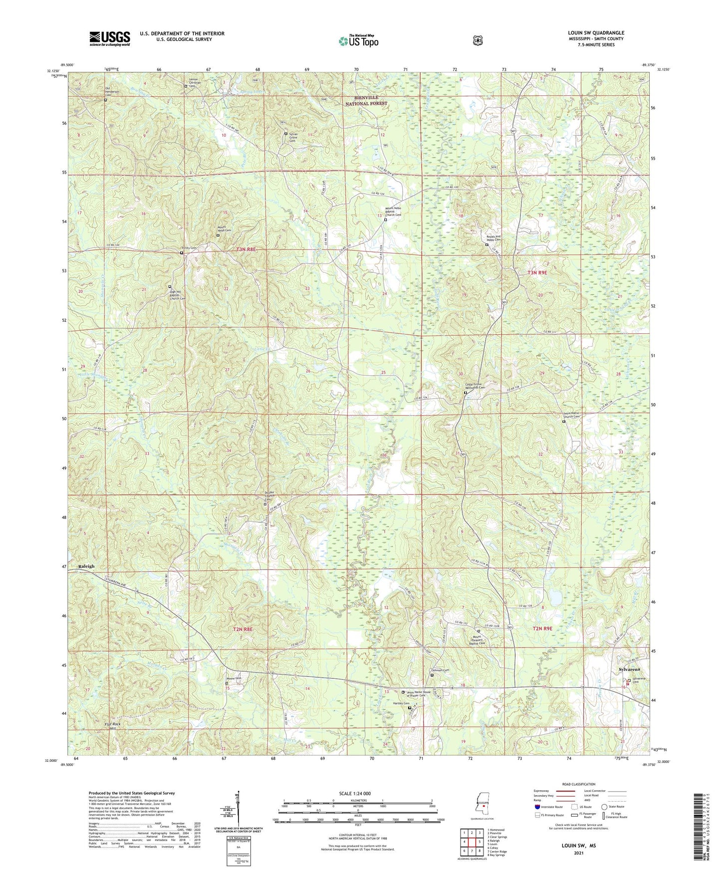
Louin SW Mississippi US Topo Map
Couldn't load pickup availability
Also explore the Louin SW Forest Service Topo of this same quad for updated USFS data
2024 topographic map quadrangle Louin SW in the state of Mississippi. Scale: 1:24000. Based on the newly updated USGS 7.5' US Topo map series, this map is in the following counties: Smith. The map contains contour data, water features, and other items you are used to seeing on USGS maps, but also has updated roads and other features. This is the next generation of topographic maps. Printed on high-quality waterproof paper with UV fade-resistant inks.
Quads adjacent to this one:
West: Raleigh
Northwest: Homewood
North: Pineville
Northeast: Clear Springs
East: Louin
Southeast: Bay Springs
South: Center Ridge
Southwest: Cohay
This map covers the same area as the classic USGS quad with code o32089a4.
Contains the following named places: Bailey Lake Dam, Bethel Church, Bowling Creek, Cedar Grove Church, Chisholm Branch, Christian Chapel, Craft School, Double Church, Flat Rock Hill, High Hill Baptist Church Cemetery, High Hill Church, Jesus Name Church, Johnson Cemetery, Lemon Christian Cemetery, Little Creek, Little Ichusa Creek, Little Shongelo Creek, Moore Cemetery, Morgan Creek, Mount Nebo Baptist Church Cemetery, Mount Nebo Cemetery, Mount Nebo Church, Mount Pleasant, Mount Pleasant Church, Nelse Branch, Old Henderson Cemetery, Pete Branch, Royal, Royals and Webb Cemetery, Saint Johns Methodist Church, Sand Point, Shongelo Creek, Shongelo Creek Oil Field, Spring Lakes, Sylvan Grove Cemetery, Sylvarena, Sylvarena Academy, Sylvarena Attendance Center, Teock Creek, Thompson Lake Dam, Trade, Trinity Cemetery, Trinity Methodist Church, Village of Sylvarena, ZIP Code: 39153