MyTopo
Homochitto Mississippi US Topo Map
Couldn't load pickup availability
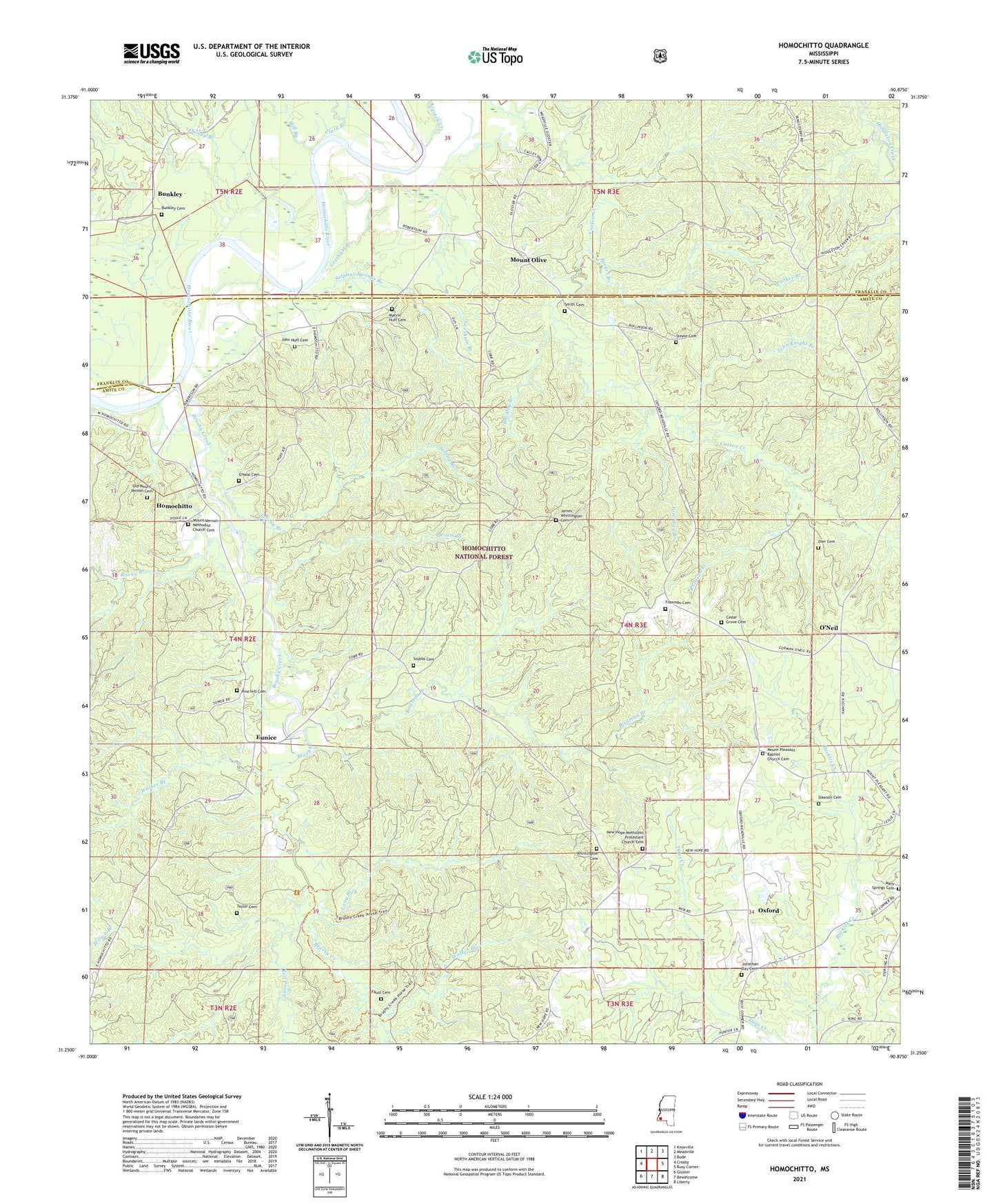
2021 topographic map quadrangle Homochitto in the state of Mississippi. Scale: 1:24000. Based on the newly updated USGS 7.5' US Topo map series, this map is in the following counties: Amite, Franklin. The map contains contour data, water features, and other items you are used to seeing on USGS maps, but also has updated roads and other features. This is the next generation of topographic maps. Printed on high-quality waterproof paper with UV fade-resistant inks.
Quads adjacent to this one:
West: Crosby
Northwest: Knoxville
North: Meadville
Northeast: Bude
East: Busy Corner
Southeast: Liberty
South: Bewelcome
Southwest: Gloster
Contains the following named places: Birdman Branch, Bradley Branch, Brown Branch, Brushy Creek, Buckleys Ferry, Bunkley, Bunkley Baptist Church, Bunkley Cemetery, Bunkley Church, Caston Creek, Cedar Grove Cemetery, Cedar Grove School, Clark Branch, Dawson Cemetery, Dier Cemetery, Eunice, Faust Cemetery, Freeman Cemetery, Gresham Branch, Homochitto, Homochitto State Wildlife Management Area, James Whittington Cemetery, John Huff Cemetery, John Knight Branch, Jonathan Day Cemetery, Long Branch, Marvin Huff Cemetery, Mary Springs Cemetery, Mary Springs Church, Merry Springs School, Mill Branch, Mount Olive, Mount Pleasant Baptist Church, Mount Pleasant Baptist Church Cemetery, Mount Vernon Church, Mount Vernon Methodist Church, Mount Vernon Methodist Church Cemetery, New Hope Church, New Hope Methodist Protestant Church Cemetery, Oak Grove Church, Old Mount Vernon Cemetery, O'Neal Cemetery, O'Neil, O'Neil Volunteer Fire Department, Oxford, Oxford School, Parker Branch, Pine Hill Cemetery, Pine Hill School, Red Prong, Rocky Branch, Rollison Branch, Sandy Branch, Scotts Branch, Smith Cemetery, Smyrna Church, Steele Cemetery, Stephenson Lookout Tower, Strong Branch, Stubbs Cemetery, Sulphur Springs Branch, Supervisor District 3, Taylor Cemetery, Tom Way Branch, Walker Branch, West Bude Oil Field, Whittington Cemetery