MyTopo
Jonestown Mississippi US Topo Map
Couldn't load pickup availability
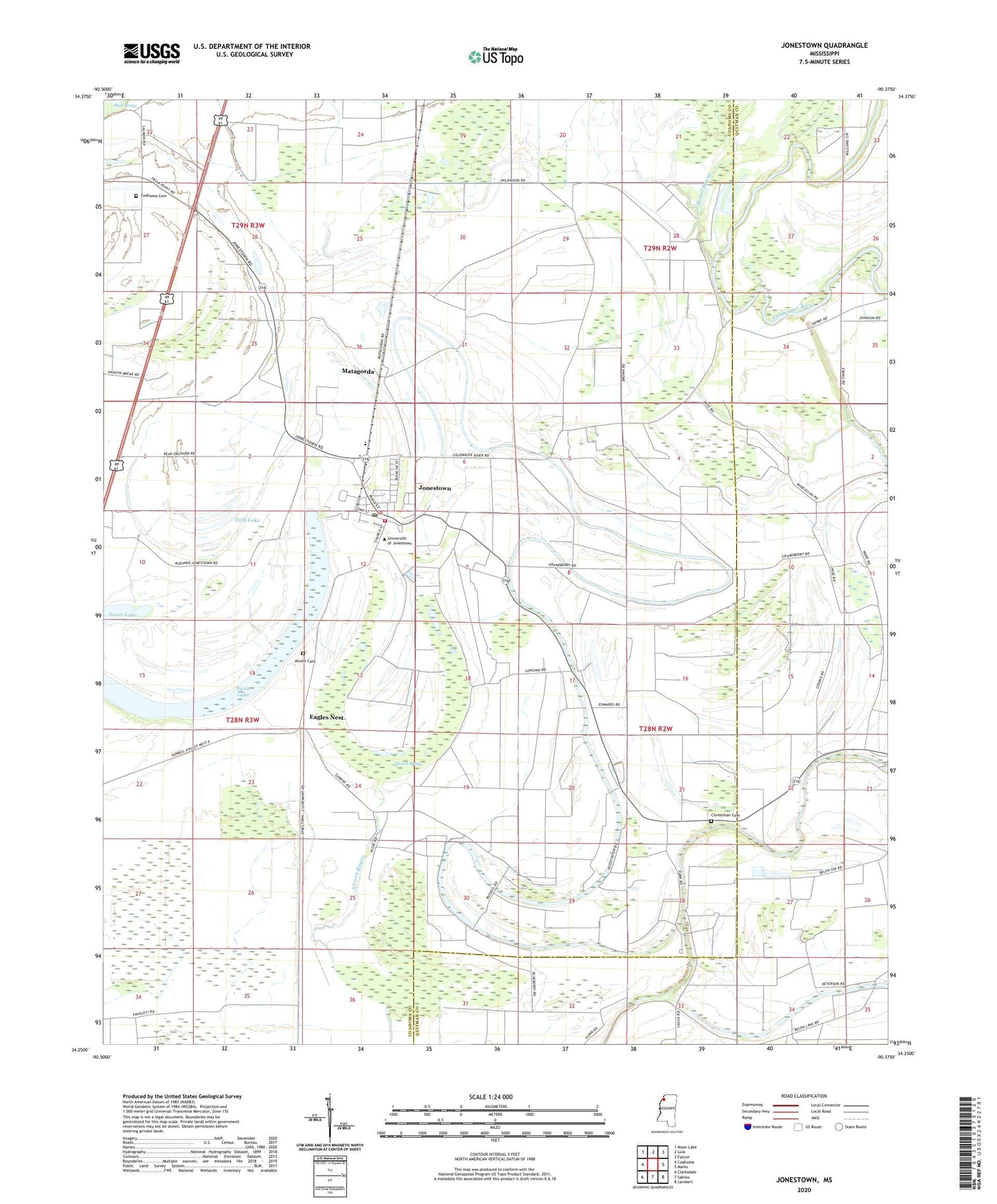
2020 topographic map quadrangle Jonestown in the state of Mississippi. Scale: 1:24000. Based on the newly updated USGS 7.5' US Topo map series, this map is in the following counties: Coahoma, Quitman. The map contains contour data, water features, and other items you are used to seeing on USGS maps, but also has updated roads and other features. This is the next generation of topographic maps. Printed on high-quality waterproof paper with UV fade-resistant inks.
Quads adjacent to this one:
West: Coahoma
Northwest: Moon Lake
North: Lula
Northeast: Falcon
East: Marks
Southeast: Lambert
South: Sabino
Southwest: Clarksdale
Contains the following named places: Alcorn Brake, Alcorn Cemetery, Broad Bayou, Chrestman Cemetery, Church of Christ, Cleary, Coahoma Cemetery, Coahoma County Volunteer Fire Department Jonestown, Cutoff Bayou, Eagles Nest, Gleason Grove Church, Gleason School, Hopewell Church, Iris, Jazzland Church, Jones Chapel, Jonestown, Jonestown Middle School, Jonestown Police Department, Jonestown Post Office, Macedonia Chapel, Mackin Chapel, Mary Bethel Church, Matagorda, Newhope Church, Nittch Church, Robinson Chapel, Saint James Church, Saint Lukes Church, Saint Pauls Church, Sunday, Sunrise Church, Swan Lake, Swan Lake College, Town of Jonestown, Tula Lake, ZIP Code: 38639