MyTopo
Sabino Mississippi US Topo Map
Couldn't load pickup availability
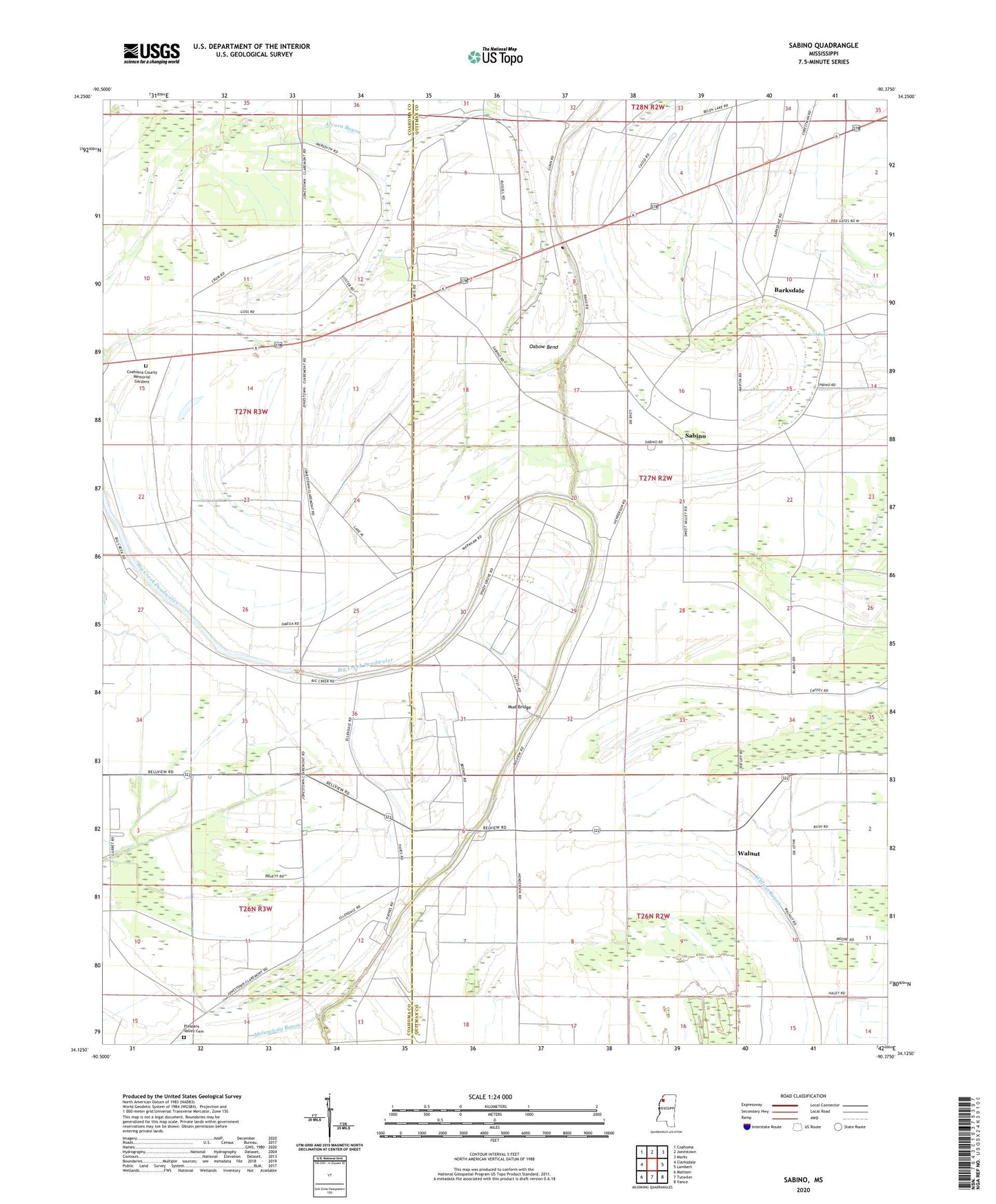
2024 topographic map quadrangle Sabino in the state of Mississippi. Scale: 1:24000. Based on the newly updated USGS 7.5' US Topo map series, this map is in the following counties: Quitman, Coahoma. The map contains contour data, water features, and other items you are used to seeing on USGS maps, but also has updated roads and other features. This is the next generation of topographic maps. Printed on high-quality waterproof paper with UV fade-resistant inks.
Quads adjacent to this one:
West: Clarksdale
Northwest: Coahoma
North: Jonestown
Northeast: Marks
East: Lambert
Southeast: Vance
South: Tutwiler
Southwest: Mattson
This map covers the same area as the classic USGS quad with code o34090b4.
Contains the following named places: Alcorn Bayou, Anderson Chapel, Barksdale, Bellview School, Big Creek Deadwater, Coahoma County Memorial Gardens, Cypress Church, Friendship Church, Friendship School, Graham School, Lost Lake, Macedonia Church, Melancholy Bayou, Mount Nemo Church, Mud Bridge, New Cassidy Church, New Cassidy School, Oxbow Bayou, Oxbow Bend, Pawpaw Church, Pleasant Hill Church, Pleasant Valley Cemetery, Redwing Church, Sabino, Sabino School, Saint Elmo Chapel, Seepwell Church, Shady Grove Church, Smith Chapel, Supervisor District 3, Walnut, Walnut Baptist Church, Walnut School, ZIP Code: 38645