MyTopo
Kokomo Mississippi US Topo Map
Couldn't load pickup availability
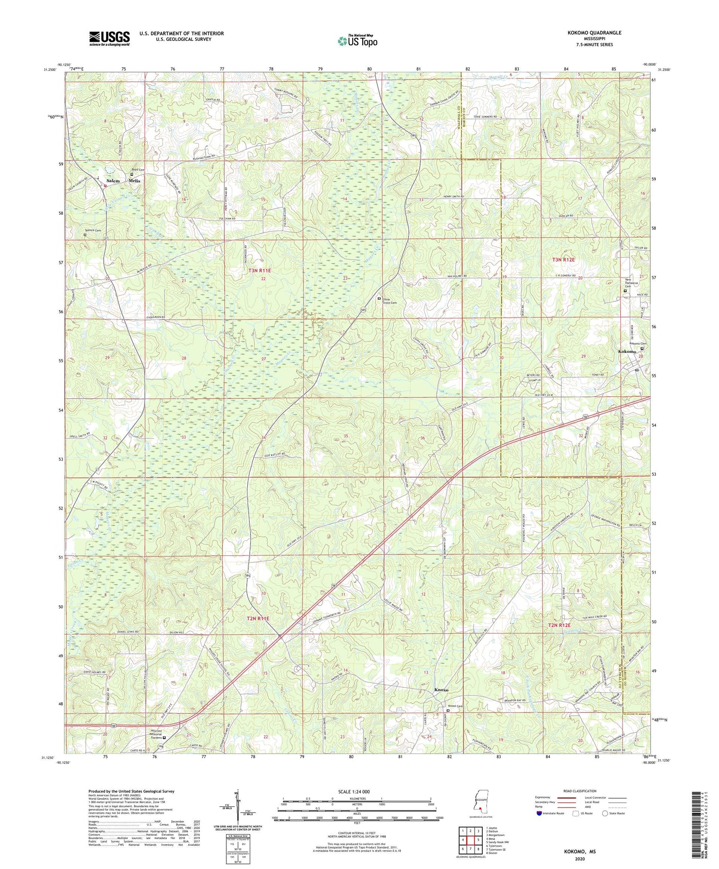
2020 topographic map quadrangle Kokomo in the state of Mississippi. Scale: 1:24000. Based on the newly updated USGS 7.5' US Topo map series, this map is in the following counties: Walthall, Marion. The map contains contour data, water features, and other items you are used to seeing on USGS maps, but also has updated roads and other features. This is the next generation of topographic maps. Printed on high-quality waterproof paper with UV fade-resistant inks.
Quads adjacent to this one:
West: Mesa
Northwest: Jayess
North: Darbun
Northeast: Morgantown
East: Sandy Hook NW
Southeast: Dexter
South: Tylertown SE
Southwest: Tylertown
Contains the following named places: 4th District Volunteer Fire Department Station 2, Barrett Dam, Boyd Cemetery, Brandon Bay Church, China Grove, China Grove Cemetery, China Grove Church of God, Darbun Creek, Dillon Hill Church of God in Christ, Faith Tabernacle, Hillcrest Memorial Gardens, Knoxo, Knoxo Baptist Church, Knoxo Cemetery, Knoxo Church of God in Christ, Kokomo, Kokomo Baptist Church, Kokomo Cemetery, Kokomo Census Designated Place, Kokomo Post Office, Kokomo School, Little Varnell Creek, Magees Creek Church, Melis, New Bethel Church, New Damascus Church, New Damascus Missionary Baptist Church Cemetery, Packwood Lake, Pilgrim Lake Dam, Pyramid Unicom Airport, Saint James Church, Salem, Salem Attendance Center, Salem Baptist Church, Spence Cemetery, Stovall Creek, Summers Poultry Farm, Supervisor District 2, Union Creek, Varnell Creek, Walthall County, ZIP Code: 39643